Mary Ellen Devine Powell
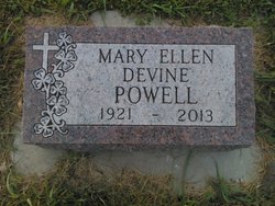
| Birth | : | 11 Nov 1921 Wakonda, Clay County, South Dakota, USA |
| Death | : | 10 Apr 2013 Vermillion, Clay County, South Dakota, USA |
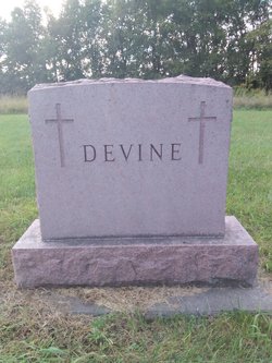
| Burial | : | Saint Patricks Catholic Cemetery, Wakonda, Clay County, USA |
| Coordinate | : | 42.9672012, -97.0516968 |
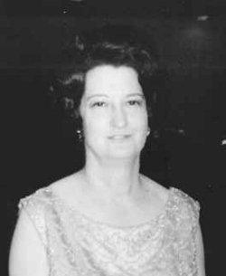
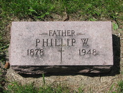
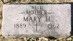
| Description | : | Mary Ellen Powell, 91, of Thousand Oaks, CA passed away Wednesday, April 10, 2013 at the Sanford Vermillion Care Center. Mary Ellen was born the first daughter to Philip and Nell (Hart) Devine on November 11, 1921 on the homestead farm near Wakonda, SD. She graduated from Wakonda High School, moved to Sioux City, IA and worked for Palmer Candy Co. and then as a secretary for Western Contracting. In 1953, Mary moved to Denver where she met and married James Powell, an Air Force military officer. Mary lived in Germany during the years Jim fought in Vietnam. During that time, she... Read More |
frequently asked questions (FAQ):
-
Where is Mary Ellen Devine Powell's memorial?
Mary Ellen Devine Powell's memorial is located at: Saint Patricks Catholic Cemetery, Wakonda, Clay County, USA.
-
When did Mary Ellen Devine Powell death?
Mary Ellen Devine Powell death on 10 Apr 2013 in Vermillion, Clay County, South Dakota, USA
-
Where are the coordinates of the Mary Ellen Devine Powell's memorial?
Latitude: 42.9672012
Longitude: -97.0516968
Family Members:
Parent
Spouse
Siblings
Flowers:
Nearby Cemetories:
1. Saint Patricks Catholic Cemetery
Wakonda, Clay County, USA
Coordinate: 42.9672012, -97.0516968
2. New Lodi Cemetery
Lodi, Clay County, USA
Coordinate: 42.9530983, -97.0417023
3. Bethel Baptist Cemetery
Wakonda, Clay County, USA
Coordinate: 42.9393570, -97.0433520
4. Old Lodi Cemetery
Lodi, Clay County, USA
Coordinate: 42.9757996, -96.9907990
5. Pleasant Valley Cemetery
Westerville, Clay County, USA
Coordinate: 42.9247017, -97.0124969
6. Union Cemetery
Wakonda, Clay County, USA
Coordinate: 42.9827995, -97.1222000
7. Mortvedt Cemetery
Clay County, USA
Coordinate: 42.9169006, -97.0028000
8. CJ Anderson Homestead
Riverside Township, Clay County, USA
Coordinate: 43.0214180, -96.9675540
9. Volin Cemetery
Volin, Yankton County, USA
Coordinate: 42.9672012, -97.1707993
10. Riverside-Barton Cemetery
Clay County, USA
Coordinate: 43.0402985, -96.9725037
11. Dalesburg Lutheran Cemetery
Vermillion, Clay County, USA
Coordinate: 42.9389424, -96.9242594
12. Saint Columbkill Cemetery
Wakonda, Clay County, USA
Coordinate: 43.0642014, -97.0828018
13. Spirit Mound Cemetery
Clay County, USA
Coordinate: 42.8885994, -96.9424973
14. Gayville Community Cemetery
Gayville, Yankton County, USA
Coordinate: 42.8950005, -97.1800003
15. Dalesburg Baptist Cemetery
Dalesburg, Clay County, USA
Coordinate: 42.9675102, -96.8850403
16. Clay Point Cemetery
Prairie Center Township, Clay County, USA
Coordinate: 42.8987700, -96.9065600
17. Clay Creek Cemetery
Clay County, USA
Coordinate: 42.8516998, -96.9788971
18. Zion Cemetery
Volin, Yankton County, USA
Coordinate: 42.9963300, -97.2234600
19. Komstad Cemetery
Dalesburg, Clay County, USA
Coordinate: 43.0417938, -96.9058914
20. Taylor Cemetery
Clay County, USA
Coordinate: 42.8372002, -97.0785980
21. Hillcrest Cemetery
Yankton County, USA
Coordinate: 43.0835991, -97.1680984
22. Meckling Cemetery
Meckling, Clay County, USA
Coordinate: 42.8252983, -97.0919037
23. Holland Cemetery
Centerville, Turner County, USA
Coordinate: 43.1114006, -97.0314026
24. Saint Johns Cemetery
Clay County, USA
Coordinate: 43.0696983, -96.9056015

