
| Birth | : | 26 Sep 1870 Licking County, Ohio, USA |
| Death | : | 26 Jan 1961 Newark, Licking County, Ohio, USA |
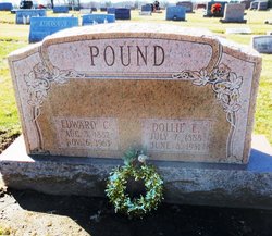
| Burial | : | West Virginia National Cemetery, Pruntytown, Taylor County, USA |
| Coordinate | : | 39.3350190, -80.0730590 |
| Description | : | DeVoll, Mary Etta Pound 26 Sept. 1870– 26 Jan. 1961 Mrs. Mary Etta DeVoll, 90, wife of William H. DeVoll. A resident of Newark 15 years, formerly of the Rocky Fork area, died at 12:55 p.m. Thursday in the home, 76 Fulton Ave. In failing health two years, she has been seriously ill a month. The daughter of Joseph Pound and Rachel Ann (Wheeler) Pound, she was born Sept. 26, 1876 in Mary Ann Township, Licking County OH. Besides her husband whom she married in 1891, she leaves four daughters, Mrs. William (Della) Donaldson, Mrs. Jesse Walker, Mrs.... Read More |
frequently asked questions (FAQ):
-
Where is Mary Etta Pound DeVoll's memorial?
Mary Etta Pound DeVoll's memorial is located at: West Virginia National Cemetery, Pruntytown, Taylor County, USA.
-
When did Mary Etta Pound DeVoll death?
Mary Etta Pound DeVoll death on 26 Jan 1961 in Newark, Licking County, Ohio, USA
-
Where are the coordinates of the Mary Etta Pound DeVoll's memorial?
Latitude: 39.3350190
Longitude: -80.0730590
Family Members:
Parent
Spouse

Siblings
Children
Flowers:


Nearby Cemetories:
1. West Virginia National Cemetery
Pruntytown, Taylor County, USA
Coordinate: 39.3350190, -80.0730590
2. Beulah Cemetery
Pruntytown, Taylor County, USA
Coordinate: 39.3336590, -80.0817140
3. Abram Smith Cemetery
Pruntytown, Taylor County, USA
Coordinate: 39.3314018, -80.0811005
4. Woodsdale Memorial Park
Pruntytown, Taylor County, USA
Coordinate: 39.3408012, -80.0658035
5. Warder Cemetery
Pruntytown, Taylor County, USA
Coordinate: 39.3360670, -80.0549330
6. Keener Cemetery
Grafton, Taylor County, USA
Coordinate: 39.3502370, -80.0503460
7. Wiseman Cemetery
Pruntytown, Taylor County, USA
Coordinate: 39.3602170, -80.0782840
8. Gawthrop Cemetery
Pruntytown, Taylor County, USA
Coordinate: 39.3292360, -80.1095210
9. Grafton National Cemetery
Grafton, Taylor County, USA
Coordinate: 39.3350296, -80.0312500
10. Carder Cemetery
Fetterman, Taylor County, USA
Coordinate: 39.3618760, -80.0409150
11. Old Catholic Cemetery
Taylor County, USA
Coordinate: 39.3445200, -80.0243000
12. Harmony Grove Cemetery
Grafton, Taylor County, USA
Coordinate: 39.3456001, -80.1267014
13. Mount Calvary Catholic Cemetery
Grafton, Taylor County, USA
Coordinate: 39.3492012, -80.0171967
14. Knotts Cemetery
Grafton, Taylor County, USA
Coordinate: 39.3550030, -80.0170860
15. Lantz Ford Cemetery
Grafton, Taylor County, USA
Coordinate: 39.3219370, -80.0132820
16. Bluemont Cemetery
Grafton, Taylor County, USA
Coordinate: 39.3446999, -80.0121994
17. Reese Cemetery
Grafton, Taylor County, USA
Coordinate: 39.3604990, -80.0068620
18. Walnut Grove Cemetery
Webster, Taylor County, USA
Coordinate: 39.2813988, -80.0472031
19. Brown Cemetery
Taylor County, USA
Coordinate: 39.3841630, -80.0295590
20. Coplin Cemetery
Taylor County, USA
Coordinate: 39.3114570, -80.1469800
21. Old Side Cemetery
Taylor County, USA
Coordinate: 39.3116989, -80.1472015
22. Lawler Cemetery
McGee, Taylor County, USA
Coordinate: 39.3845000, -80.1238000
23. Arnold Cemetery
Grafton, Taylor County, USA
Coordinate: 39.2985115, -80.0014712
24. West Hill Cemetery
Taylor County, USA
Coordinate: 39.2782810, -80.0284830