

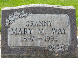
Mary Madalean Jones Way
| Birth | : | 31 Dec 1897 Burlington, Big Horn County, Wyoming, USA |
| Death | : | 30 Nov 1993 Billings, Yellowstone County, Montana, USA |
| Burial | : | Cross Hill Cemetery, Carthage, Moore County, USA |
| Coordinate | : | 35.3561040, -79.4299240 |
| Plot | : | Grave 4, Lot 66-D, Block B |
frequently asked questions (FAQ):
-
Where is Mary Madalean Jones Way's memorial?
Mary Madalean Jones Way's memorial is located at: Cross Hill Cemetery, Carthage, Moore County, USA.
-
When did Mary Madalean Jones Way death?
Mary Madalean Jones Way death on 30 Nov 1993 in Billings, Yellowstone County, Montana, USA
-
Where are the coordinates of the Mary Madalean Jones Way's memorial?
Latitude: 35.3561040
Longitude: -79.4299240
Family Members:
Parent

Siblings
Children


Nearby Cemetories:
1. Cross Hill Cemetery
Carthage, Moore County, USA
Coordinate: 35.3561040, -79.4299240
2. Muse-Glascock Family Cemetery
Carthage, Moore County, USA
Coordinate: 35.3575211, -79.4321289
3. Carthage United Methodist Church Cemetery
Carthage, Moore County, USA
Coordinate: 35.3508030, -79.4214230
4. Saint Johns Holy Church of God Cemetery
Carthage, Moore County, USA
Coordinate: 35.3574510, -79.4405290
5. Mount Olive AME Zion Church Cemetery
Carthage, Moore County, USA
Coordinate: 35.3567530, -79.4424460
6. First Presbyterian Church Cemetery
Moore County, USA
Coordinate: 35.3459180, -79.4202590
7. Carthage Presbyterian Church Cemetery
Carthage, Moore County, USA
Coordinate: 35.3465070, -79.4183190
8. John Hall Presbyterian Church Cemetery
Carthage, Moore County, USA
Coordinate: 35.3419230, -79.4296210
9. First Missionary Baptist Church Cemetery
Carthage, Moore County, USA
Coordinate: 35.3654450, -79.4160830
10. Saint Augustine AME Zion Church Cemetery
Carthage, Moore County, USA
Coordinate: 35.3409460, -79.4253210
11. Stony Hill Free Will Baptist Church Cemetery
Carthage, Moore County, USA
Coordinate: 35.3353860, -79.4073180
12. Community Friends Church Cemetery
Carthage, Moore County, USA
Coordinate: 35.3417360, -79.3957510
13. Warner Family Cemetery
Carthage, Moore County, USA
Coordinate: 35.3398440, -79.4695190
14. Sassafras Springs Cemetery
Carthage, Moore County, USA
Coordinate: 35.3202400, -79.4099100
15. Priest Hill Presbyterian Church Cemetery
Carthage, Moore County, USA
Coordinate: 35.3695820, -79.3839880
16. Trinity Bible Church Cemetery
Carthage, Moore County, USA
Coordinate: 35.3215750, -79.3938350
17. Bethlehem Baptist Church Cemetery
Carthage, Moore County, USA
Coordinate: 35.3525150, -79.4856250
18. Summer Hill Baptist Church Cemetery
Carthage, Moore County, USA
Coordinate: 35.3093470, -79.4372090
19. Pleasant Hill Freewill Baptist Church Cemetery
Carthage, Moore County, USA
Coordinate: 35.4067770, -79.4425240
20. Emmanuel Baptist Church Cemetery
Carthage, Moore County, USA
Coordinate: 35.3569160, -79.3615360
21. Davis Family Cemetery
Robbins, Moore County, USA
Coordinate: 35.3798600, -79.4992600
22. Red Branch Baptist Church Cemetery
Carthage, Moore County, USA
Coordinate: 35.3826320, -79.3548600
23. Chestley Horner Grave Marker
Robbins, Moore County, USA
Coordinate: 35.3925143, -79.5013028
24. Victory Community Baptist Church Cemetery
Carthage, Moore County, USA
Coordinate: 35.2877820, -79.4522750