| Birth | : | 27 Sep 1827 Colrain, Franklin County, Massachusetts, USA |
| Death | : | 22 Nov 1902 Delaware County, Iowa, USA |
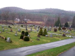
| Burial | : | Mountain View Cemetery, Loyalton, Sierra County, USA |
| Coordinate | : | 39.6718490, -120.2496190 |
| Description | : | Wife of John S. Barry II, married 1851 in Massachusetts. Pamelia Barry was born Mary Pamelia Brown. She and her twin sister Rachel Fidelia Brown were born on 27 Sep 1827. They were always known as Pamelia and Fidelia. --- < > --- Mrs. John S. Barry Pamelia M. Brown, one of the pioneer residents of this county, was born in Franklin county Mass., September 27, 1827, and was married to John S. Barry on March 19, 1852. Four years thereafter they came west and settled on the farm in Prairie township which was her home continuously from that time--April... Read More |
frequently asked questions (FAQ):
-
Where is Mary Pamelia “Pamelia” Brown Barry's memorial?
Mary Pamelia “Pamelia” Brown Barry's memorial is located at: Mountain View Cemetery, Loyalton, Sierra County, USA.
-
When did Mary Pamelia “Pamelia” Brown Barry death?
Mary Pamelia “Pamelia” Brown Barry death on 22 Nov 1902 in Delaware County, Iowa, USA
-
Where are the coordinates of the Mary Pamelia “Pamelia” Brown Barry's memorial?
Latitude: 39.6718490
Longitude: -120.2496190
Family Members:
Parent
Spouse
Siblings
Children
Flowers:
Nearby Cemetories:
1. Mountain View Cemetery
Loyalton, Sierra County, USA
Coordinate: 39.6718490, -120.2496190
2. Westside-Sharkey Cemetery
Beckworth, Plumas County, USA
Coordinate: 39.7378006, -120.3867035
3. Sierraville Cemetery
Sierraville, Sierra County, USA
Coordinate: 39.5842018, -120.3786011
4. Sattley Cemetery
Sattley, Sierra County, USA
Coordinate: 39.6214000, -120.4225500
5. Summers Family Cemetery
Calpine, Sierra County, USA
Coordinate: 39.6861940, -120.4355350
6. Vinton Cemetery
Vinton, Plumas County, USA
Coordinate: 39.8011017, -120.1592026
7. Chilcoot Cemetery
Chilcoot, Plumas County, USA
Coordinate: 39.7966800, -120.1254400
8. Whispering Pines Cemetery
Beckworth, Plumas County, USA
Coordinate: 39.8252983, -120.4180984
9. Shady Grove Cemetery
Portola, Plumas County, USA
Coordinate: 39.8072014, -120.4593964
10. Crystal Peak Cemetery
Verdi, Washoe County, USA
Coordinate: 39.5250310, -119.9984690
11. Boca Cemetery
Boca, Nevada County, USA
Coordinate: 39.3870510, -120.0922310
12. Sierra Memorial Gardens Cemetery
Reno, Washoe County, USA
Coordinate: 39.6081009, -119.8491974
13. Mohawk Cemetery
Mohawk, Plumas County, USA
Coordinate: 39.7791060, -120.6384200
14. Sierra City Cemetery
Sierra City, Sierra County, USA
Coordinate: 39.5663900, -120.6408300
15. Meadow Lake Cemetery
Summit City, Nevada County, USA
Coordinate: 39.4123400, -120.5079700
16. Sierra Mountains Cemetery
Truckee, Nevada County, USA
Coordinate: 39.3342018, -120.1772003
17. Catholic Cemetery
Truckee, Nevada County, USA
Coordinate: 39.3319931, -120.1805801
18. Masonic Memorial Gardens
Reno, Washoe County, USA
Coordinate: 39.5266724, -119.8409042
19. Mountain View Cemetery
Reno, Washoe County, USA
Coordinate: 39.5238991, -119.8419037
20. Donner Memorial State Park
Truckee, Nevada County, USA
Coordinate: 39.3246040, -120.2330160
21. Our Mother of Sorrows Cemetery
Reno, Washoe County, USA
Coordinate: 39.5519981, -119.8229980
22. Donner Party Camp at Alder Creek Valley
Truckee, Nevada County, USA
Coordinate: 39.3216670, -120.2327500
23. Brickelltown Cemetery
Truckee, Nevada County, USA
Coordinate: 39.3248030, -120.1854090
24. Johnsville Cemetery
Johnsville, Plumas County, USA
Coordinate: 39.7627983, -120.6913986

