| Memorials | : | 0 |
| Location | : | Summit City, Nevada County, USA |
| Coordinate | : | 39.4123400, -120.5079700 |
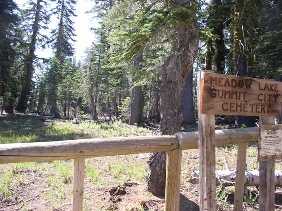
| Description | : | There are several graves marked only with wooden crosses or outlined with rocks. Not accessible in winter. From Truckee: Travel north on Hwy 89 for 17 miles to Forest Road 7. Turn left and travel west to the Meadow Lake turnoff. Turn left on Forest Service Road 86 which becomes Nevada County Road 843 traveling south for approximately 10 miles. Most of the route is paved, but the last few miles are unpaved and becomes very rough. (USDA Forest Service) |
frequently asked questions (FAQ):
-
Where is Meadow Lake Cemetery?
Meadow Lake Cemetery is located at Summit City, Nevada County ,California ,USA.
-
Meadow Lake Cemetery cemetery's updated grave count on graveviews.com?
0 memorials
-
Where are the coordinates of the Meadow Lake Cemetery?
Latitude: 39.4123400
Longitude: -120.5079700
Nearby Cemetories:
1. Fall Creek Cemetery
Camp Spaulding, Nevada County, USA
Coordinate: 39.3806200, -120.6619410
2. Sierra City Cemetery
Sierra City, Sierra County, USA
Coordinate: 39.5663900, -120.6408300
3. Graniteville Cemetery
Graniteville, Nevada County, USA
Coordinate: 39.4395860, -120.7462590
4. Sierraville Cemetery
Sierraville, Sierra County, USA
Coordinate: 39.5842018, -120.3786011
5. Omega Cemetery
Omega, Nevada County, USA
Coordinate: 39.3310100, -120.7498500
6. Sattley Cemetery
Sattley, Sierra County, USA
Coordinate: 39.6214000, -120.4225500
7. Donner Memorial State Park
Truckee, Nevada County, USA
Coordinate: 39.3246040, -120.2330160
8. Donner Party Camp at Alder Creek Valley
Truckee, Nevada County, USA
Coordinate: 39.3216670, -120.2327500
9. Washington Cemetery
Washington, Nevada County, USA
Coordinate: 39.3573220, -120.8010220
10. Brickelltown Cemetery
Truckee, Nevada County, USA
Coordinate: 39.3248030, -120.1854090
11. Alleghany Cemetery
Alleghany, Sierra County, USA
Coordinate: 39.4696900, -120.8429100
12. Catholic Cemetery
Truckee, Nevada County, USA
Coordinate: 39.3319931, -120.1805801
13. Sierra Mountains Cemetery
Truckee, Nevada County, USA
Coordinate: 39.3342018, -120.1772003
14. Moores Flat Cemetery
Moores Flat, Nevada County, USA
Coordinate: 39.4275170, -120.8556670
15. Schaffer Family Cemetery
Truckee, Nevada County, USA
Coordinate: 39.3240900, -120.1780200
16. Forest Old Pioneer Cemetery
Forest, Sierra County, USA
Coordinate: 39.4939410, -120.8515940
17. Forest City Cemetery
Forest, Sierra County, USA
Coordinate: 39.4883100, -120.8553100
18. Relief Hill Cemetery
North Bloomfield, Nevada County, USA
Coordinate: 39.3552140, -120.8610870
19. Summers Family Cemetery
Calpine, Sierra County, USA
Coordinate: 39.6861940, -120.4355350
20. Downieville Cemetery
Downieville, Sierra County, USA
Coordinate: 39.5676700, -120.8252390
21. North Bloomfield Cemetery
North Bloomfield, Nevada County, USA
Coordinate: 39.3678150, -120.9038890
22. Last Chance Cemetery
Last Chance, Placer County, USA
Coordinate: 39.1111900, -120.6254100
23. Goodyears Bar Cemetery
Goodyears Bar, Sierra County, USA
Coordinate: 39.5403470, -120.8836760
24. Boca Cemetery
Boca, Nevada County, USA
Coordinate: 39.3870510, -120.0922310

