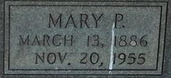
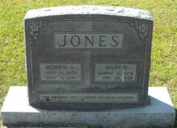
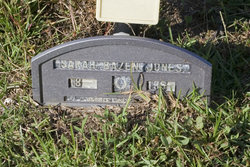
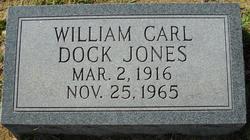
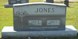
Mary Pauline Bazen Jones
| Birth | : | 13 Mar 1886 Florence County, South Carolina, USA |
| Death | : | 20 Nov 1955 Bazen Crossroads, Florence County, South Carolina, USA |
| Burial | : | Weybridge Cemetery, Weybridge, Elmbridge Borough, England |
| Coordinate | : | 51.3666540, -0.4639780 |
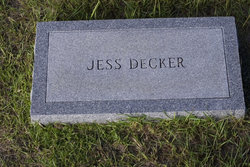
| Description | : | Complete name Mary Pauline Bazen Decker. Survived by her 2nd husband Jesse Deker. |
frequently asked questions (FAQ):
-
Where is Mary Pauline Bazen Jones's memorial?
Mary Pauline Bazen Jones's memorial is located at: Weybridge Cemetery, Weybridge, Elmbridge Borough, England.
-
When did Mary Pauline Bazen Jones death?
Mary Pauline Bazen Jones death on 20 Nov 1955 in Bazen Crossroads, Florence County, South Carolina, USA
-
Where are the coordinates of the Mary Pauline Bazen Jones's memorial?
Latitude: 51.3666540
Longitude: -0.4639780
Family Members:
Parent
Spouse
Siblings
Children
Flowers:
Nearby Cemetories:
1. Weybridge Cemetery
Weybridge, Elmbridge Borough, England
Coordinate: 51.3666540, -0.4639780
2. St. Charles Borromeo Chapel
Weybridge, Elmbridge Borough, England
Coordinate: 51.3664280, -0.4597150
3. St James' Churchyard
Weybridge, Elmbridge Borough, England
Coordinate: 51.3715530, -0.4612760
4. Shepperton New Cemetery
Shepperton, Spelthorne Borough, England
Coordinate: 51.3887000, -0.4550550
5. St Paul's Churchyard
Addlestone, Runnymede Borough, England
Coordinate: 51.3687400, -0.5027050
6. Addlestone Cemetery
Addlestone, Runnymede Borough, England
Coordinate: 51.3780880, -0.5031800
7. Chertsey Cemetery
Chertsey, Runnymede Borough, England
Coordinate: 51.3849600, -0.5009760
8. Burvale Cemetery
Hersham, Elmbridge Borough, England
Coordinate: 51.3607100, -0.4142800
9. St Mary Churchyard
Byfleet, Woking Borough, England
Coordinate: 51.3328210, -0.4757360
10. St. Mary's Churchyard
Walton-on-Thames, Elmbridge Borough, England
Coordinate: 51.3869300, -0.4171800
11. St. Peter's Churchyard
Chertsey, Runnymede Borough, England
Coordinate: 51.3924010, -0.5036640
12. Walton-on-Thames Cemetery
Walton-on-Thames, Elmbridge Borough, England
Coordinate: 51.3876070, -0.4169830
13. St John the Baptist Church
West Byfleet, Woking Borough, England
Coordinate: 51.3383570, -0.5023990
14. Chertsey Abbey (Defunct)
Chertsey, Runnymede Borough, England
Coordinate: 51.3950000, -0.5031000
15. St. Peter's Churchyard
Hersham, Elmbridge Borough, England
Coordinate: 51.3641720, -0.4020110
16. St Mary Magdelene Churchyard
Littleton, Spelthorne Borough, England
Coordinate: 51.4066940, -0.4618950
17. Wisley Church Churchyard
Wisley, Guildford Borough, England
Coordinate: 51.3257400, -0.4847130
18. Christ Church Cemetery
Ottershaw, Runnymede Borough, England
Coordinate: 51.3610140, -0.5353310
19. All Saints Churchyard
Laleham, Spelthorne Borough, England
Coordinate: 51.4091880, -0.4898680
20. Sunbury-on-Thames Cemetery
Sunbury, Spelthorne Borough, England
Coordinate: 51.4044460, -0.4189620
21. Sunbury Old Cemetery
Sunbury, Spelthorne Borough, England
Coordinate: 51.4059100, -0.4147300
22. St Mary Churchyard
Sunbury, Spelthorne Borough, England
Coordinate: 51.4048370, -0.4109130
23. St Andrew Churchyard
Cobham, Elmbridge Borough, England
Coordinate: 51.3259580, -0.4114970
24. St Marys Churchyard
Thorpe, Runnymede Borough, England
Coordinate: 51.4075720, -0.5293820

