
| Memorials | : | 0 |
| Location | : | Thorpe, Runnymede Borough, England |
| Coordinate | : | 51.4075720, -0.5293820 |
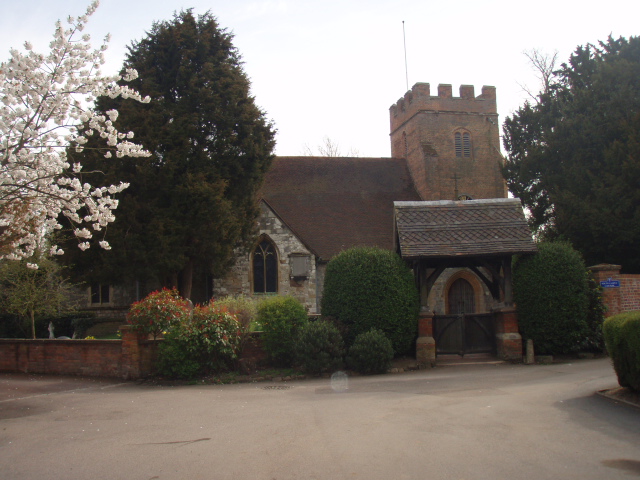
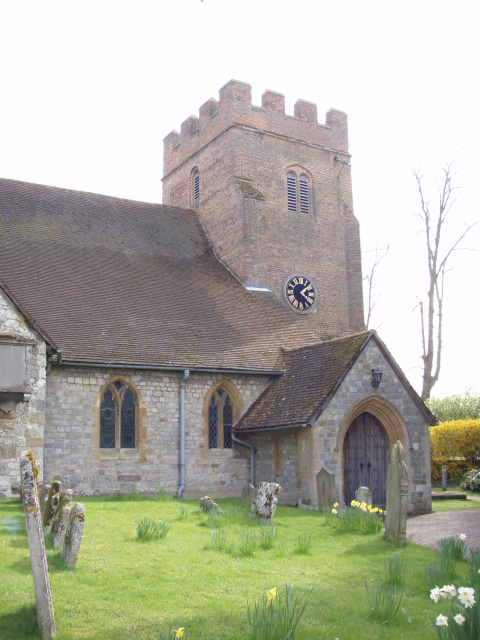
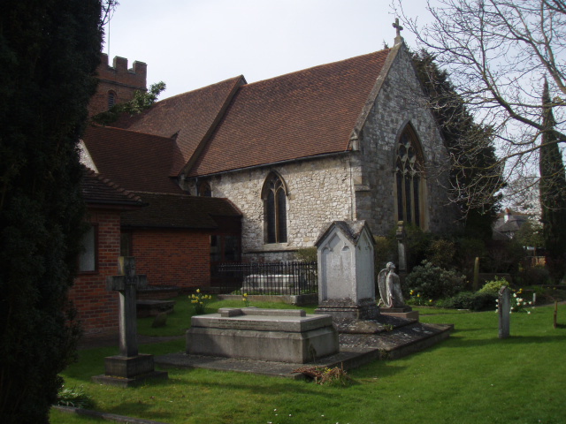
| Description | : | St Mary's Church is part of the conservation area along with a number of other listed and protected buildings possibly dating from the 1600s onwards. Renalds Herne, an 18th-century, brick-built house, stands almost opposite the parish church facing a picturesque close. Added by Anthony Bysouth |
frequently asked questions (FAQ):
-
Where is St Marys Churchyard?
St Marys Churchyard is located at Coldharbour Lane Thorpe, Runnymede Borough ,Surrey , TW20 8TQEngland.
-
St Marys Churchyard cemetery's updated grave count on graveviews.com?
0 memorials
-
Where are the coordinates of the St Marys Churchyard?
Latitude: 51.4075720
Longitude: -0.5293820
Nearby Cemetories:
1. Chertsey Abbey (Defunct)
Chertsey, Runnymede Borough, England
Coordinate: 51.3950000, -0.5031000
2. St. Peter's Churchyard
Chertsey, Runnymede Borough, England
Coordinate: 51.3924010, -0.5036640
3. All Saints Churchyard
Laleham, Spelthorne Borough, England
Coordinate: 51.4091880, -0.4898680
4. St. John the Baptist Churchyard
Egham, Runnymede Borough, England
Coordinate: 51.4327120, -0.5443380
5. Chertsey Cemetery
Chertsey, Runnymede Borough, England
Coordinate: 51.3849600, -0.5009760
6. St. Mary's Churchyard
Staines, Spelthorne Borough, England
Coordinate: 51.4365400, -0.5191540
7. Christ Church Churchyard
Virginia Water, Runnymede Borough, England
Coordinate: 51.4073160, -0.5796440
8. Englefield Green Cemetery
Englefield Green, Runnymede Borough, England
Coordinate: 51.4273640, -0.5730490
9. Addlestone Cemetery
Addlestone, Runnymede Borough, England
Coordinate: 51.3780880, -0.5031800
10. Runnymede Memorial
Englefield Green, Runnymede Borough, England
Coordinate: 51.4378433, -0.5649990
11. London Road Cemetery
Staines, Spelthorne Borough, England
Coordinate: 51.4380000, -0.4889100
12. St Mary Magdelene Churchyard
Littleton, Spelthorne Borough, England
Coordinate: 51.4066940, -0.4618950
13. St Paul's Churchyard
Addlestone, Runnymede Borough, England
Coordinate: 51.3687400, -0.5027050
14. Christ Church
Chertsey, Runnymede Borough, England
Coordinate: 51.3781700, -0.5831300
15. Christ Church Cemetery
Ottershaw, Runnymede Borough, England
Coordinate: 51.3610140, -0.5353310
16. Shepperton New Cemetery
Shepperton, Spelthorne Borough, England
Coordinate: 51.3887000, -0.4550550
17. Saint Matthew's Churchyard
Ashford, Spelthorne Borough, England
Coordinate: 51.4321830, -0.4588780
18. Saint Andrew's Churchyard
Wraysbury, Windsor and Maidenhead Royal Borough, England
Coordinate: 51.4558200, -0.5600900
19. Stanwell Cemetery
Stanwell, Spelthorne Borough, England
Coordinate: 51.4523640, -0.4840770
20. Ashford Burial Ground
Staines, Spelthorne Borough, England
Coordinate: 51.4465100, -0.4677360
21. St James' Churchyard
Weybridge, Elmbridge Borough, England
Coordinate: 51.3715530, -0.4612760
22. Weybridge Cemetery
Weybridge, Elmbridge Borough, England
Coordinate: 51.3666540, -0.4639780
23. St Mary the Virgin
Stanwell, Spelthorne Borough, England
Coordinate: 51.4564840, -0.4799090
24. St. Charles Borromeo Chapel
Weybridge, Elmbridge Borough, England
Coordinate: 51.3664280, -0.4597150