
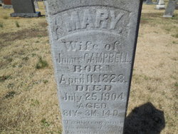
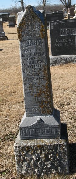
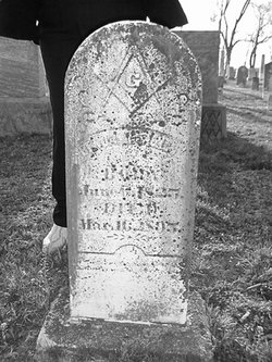
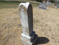
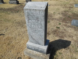
Mary Polly Enloe Campbell
| Birth | : | 11 Apr 1823 |
| Death | : | 25 Jul 1904 |
| Burial | : | St Margaret Churchyard, Hales, South Norfolk District, England |
| Coordinate | : | 52.5109380, 1.5110840 |
| Plot | : | Section 1 |
frequently asked questions (FAQ):
-
Where is Mary Polly Enloe Campbell's memorial?
Mary Polly Enloe Campbell's memorial is located at: St Margaret Churchyard, Hales, South Norfolk District, England.
-
When did Mary Polly Enloe Campbell death?
Mary Polly Enloe Campbell death on 25 Jul 1904 in
-
Where are the coordinates of the Mary Polly Enloe Campbell's memorial?
Latitude: 52.5109380
Longitude: 1.5110840
Family Members:
Parent
Spouse
Siblings
Children
Flowers:

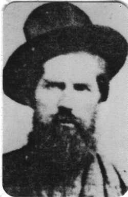
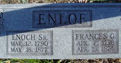
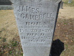
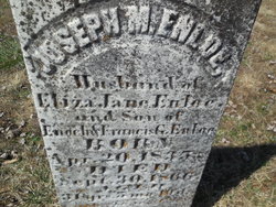
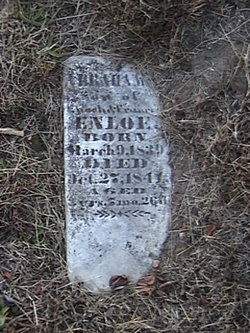
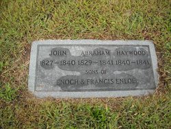
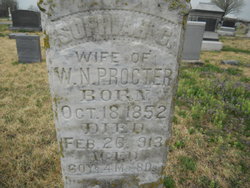
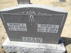
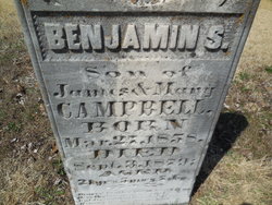
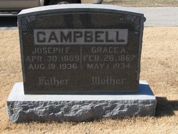
Mary "Polly" Enloe, wife of James Campbell (b. 29 Feb 1820 Barren County, Kentucky-d. Dec 1895 Cole County, Missouri); mother of Enoch Enloe, James, Frances Jane, Moses D., Sophia Catherine, Sarah C., Elizabeth G., Benjamin S., Mary Ann and Joseph Franklin Campbell. Read less
Left by Anonymous on 04 Dec 2007

Left by Anonymous on 10 Aug 2010

Requiescat In Pace
Left by Anonymous on 22 Apr 2013

Left by Anonymous on 09 Dec 2015

Left by Anonymous on 02 Mar 2017

Left by Anonymous on 25 Apr 2018


Nearby Cemetories:
1. St Margaret Churchyard
Hales, South Norfolk District, England
Coordinate: 52.5109380, 1.5110840
2. St Andrews Churchyard
Raveningham, South Norfolk District, England
Coordinate: 52.5126430, 1.5323570
3. All Saints Churchyard
Kirby Cane, South Norfolk District, England
Coordinate: 52.4937500, 1.4952820
4. St Gregory Churchyard
Heckingham, South Norfolk District, England
Coordinate: 52.5350940, 1.5144710
5. Holy Trinity Churchyard
Loddon, South Norfolk District, England
Coordinate: 52.5350430, 1.4832560
6. Ss Mary and Margaret Churchyard
Norton Subcourse, North Norfolk District, England
Coordinate: 52.5324780, 1.5483860
7. Methodist Churchyard
Norton Subcourse, North Norfolk District, England
Coordinate: 52.5317630, 1.5557020
8. All Saints Churchyard
Chedgrave, South Norfolk District, England
Coordinate: 52.5409130, 1.4831200
9. St Michael Churchyard
Geldeston, South Norfolk District, England
Coordinate: 52.4759460, 1.5246070
10. St Mary's Churchyard
Ellingham, South Norfolk District, England
Coordinate: 52.4739393, 1.4827976
11. St Margaret's Churchyard
Hardley Street, South Norfolk District, England
Coordinate: 52.5522980, 1.5170630
12. All Saints Churchyard
Gillingham, South Norfolk District, England
Coordinate: 52.4753720, 1.5479546
13. St Michael's Churchyard
Broome, South Norfolk District, England
Coordinate: 52.4860360, 1.4547410
14. St Mary's Churchyard
Gillingham, South Norfolk District, England
Coordinate: 52.4750343, 1.5489500
15. Hardley Methodist Chapel
Langley with Hardley, South Norfolk District, England
Coordinate: 52.5577290, 1.4957960
16. St. Michaels's Church Cemetery
Langley with Hardley, South Norfolk District, England
Coordinate: 52.5552220, 1.4727530
17. Thorpe-next-Haddiscoe St Mathias Churchyard
Haddiscoe, South Norfolk District, England
Coordinate: 52.5261880, 1.5896380
18. St. Mary's Churchyard
Haddiscoe, South Norfolk District, England
Coordinate: 52.5153200, 1.5939300
19. St Peter's Churchyard
Mundham, South Norfolk District, England
Coordinate: 52.5303890, 1.4260120
20. St. Bartholomew's Churchyard
Shipmeadow, Waveney District, England
Coordinate: 52.4557540, 1.5046408
21. Wangford Union Workhouse Cemetery
Shipmeadow, Waveney District, England
Coordinate: 52.4540960, 1.4997050
22. All Saints Churchyard
Mettingham, Waveney District, England
Coordinate: 52.4566620, 1.4764720
23. Ditchingham Cemetery
Ditchingham, South Norfolk District, England
Coordinate: 52.4793614, 1.4307304
24. St Margaret and St Remigius Churchyard
Seething, South Norfolk District, England
Coordinate: 52.5303390, 1.4185000