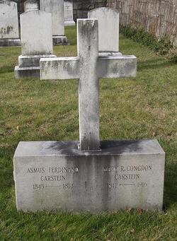
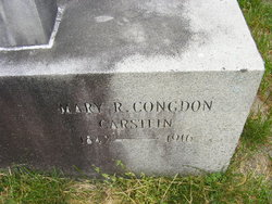
Mary Remington Congdon Dearstyne
| Birth | : | 1842 |
| Death | : | 1916 |
| Burial | : | Austwick Church Cemetery, Austwick, Craven District, England |
| Coordinate | : | 54.1081700, -2.3660600 |
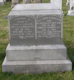
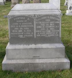
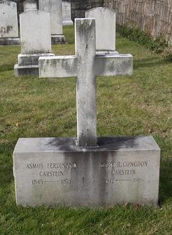
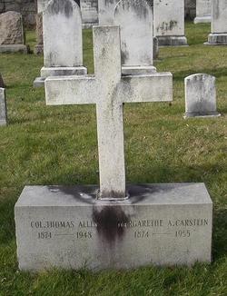
| Description | : | Daughter of Capt. John & Cynthia (Sprague) Congdon Travelled at sea with her parents on the Hannah Thornton in 1852 and on the Caroline Tucker from 1860 to 1862 Attended the Hillside Boarding and Day School for Young Ladies in East Greenwich while living with her grandmother Lydia (Anthony) Sprague Married Asmus Carstein in 1870 & they had 2 daughters, Mary K. who died in 1882 and Margarethe Allen After the death of Asmus, she married her second cousin James Dearstyne in 1883. He died in 1892. |
frequently asked questions (FAQ):
-
Where is Mary Remington Congdon Dearstyne's memorial?
Mary Remington Congdon Dearstyne's memorial is located at: Austwick Church Cemetery, Austwick, Craven District, England.
-
When did Mary Remington Congdon Dearstyne death?
Mary Remington Congdon Dearstyne death on 1916 in
-
Where are the coordinates of the Mary Remington Congdon Dearstyne's memorial?
Latitude: 54.1081700
Longitude: -2.3660600
Family Members:
Parent
Spouse
Siblings
Children
Flowers:
Nearby Cemetories:
1. Austwick Church Cemetery
Austwick, Craven District, England
Coordinate: 54.1081700, -2.3660600
2. Clapham Parish Cemetery
Clapham, Craven District, England
Coordinate: 54.1110400, -2.3963100
3. St James Churchyard
Clapham, Craven District, England
Coordinate: 54.1202400, -2.3904970
4. St. Matthew's Churchyard
Keasden, Craven District, England
Coordinate: 54.0945680, -2.4245830
5. St Peter Churchyard
Stainforth, Craven District, England
Coordinate: 54.1019280, -2.2754890
6. St Oswald Churchyard
Horton-in-Ribblesdale, Craven District, England
Coordinate: 54.1445140, -2.2922550
7. St Alkelda Churchyard
Giggleswick, Craven District, England
Coordinate: 54.0721700, -2.2894600
8. St John the Evangelist Churchyard
Langcliffe, Craven District, England
Coordinate: 54.0807400, -2.2721000
9. Holy Ascension Churchyard
Settle, Craven District, England
Coordinate: 54.0704320, -2.2775390
10. Friends Burial Ground
Settle, Craven District, England
Coordinate: 54.0685370, -2.2791100
11. Zion Congregational Chapelyard
Settle, Craven District, England
Coordinate: 54.0672490, -2.2747040
12. Ingleton Cemetery
Ingleton, Craven District, England
Coordinate: 54.1495470, -2.4569780
13. St Mary Churchyard
Ingleton, Craven District, England
Coordinate: 54.1540480, -2.4682980
14. Holy Trinity Churchyard
Rathmell, Craven District, England
Coordinate: 54.0351000, -2.3002300
15. St Margaret Churchyard
Bentham, Craven District, England
Coordinate: 54.1146000, -2.5087300
16. St Oswald Churchyard
Thornton-in-Lonsdale, Craven District, England
Coordinate: 54.1573600, -2.4830810
17. St Leonard Churchyard
Chapel-le-Dale, Craven District, England
Coordinate: 54.1897200, -2.4032880
18. Brocklands Woodland Burial Site
Rathmell, Craven District, England
Coordinate: 54.0275720, -2.2998880
19. Church of the Good Shepherd Churchyard
Tatham, City of Lancaster, England
Coordinate: 54.0830170, -2.5301250
20. Friends Burial Group
Bentham, Craven District, England
Coordinate: 54.1265450, -2.5374290
21. All Saints Churchyard
Burton-in-Lonsdale, Craven District, England
Coordinate: 54.1437630, -2.5357130
22. St. John the Baptist Churchyard
Bentham, Craven District, England
Coordinate: 54.1180880, -2.5454540
23. St Bartholomew Churchyard
Tosside, Ribble Valley Borough, England
Coordinate: 54.0002500, -2.3536700
24. Long Preston Baptist Chapel
Long Preston, Craven District, England
Coordinate: 54.0204249, -2.2560031

