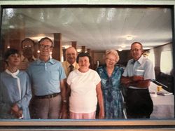
| Birth | : | 27 Jun 1875 Stokes County, North Carolina, USA |
| Death | : | 3 Jul 1940 Stokes County, North Carolina, USA |
| Burial | : | Brims Grove Cemetery, Brims Grove, Stokes County, USA |
| Coordinate | : | 36.4104340, -80.4169710 |
| Description | : | Matt Oliver Lynch was born on June 27, 1875, the first child of John Pervis Lynch and Mary Virginia "Jennie" Turpin of Quaker Gap Township in Stokes County, North Carolina. On New Years Eve, December 31, 1901, Matt married Catherine Leticia Pell also of Quaker Gap Township. He farmed as well as it appears that sometime shortly thereafter he either ran as a Republican or joined the Stokes County Sheriff's Office as a Republican constable as he actually made an arrest in January, 1910 according to The Danbury Reporter archives. On October... Read More |
frequently asked questions (FAQ):
-
Where is Matthew Oliver “Matt” Lynch's memorial?
Matthew Oliver “Matt” Lynch's memorial is located at: Brims Grove Cemetery, Brims Grove, Stokes County, USA.
-
When did Matthew Oliver “Matt” Lynch death?
Matthew Oliver “Matt” Lynch death on 3 Jul 1940 in Stokes County, North Carolina, USA
-
Where are the coordinates of the Matthew Oliver “Matt” Lynch's memorial?
Latitude: 36.4104340
Longitude: -80.4169710
Family Members:
Parent
Spouse
Siblings
Children
Flowers:
Nearby Cemetories:
1. Brims Grove Cemetery
Brims Grove, Stokes County, USA
Coordinate: 36.4104340, -80.4169710
2. Brim Family Cemetery
Stokes County, USA
Coordinate: 36.4026952, -80.4201749
3. Gospel Baptist Church Cemetery
Brims Grove, Stokes County, USA
Coordinate: 36.4205140, -80.4255970
4. Alexander Lee Joyce Family Cemetery
Brims Grove, Stokes County, USA
Coordinate: 36.4272000, -80.4233000
5. New Beginning Baptist Church Cemetery
Brims Grove, Stokes County, USA
Coordinate: 36.4177430, -80.3940760
6. Captain Bill Wilson Family Cemetery
Brims Grove, Stokes County, USA
Coordinate: 36.4168750, -80.4405590
7. Frances Memorial Primitive Baptist Church Cemetery
Brown Mountain, Stokes County, USA
Coordinate: 36.4303550, -80.3831110
8. McDaniel Family Cemetery
Pilot Mountain, Surry County, USA
Coordinate: 36.4285800, -80.4560500
9. Jessup Family Cemetery
Pilot Mountain, Surry County, USA
Coordinate: 36.4282990, -80.4563980
10. Hills Presbyterian Church Cemetery
Hills Grove, Surry County, USA
Coordinate: 36.4234161, -80.4621658
11. Waugh Cemetery
Westfield, Surry County, USA
Coordinate: 36.4413986, -80.4480972
12. Rescue Baptist Church Cemetery
Pilot Mountain, Surry County, USA
Coordinate: 36.3898080, -80.4613240
13. Hills Village Family Cemetery
Hills Grove, Surry County, USA
Coordinate: 36.4352200, -80.4594500
14. Lovells Chapel Church Cemetery
Pilot Mountain, Surry County, USA
Coordinate: 36.3879160, -80.4652290
15. John Martin Family Cemetery
Flat Rock, Stokes County, USA
Coordinate: 36.4036590, -80.3600630
16. Lawrence Cemetery
Pilot Mountain, Surry County, USA
Coordinate: 36.3716080, -80.4537230
17. Nunn Family Cemetery
Brown Mountain, Stokes County, USA
Coordinate: 36.4510994, -80.3722000
18. Pilot Mountain City Cemetery
Pilot Mountain, Surry County, USA
Coordinate: 36.3918343, -80.4809418
19. Green Family Cemetery
Pilot Mountain, Surry County, USA
Coordinate: 36.3956630, -80.4833990
20. Brown Mountain Baptist Church Cemetery
Brown Mountain, Stokes County, USA
Coordinate: 36.4482390, -80.3635740
21. Stone Family Cemetery
Pilot Mountain, Surry County, USA
Coordinate: 36.3695070, -80.4689960
22. Forest Cemetery
Stokes County, USA
Coordinate: 36.4533005, -80.3647003
23. Hunter Cemetery
Surry County, USA
Coordinate: 36.4566994, -80.4700012
24. John Nunn Cemetery
Brown Mountain, Stokes County, USA
Coordinate: 36.4647210, -80.3772960


