
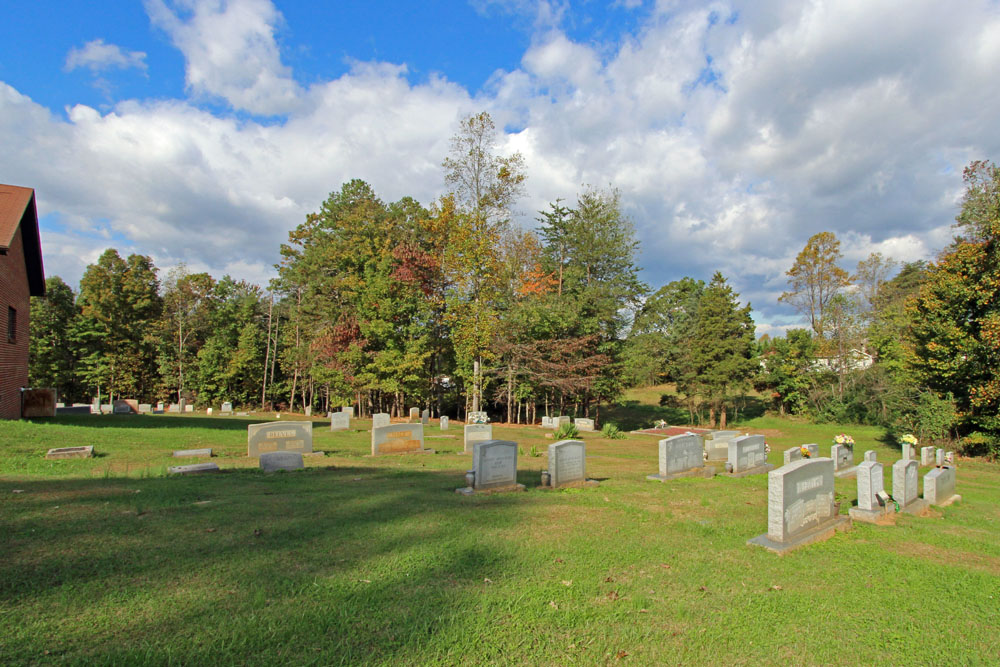
| Memorials | : | 32 |
| Location | : | Pilot Mountain, Surry County, USA |
| Coordinate | : | 36.3879160, -80.4652290 |
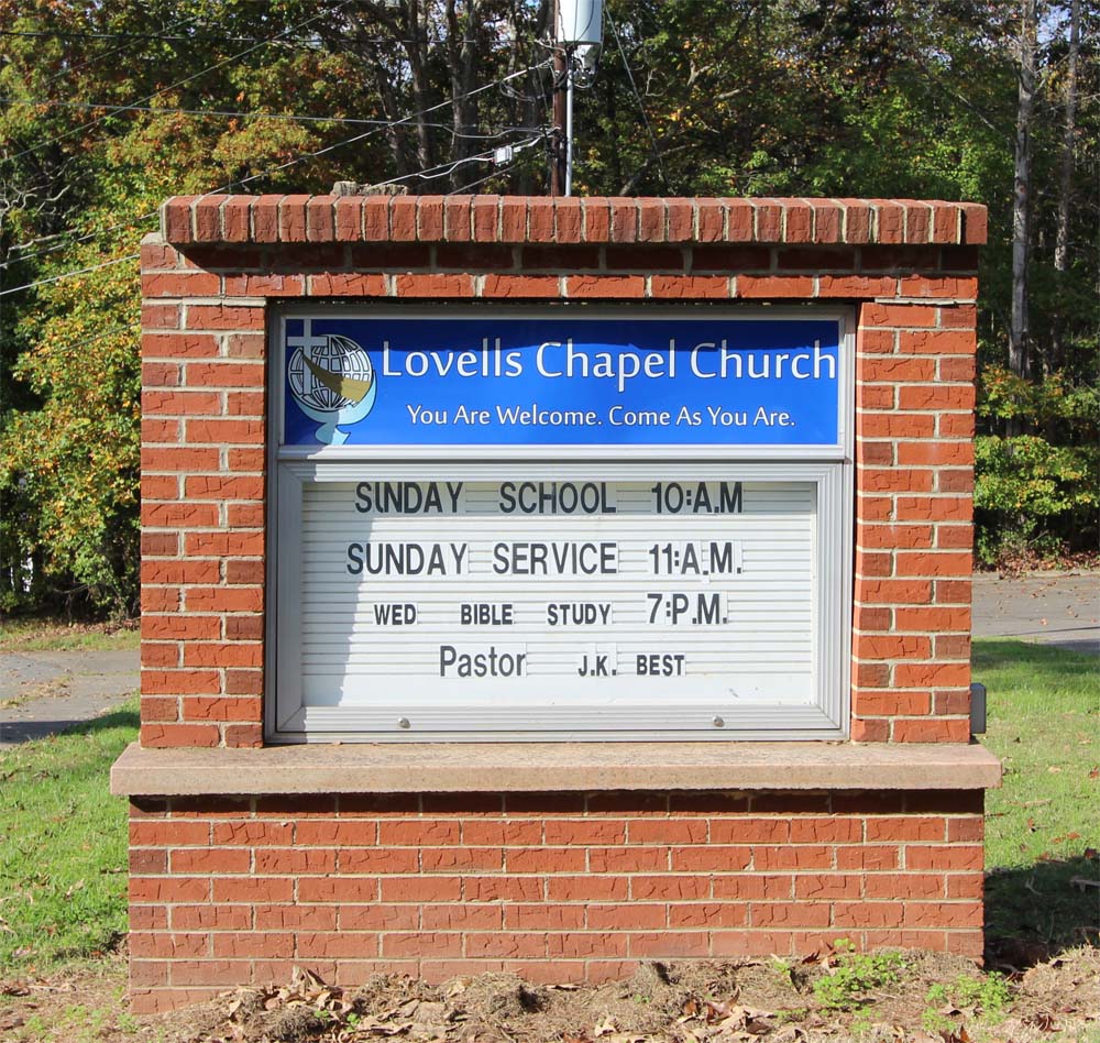
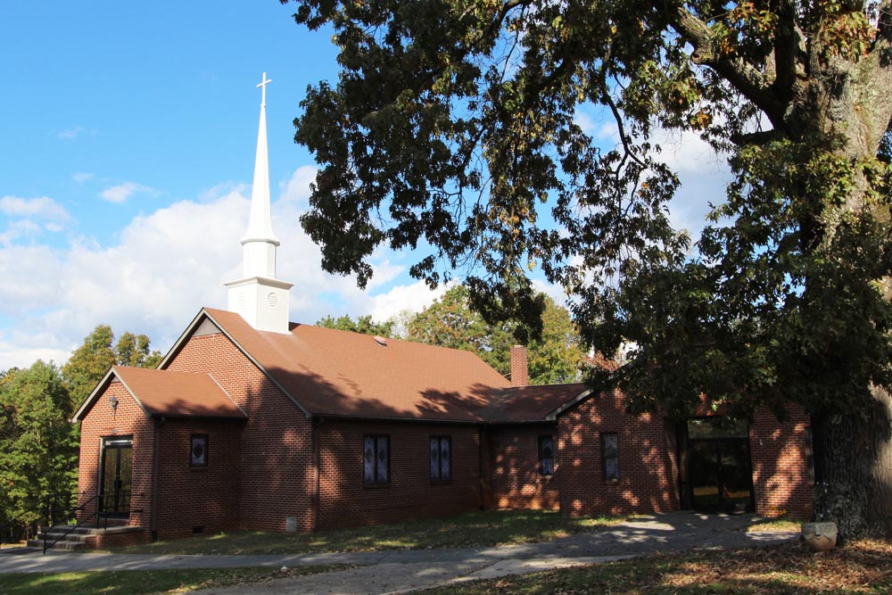
| Description | : | From the intersection of North Depot Street and East 52 Bypass, travel approximately 0.12 miles on Depot Street; the church will be on the right. The cemetery is located behind the church. |
frequently asked questions (FAQ):
-
Where is Lovells Chapel Church Cemetery?
Lovells Chapel Church Cemetery is located at 317 North Depot Street Pilot Mountain, Surry County ,North Carolina , 27041USA.
-
Lovells Chapel Church Cemetery cemetery's updated grave count on graveviews.com?
32 memorials
-
Where are the coordinates of the Lovells Chapel Church Cemetery?
Latitude: 36.3879160
Longitude: -80.4652290
Nearby Cemetories:
1. Rescue Baptist Church Cemetery
Pilot Mountain, Surry County, USA
Coordinate: 36.3898080, -80.4613240
2. Pilot Mountain City Cemetery
Pilot Mountain, Surry County, USA
Coordinate: 36.3918343, -80.4809418
3. Green Family Cemetery
Pilot Mountain, Surry County, USA
Coordinate: 36.3956630, -80.4833990
4. Stone Family Cemetery
Pilot Mountain, Surry County, USA
Coordinate: 36.3695070, -80.4689960
5. Lawrence Cemetery
Pilot Mountain, Surry County, USA
Coordinate: 36.3716080, -80.4537230
6. John Denny Cemetery
Pilot Mountain, Surry County, USA
Coordinate: 36.3755989, -80.4910965
7. Tucker-Stone Cemetery
Surry County, USA
Coordinate: 36.3990000, -80.4954167
8. Bennett Cemetery
Pilot Mountain, Surry County, USA
Coordinate: 36.3988991, -80.4957962
9. Friendly Chapel Church Cemetery
Pilot Mountain, Surry County, USA
Coordinate: 36.3635292, -80.4816132
10. Beulahland Baptist Church Cemetery
Pilot Mountain, Surry County, USA
Coordinate: 36.4037330, -80.4954900
11. John Wesley Hill Cemetery
Pilot Mountain, Surry County, USA
Coordinate: 36.4000282, -80.5012817
12. Captain Bill Wilson Family Cemetery
Brims Grove, Stokes County, USA
Coordinate: 36.4168750, -80.4405590
13. Hills Presbyterian Church Cemetery
Hills Grove, Surry County, USA
Coordinate: 36.4234161, -80.4621658
14. Whitakers Chapel United Methodist Church Cemetery
Pilot Mountain, Surry County, USA
Coordinate: 36.3763008, -80.5105057
15. Brim Family Cemetery
Stokes County, USA
Coordinate: 36.4026952, -80.4201749
16. Jessup Family Cemetery
Pilot Mountain, Surry County, USA
Coordinate: 36.4282990, -80.4563980
17. McDaniel Family Cemetery
Pilot Mountain, Surry County, USA
Coordinate: 36.4285800, -80.4560500
18. Sulphur Springs Baptist Church Cemetery
Pilot Mountain, Surry County, USA
Coordinate: 36.4074440, -80.5108871
19. Brims Grove Cemetery
Brims Grove, Stokes County, USA
Coordinate: 36.4104340, -80.4169710
20. Gospel Baptist Church Cemetery
Brims Grove, Stokes County, USA
Coordinate: 36.4205140, -80.4255970
21. Hills Village Family Cemetery
Hills Grove, Surry County, USA
Coordinate: 36.4352200, -80.4594500
22. Carey Bird Denny Cemetery
Pilot Mountain, Surry County, USA
Coordinate: 36.3582000, -80.5177500
23. Alexander Lee Joyce Family Cemetery
Brims Grove, Stokes County, USA
Coordinate: 36.4272000, -80.4233000
24. Worth Cemetery
Ararat, Surry County, USA
Coordinate: 36.4180130, -80.5205710