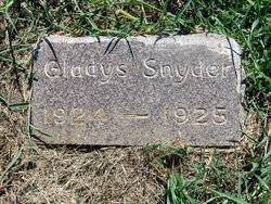
| Birth | : | 26 Feb 1926 Oak Hill, Clay County, Kansas, USA |
| Death | : | 30 Dec 2003 |
| Burial | : | Broughton Cemetery, Clay Center, Clay County, USA |
| Coordinate | : | 39.3306007, -97.0535965 |
| Description | : | Max Gordon Snyder, of Clay Center, died on Tuesday, Dec. 30, 2003. Max was born Feb. 26, 1926, at Oak Hill. He was retired from Weir Manufacturing. Max loved animals; especially raising birds. He was preceded in death by his first wife, Mildred, in 1983; and a son, Thomas. Survivors include his wife, Deb, of the home; a daughter, Bonnie Jean Trumpp of Douglas; three sons, Mike, Bill and Kelly, all of Clay Center; a stepdaughter Christine House of Topeka; two sisters, Dorothy Jones of Savannah, Ga., and Shirley Vestal of Aurora, Colo.; 11 grandchildren; and three stepgrandchildren. lnurnment services... Read More |
frequently asked questions (FAQ):
-
Where is Max Gordon Snyder's memorial?
Max Gordon Snyder's memorial is located at: Broughton Cemetery, Clay Center, Clay County, USA.
-
When did Max Gordon Snyder death?
Max Gordon Snyder death on 30 Dec 2003 in
-
Where are the coordinates of the Max Gordon Snyder's memorial?
Latitude: 39.3306007
Longitude: -97.0535965
Family Members:
Parent
Spouse
Siblings
Children
Flowers:
Nearby Cemetories:
1. Broughton Cemetery
Clay Center, Clay County, USA
Coordinate: 39.3306007, -97.0535965
2. Milo Chapman Gravesite
Broughton, Clay County, USA
Coordinate: 39.2888500, -97.0724400
3. Gilbert Cemetery
Clay County, USA
Coordinate: 39.2853012, -97.0625000
4. Clay County Poor Farm Cemetery
Clay Center, Clay County, USA
Coordinate: 39.3772700, -97.0727000
5. Gatesville Cemetery
Wakefield, Clay County, USA
Coordinate: 39.2721460, -97.0041380
6. Ebenezer Cemetery
Green, Clay County, USA
Coordinate: 39.3866997, -96.9974976
7. Republican City Cemetery
Clay Center, Clay County, USA
Coordinate: 39.3431015, -97.1628036
8. Zion Lutheran Cemetery
Clay County, USA
Coordinate: 39.2928009, -97.1557999
9. Saint Peter and Saint Pauls Catholic Cemetery
Clay Center, Clay County, USA
Coordinate: 39.4005450, -97.1236680
10. Greenwood Cemetery
Clay Center, Clay County, USA
Coordinate: 39.4011002, -97.1275024
11. Bala Cemetery
Bala, Riley County, USA
Coordinate: 39.3053017, -96.9341965
12. Uniondale Cemetery
Wakefield, Clay County, USA
Coordinate: 39.2382800, -97.0918400
13. Green Cemetery
Green, Clay County, USA
Coordinate: 39.4235992, -96.9882965
14. Saint John's Episcopal Cemetery
Clay County, USA
Coordinate: 39.2193985, -97.0744019
15. Pleasant Ridge Cemetery
Clay County, USA
Coordinate: 39.2789001, -97.1841965
16. Highland Cemetery
Wakefield, Clay County, USA
Coordinate: 39.2190247, -97.0133667
17. Wilson Cemetery
Clay County, USA
Coordinate: 39.3800011, -97.1896973
18. Lasita Cemetery
Leonardville, Riley County, USA
Coordinate: 39.4092900, -96.9422900
19. Hayes Cemetery
Clay County, USA
Coordinate: 39.4516983, -97.0811005
20. Timber Creek Cemetery
Wakefield, Clay County, USA
Coordinate: 39.2182999, -96.9805984
21. Mizpah Cemetery
Clay County, USA
Coordinate: 39.2057800, -97.1238500
22. Pleasant Hill Cemetery
Leonardville, Riley County, USA
Coordinate: 39.4371210, -96.9426730
23. Fancy Creek Cemetery
Green, Clay County, USA
Coordinate: 39.4668999, -96.9969025
24. Madura Cemetery
Wakefield, Clay County, USA
Coordinate: 39.1842003, -97.0117035


