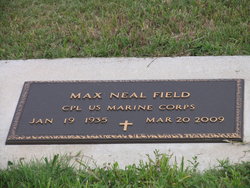
Max Neil Field
| Birth | : | 19 Jan 1935 Burr Oak, Jewell County, Kansas, USA |
| Death | : | 20 Mar 2009 Wichita, Sedgwick County, Kansas, USA |
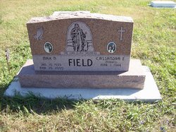
| Burial | : | Esbon Cemetery, Esbon, Jewell County, USA |
| Coordinate | : | 39.8143997, -98.4199982 |
| Plot | : | Block 6 Lot 22 |
frequently asked questions (FAQ):
-
Where is Max Neil Field's memorial?
Max Neil Field's memorial is located at: Esbon Cemetery, Esbon, Jewell County, USA.
-
When did Max Neil Field death?
Max Neil Field death on 20 Mar 2009 in Wichita, Sedgwick County, Kansas, USA
-
Where are the coordinates of the Max Neil Field's memorial?
Latitude: 39.8143997
Longitude: -98.4199982
Family Members:
Parent
Siblings
Children
Flowers:
Nearby Cemetories:
1. Esbon Cemetery
Esbon, Jewell County, USA
Coordinate: 39.8143997, -98.4199982
2. Saint Elizabeth Cemetery
Esbon, Jewell County, USA
Coordinate: 39.7844009, -98.4347000
3. Prairie Home Cemetery
Esbon, Jewell County, USA
Coordinate: 39.8278008, -98.4661026
4. Zion Cemetery
Jewell County, USA
Coordinate: 39.7672005, -98.3914032
5. Baker Cemetery
Jewell County, USA
Coordinate: 39.8581009, -98.3617020
6. Pleasant View Cemetery
Jewell County, USA
Coordinate: 39.7666900, -98.3668040
7. Providence Cemetery
Jewell County, USA
Coordinate: 39.8866997, -98.4008026
8. Salem Cemetery
Esbon, Jewell County, USA
Coordinate: 39.8755989, -98.5006027
9. Oak Creek Cemetery
Jewell County, USA
Coordinate: 39.9014015, -98.3918991
10. Baxter Cemetery
Ionia, Jewell County, USA
Coordinate: 39.7158420, -98.4158680
11. Sweet Home Cemetery
Lebanon, Smith County, USA
Coordinate: 39.7854830, -98.5465380
12. Amity Cemetery
Jewell County, USA
Coordinate: 39.9153170, -98.4673780
13. Pleasant Plains Cemetery
Lebanon, Smith County, USA
Coordinate: 39.8793400, -98.5419400
14. German Baptist Brethren Cemetery I
Burr Oak, Jewell County, USA
Coordinate: 39.8787900, -98.2955400
15. Burr Oak Cemetery
Burr Oak, Jewell County, USA
Coordinate: 39.8652992, -98.2846985
16. Odessa Cemetery
Jewell County, USA
Coordinate: 39.7124100, -98.4953613
17. West Lutheran Cemetery
Mankato, Jewell County, USA
Coordinate: 39.7852150, -98.2694250
18. German Baptist Brethren Cemetery II
Burr Oak, Jewell County, USA
Coordinate: 39.8720860, -98.2786470
19. Walnut Creek Friends Cemetery
Northbranch, Jewell County, USA
Coordinate: 39.9298800, -98.3436400
20. Old Highland Township Cemetery
Jewell County, USA
Coordinate: 39.9430600, -98.4458900
21. Price Cemetery
Oak Township, Smith County, USA
Coordinate: 39.7986860, -98.5993060
22. Conservative Friends Cemetery
Jewell County, USA
Coordinate: 39.9448800, -98.3527500
23. Ionia Cemetery
Ionia, Jewell County, USA
Coordinate: 39.6772003, -98.3574982
24. Mount Hope Cemetery
Mankato, Jewell County, USA
Coordinate: 39.7825012, -98.2300034

