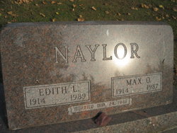
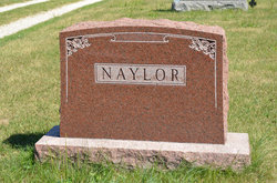
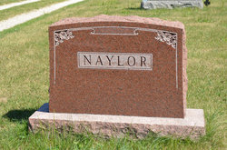
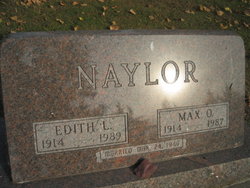
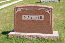
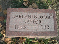
Max Owen Naylor
| Birth | : | 11 Sep 1914 Elk River, Sherburne County, Minnesota, USA |
| Death | : | 10 Jul 1987 Omaha, Douglas County, Nebraska, USA |
| Burial | : | Rose Hill Memorial Park, Rocky Hill, Hartford County, USA |
| Coordinate | : | 41.6547012, -72.6588974 |
| Plot | : | 2nd Addition, Lot 13 |
| Description | : | MAX NAYLOR SERVICES TUESDAY Max Owen Naylor, 72, of rural Emerson, died Friday night at Nebraska Methodist Hospital following multiple blood clots on the brain. Funeral services were held at 10:30 a.m. Tuesday, July 14, 1967 at the First United Methodist Church in Red Oak. Burial followed in the Emerson Cemetery. Mr. Naylor was a charter member of the Iowa Corn Promotion Board and served as vice-chairman in 1976. He also served on the Iowa Corn Growers Association Board of Directors from 1978 through 1980. He was president of the Montgomery County Farm Bureau in 1976, and was a voting... Read More |
frequently asked questions (FAQ):
-
Where is Max Owen Naylor's memorial?
Max Owen Naylor's memorial is located at: Rose Hill Memorial Park, Rocky Hill, Hartford County, USA.
-
When did Max Owen Naylor death?
Max Owen Naylor death on 10 Jul 1987 in Omaha, Douglas County, Nebraska, USA
-
Where are the coordinates of the Max Owen Naylor's memorial?
Latitude: 41.6547012
Longitude: -72.6588974
Family Members:
Parent
Spouse
Siblings
Children
Flowers:
Nearby Cemetories:
1. Rose Hill Memorial Park
Rocky Hill, Hartford County, USA
Coordinate: 41.6547012, -72.6588974
2. Colonel Raymond F. Gates Memorial Cemetery
Rocky Hill, Hartford County, USA
Coordinate: 41.6512718, -72.6548615
3. Saint Andrews Church Memorial Garden
Rocky Hill, Hartford County, USA
Coordinate: 41.6671830, -72.6586290
4. Center Cemetery
Rocky Hill, Hartford County, USA
Coordinate: 41.6605988, -72.6389008
5. Bethany Lutheran Church Memorial Garden
Cromwell, Middlesex County, USA
Coordinate: 41.6214800, -72.6623400
6. Old South Cemetery
South Glastonbury, Hartford County, USA
Coordinate: 41.6585999, -72.6042023
7. Beckley Cemetery
Berlin, Hartford County, USA
Coordinate: 41.6447560, -72.7175720
8. West Cemetery
Cromwell, Middlesex County, USA
Coordinate: 41.6075134, -72.6573639
9. Old Center Cemetery
Cromwell, Middlesex County, USA
Coordinate: 41.6065178, -72.6573486
10. Saint Augustine Cemetery
Glastonbury, Hartford County, USA
Coordinate: 41.6646996, -72.5952988
11. Hilltop Covenant Church Memorial Garden
Cromwell, Middlesex County, USA
Coordinate: 41.6049700, -72.6681000
12. Old Church Cemetery
South Glastonbury, Hartford County, USA
Coordinate: 41.6814003, -72.6007996
13. Kelsey Cemetery
Cromwell, Middlesex County, USA
Coordinate: 41.6091232, -72.6994476
14. Wilcox Cemetery
Berlin, Hartford County, USA
Coordinate: 41.6192017, -72.7185974
15. Wethersfield Village Cemetery
Wethersfield, Hartford County, USA
Coordinate: 41.7116013, -72.6499481
16. Old Burying Ground
Cromwell, Middlesex County, USA
Coordinate: 41.5954018, -72.6509171
17. Trinity Parish Memorial Garden
Wethersfield, Hartford County, USA
Coordinate: 41.7148190, -72.6522590
18. Church Street Cemetery
Newington, Hartford County, USA
Coordinate: 41.6548996, -72.7403030
19. Green Cemetery
Glastonbury, Hartford County, USA
Coordinate: 41.7014008, -72.6053009
20. Church of Christ Congregational Memorial Garden
Newington, Hartford County, USA
Coordinate: 41.6973190, -72.7238980
21. Wethersfield State Prison Cemetery
Wethersfield, Hartford County, USA
Coordinate: 41.7195360, -72.6603130
22. Newington Cemetery
Newington, Hartford County, USA
Coordinate: 41.6978455, -72.7239532
23. Congregation Bnai Sholom Cemetery
Wethersfield, Hartford County, USA
Coordinate: 41.7170400, -72.6955200
24. Bess Israel Cemetery
Hartford, Hartford County, USA
Coordinate: 41.7170400, -72.6955200

