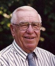
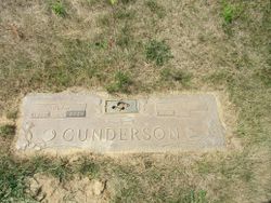
Maxile Iona Gunderson Burns
| Birth | : | 29 Jun 1925 Gilman, Marshall County, Iowa, USA |
| Death | : | 25 Nov 2005 Marshalltown, Marshall County, Iowa, USA |
| Burial | : | Saint Andrew the Apostle, Holt, North Norfolk District, England |
| Coordinate | : | 52.9063400, 1.0933500 |
| Description | : | Maxile (Mrs. Bob) Burns, 80, of 2431 Tiffin Avenue, Marshalltown, died Friday night, November 25th, at her home while under the care of her family and the Iowa River Hospice. Funeral services at the Mitchell Family Funeral Home, Bobby Shomo officiating. Burial in Rose Hill Memorial Gardens. Maxile I. Gunderson was born on June 29th, 1925, at her home in Gilman, Iowa, the daughter of Albert and Virgil LaRue (Bales) Gunderson. She graduated from Albion High School, Class of 1942. On September 22, 1944, she married Robert "Bob" Burns at the Christian... Read More |
frequently asked questions (FAQ):
-
Where is Maxile Iona Gunderson Burns's memorial?
Maxile Iona Gunderson Burns's memorial is located at: Saint Andrew the Apostle, Holt, North Norfolk District, England.
-
When did Maxile Iona Gunderson Burns death?
Maxile Iona Gunderson Burns death on 25 Nov 2005 in Marshalltown, Marshall County, Iowa, USA
-
Where are the coordinates of the Maxile Iona Gunderson Burns's memorial?
Latitude: 52.9063400
Longitude: 1.0933500
Family Members:
Parent
Spouse
Siblings
Children
Flowers:
Nearby Cemetories:
1. Saint Andrew the Apostle
Holt, North Norfolk District, England
Coordinate: 52.9063400, 1.0933500
2. Methodist Memorial Gardens
Holt, North Norfolk District, England
Coordinate: 52.9067730, 1.0878360
3. Holt Town Cemetery
Holt, North Norfolk District, England
Coordinate: 52.9117900, 1.0850400
4. St. Andrews Churchyard
Letheringsett, North Norfolk District, England
Coordinate: 52.9081600, 1.0623490
5. St Andrew Churchyard
Hempstead, North Norfolk District, England
Coordinate: 52.8895750, 1.1270070
6. All Saints Churchyard
Hempstead, North Norfolk District, England
Coordinate: 52.8895200, 1.1274620
7. St. Mary the Virgin Churchyard
Kelling, North Norfolk District, England
Coordinate: 52.9322300, 1.1053700
8. St Lawrence Churchyard
Hunworth, North Norfolk District, England
Coordinate: 52.8772530, 1.0673080
9. Edgefield Old Churchyard
Edgefield, North Norfolk District, England
Coordinate: 52.8687300, 1.1001800
10. All Saints Churchyard
Bodham, North Norfolk District, England
Coordinate: 52.9057700, 1.1596200
11. St. Martin's Churchyard, Glandford
Letheringsett, North Norfolk District, England
Coordinate: 52.9311970, 1.0396308
12. St. Peter and St. Paul's Churchyard
Edgefield, North Norfolk District, England
Coordinate: 52.8645320, 1.1089840
13. St Nicholas Churchyard
Salthouse, North Norfolk District, England
Coordinate: 52.9503200, 1.0889800
14. Saint Mary's Churchyard
Baconsthorpe, North Norfolk District, England
Coordinate: 52.8872500, 1.1606900
15. St. Andrew's Churchyard
Brinton, North Norfolk District, England
Coordinate: 52.8803690, 1.0274610
16. St Margaret Churchyard
Cley, North Norfolk District, England
Coordinate: 52.9463890, 1.0475480
17. St. Margaret's Churchyard
Saxlingham, North Norfolk District, England
Coordinate: 52.9155250, 1.0121410
18. St Maurice Churchyard
Briningham, North Norfolk District, England
Coordinate: 52.8682680, 1.0271340
19. St. Michael's Churchyard
Plumstead, North Norfolk District, England
Coordinate: 52.8691700, 1.1669320
20. St Mary Churchyard Burgh Parva
Melton Constable, North Norfolk District, England
Coordinate: 52.8605700, 1.0337300
21. All Saints Churchyard
Briston, North Norfolk District, England
Coordinate: 52.8511120, 1.0617870
22. St. Nicholas' Churchyard
Blakeney, North Norfolk District, England
Coordinate: 52.9512300, 1.0247250
23. St. Peter's Churchyard
North Barningham, North Norfolk District, England
Coordinate: 52.8888040, 1.1954330
24. Carmelite Friary of the Blessed Virgin
Blakeney, North Norfolk District, England
Coordinate: 52.9553240, 1.0234250


