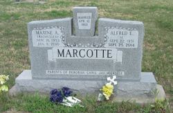
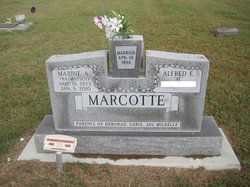
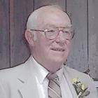
Maxine Amelia Rasmussen Marcotte
| Birth | : | 18 Nov 1933 Republic County, Kansas, USA |
| Death | : | 8 Jan 2010 Clay Center, Clay County, Kansas, USA |
| Burial | : | Harris Creek Cemetery, Bradford, Miami County, USA |
| Coordinate | : | 40.1492320, -84.4312640 |
| Description | : | died January 8, 2010 at Clay County Medical Center, Clay Center, KS at the age of 76. She was born on November 18, 1933 in Republic County, KS the daughter of Peter Rasmussen and Hilda Sallman. She was raised in Concordia and graduated from Concordia High School. She married Alfred Marcotte on April 10, 1953. They made their home in Manhattan before moving to Morganville in 1970. They owned and operated Marcotte Grocery in Morganville until they retired in the early 1980's. She was a member of SS Peter and Paul Catholic Church, American Legion Auxilary in Clifton and the... Read More |
frequently asked questions (FAQ):
-
Where is Maxine Amelia Rasmussen Marcotte's memorial?
Maxine Amelia Rasmussen Marcotte's memorial is located at: Harris Creek Cemetery, Bradford, Miami County, USA.
-
When did Maxine Amelia Rasmussen Marcotte death?
Maxine Amelia Rasmussen Marcotte death on 8 Jan 2010 in Clay Center, Clay County, Kansas, USA
-
Where are the coordinates of the Maxine Amelia Rasmussen Marcotte's memorial?
Latitude: 40.1492320
Longitude: -84.4312640
Family Members:
Flowers:
Nearby Cemetories:
1. Harris Creek Cemetery
Bradford, Miami County, USA
Coordinate: 40.1492320, -84.4312640
2. Old Harris Creek Cemetery
Darke County, USA
Coordinate: 40.1523323, -84.4336700
3. Wise Cemetery
Miami County, USA
Coordinate: 40.1383590, -84.4207160
4. Rarick Burial Ground
Miami County, USA
Coordinate: 40.1660680, -84.4273570
5. Brumbaugh Cemetery
Miami County, USA
Coordinate: 40.1626080, -84.4094180
6. Miller Cemetery
Darke County, USA
Coordinate: 40.1522700, -84.4694500
7. Christian Cemetery
Adams Township, Darke County, USA
Coordinate: 40.1737530, -84.4578910
8. Friedens Cemetery
Covington, Miami County, USA
Coordinate: 40.1809200, -84.4140630
9. Byrd Cemetery
Adams Township, Darke County, USA
Coordinate: 40.1783150, -84.4643670
10. Greenville Creek Cemetery
Bradford, Miami County, USA
Coordinate: 40.1133003, -84.4119034
11. Arnold Cemetery
Miami County, USA
Coordinate: 40.1195510, -84.3973400
12. Bradford Cemetery
Bradford, Miami County, USA
Coordinate: 40.1096992, -84.4282990
13. Mott Cemetery
Gettysburg, Darke County, USA
Coordinate: 40.1051480, -84.4656910
14. Saint Peters Lutheran Church Cemetery
Webster, Darke County, USA
Coordinate: 40.1953310, -84.4657230
15. Cable Cemetery
Miami County, USA
Coordinate: 40.1388100, -84.3615800
16. Oakland Cemetery
Gettysburg, Darke County, USA
Coordinate: 40.1541939, -84.5044403
17. Union Church Cemetery
Covington, Miami County, USA
Coordinate: 40.1685982, -84.3578033
18. Miami Memorial Park Cemetery
Covington, Miami County, USA
Coordinate: 40.1500015, -84.3516998
19. Highland Cemetery
Covington, Miami County, USA
Coordinate: 40.1293983, -84.3535995
20. Gettysburg Cemetery
Gettysburg, Darke County, USA
Coordinate: 40.1073570, -84.4946060
21. Saint Pauls Cemetery
Piqua, Miami County, USA
Coordinate: 40.1973310, -84.3680020
22. Stoner Cemetery
Stelvideo, Darke County, USA
Coordinate: 40.1786003, -84.5192032
23. Hoover Cemetery
Versailles, Darke County, USA
Coordinate: 40.2061005, -84.4938965
24. Priest Cemetery
Covington, Miami County, USA
Coordinate: 40.1276540, -84.3358590


