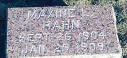
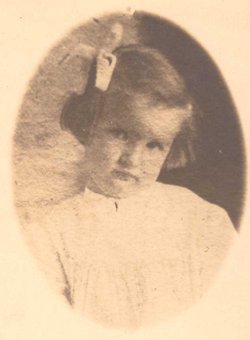
Maxine Lavena Hahn
| Birth | : | 26 Sep 1904 Maryville, Nodaway County, Missouri, USA |
| Death | : | 25 Jan 1909 Nodaway County, Missouri, USA |
| Burial | : | Braidwood Cemetery, Braidwood, Queanbeyan–Palerang Regional Council, Australia |
| Coordinate | : | -35.4505750, 149.7967550 |
| Plot | : | Sec 7, Row 11, N-S |
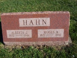
| Description | : | Daughter of Moses Albert Hahn and Alberta "Bird" Howard Hahn. Maxine Hahn succumbs to Whooping Cough Was Four-Year-Old Daughter of Mr. and Mrs. Moses Hahn in East Fourth Street Maxine, the little daughter of Mr. and Mrs. Moses Hahn, died Monday evening at 7:45 o'clock. The little one, who was four and one-half years old, contracted whooping cough several weeks ago which developed into acute bronchitis, resulting in her death. The funeral was held from the residence, 908 East Fourth Street, Tuesday afternoon. Two other children of Mr. and Mrs. Hahn, one a little girl of six years, the... Read More |
frequently asked questions (FAQ):
-
Where is Maxine Lavena Hahn's memorial?
Maxine Lavena Hahn's memorial is located at: Braidwood Cemetery, Braidwood, Queanbeyan–Palerang Regional Council, Australia.
-
When did Maxine Lavena Hahn death?
Maxine Lavena Hahn death on 25 Jan 1909 in Nodaway County, Missouri, USA
-
Where are the coordinates of the Maxine Lavena Hahn's memorial?
Latitude: -35.4505750
Longitude: 149.7967550
Family Members:
Parent
Siblings
Nearby Cemetories:
1. Braidwood Cemetery
Braidwood, Queanbeyan–Palerang Regional Council, Australia
Coordinate: -35.4505750, 149.7967550
2. Charleyong Cemetery
Charleyong, Queanbeyan–Palerang Regional Council, Australia
Coordinate: -35.4500740, 149.7970560
3. Braidwood Lawn Cemetery
Braidwood, Queanbeyan–Palerang Regional Council, Australia
Coordinate: -35.4491000, 149.7966000
4. Mongarlowe Cemetery
Mongarlowe, Queanbeyan–Palerang Regional Council, Australia
Coordinate: -35.4242770, 149.9411370
5. Majors Creek Cemetery
Majors Creek, Queanbeyan–Palerang Regional Council, Australia
Coordinate: -35.5804770, 149.7281970
6. Larbert Cemetery
Queanbeyan–Palerang Regional Council, Australia
Coordinate: -35.2961950, 149.7608180
7. Araluen Church of England Cemetery
Araluen, Queanbeyan–Palerang Regional Council, Australia
Coordinate: -35.6110340, 149.7795490
8. Araluen Catholic Cemetery
Araluen, Queanbeyan–Palerang Regional Council, Australia
Coordinate: -35.6340000, 149.8228333
9. Currowan Cemetery
Currowan, Eurobodalla Shire, Australia
Coordinate: -35.5765330, 150.0580070
10. St Peter & Paul Roman Catholic Cemetery
Hoskinstown, Queanbeyan–Palerang Regional Council, Australia
Coordinate: -35.4229520, 149.4534450
11. Gundillion Cemetery
Queanbeyan–Palerang Regional Council, Australia
Coordinate: -35.7247510, 149.6396220
12. Captain's Flat Cemetery
Captains Flat, Queanbeyan–Palerang Regional Council, Australia
Coordinate: -35.6124200, 149.4589850
13. Saint Thomas' Cemetery
Carwoola, Queanbeyan–Palerang Regional Council, Australia
Coordinate: -35.4389480, 149.3827710
14. Bungendore Cemetery
Bungendore, Queanbeyan–Palerang Regional Council, Australia
Coordinate: -35.2590741, 149.4526073
15. Nelligen Cemetery
Nelligen, Eurobodalla Shire, Australia
Coordinate: -35.6516110, 150.1338960
16. Nelligen Church Of England Cemetery Former
Nelligen, Eurobodalla Shire, Australia
Coordinate: -35.6477114, 150.1387833
17. Turalla Cemetery
Bungendore, Queanbeyan–Palerang Regional Council, Australia
Coordinate: -35.2419090, 149.4080250
18. Tarago General Cemetery
Tarago, Goulburn Mulwaree Council, Australia
Coordinate: -35.0786380, 149.6413420
19. Nerriga Catholic Cemetery
Nerriga, Queanbeyan–Palerang Regional Council, Australia
Coordinate: -35.1226300, 150.0800301
20. Batemans Bay Historic Cemetery
Batemans Bay, Eurobodalla Shire, Australia
Coordinate: -35.7089400, 150.1762900
21. Batemans Bay Old Catholic
Batemans Bay, Eurobodalla Shire, Australia
Coordinate: -35.7093950, 150.1764310
22. Batemans Bay Cemetery
Batemans Bay, Eurobodalla Shire, Australia
Coordinate: -35.7207690, 150.1756980
23. Batemans Bay Old Anglican Cemetery
Batemans Bay, Eurobodalla Shire, Australia
Coordinate: -35.7166672, 150.1833344
24. Nerriga General Cemetery
Nerriga, Queanbeyan–Palerang Regional Council, Australia
Coordinate: -35.1127380, 150.0868650

