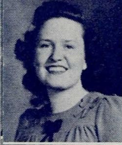
Merle Mumford
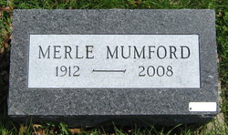
| Birth | : | 15 Jun 1912 Valley Falls, Jefferson County, Kansas, USA |
| Death | : | 27 Jun 2008 Maryville, Nodaway County, Missouri, USA |
| Burial | : | McLouth Cemetery, McLouth, Jefferson County, USA |
| Coordinate | : | 39.1940727, -95.2149429 |
| Plot | : | New Central C (6), Row 9 |
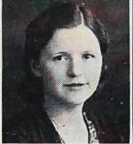
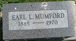
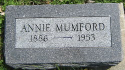
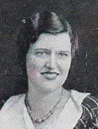
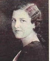
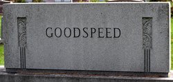
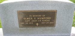
| Description | : | Merle Mumford, 96, Maryville, Missouri, died Friday, June 27, 2008, at St. Francis Hospital in Maryville. She was born June 15, 1912, in Valley Falls, Kansas to Earl L. and Annie Towler Mumford. Ms Mumford was retired as a teacher with the Hillsborough Elementary School, San Mateo, California. She was a lifetime member of the Missouri and California Retired Teachers Association. She was preceded in death by her parents, sisters Naomi Mumford, Ruth Mumford and Martha Goodspeed, and brother Elmer Mumford. She is survived by a brother Theodore Mumford, sister Irene Brown, both of Maryville, and nieces and nephews. Merle's wishes were to be... Read More |
frequently asked questions (FAQ):
-
Where is Merle Mumford's memorial?
Merle Mumford's memorial is located at: McLouth Cemetery, McLouth, Jefferson County, USA.
-
When did Merle Mumford death?
Merle Mumford death on 27 Jun 2008 in Maryville, Nodaway County, Missouri, USA
-
Where are the coordinates of the Merle Mumford's memorial?
Latitude: 39.1940727
Longitude: -95.2149429
Family Members:
Parent
Siblings
Flowers:
Nearby Cemetories:
1. McLouth Cemetery
McLouth, Jefferson County, USA
Coordinate: 39.1940727, -95.2149429
2. Wild Horse Cemetery
McLouth, Jefferson County, USA
Coordinate: 39.1801796, -95.1968307
3. Fowler Cemetery
McLouth, Jefferson County, USA
Coordinate: 39.2383003, -95.1911011
4. County Poor Farm Cemetery
Jefferson County, USA
Coordinate: 39.2343050, -95.2842700
5. Eagle Cemetery
Jarbalo, Leavenworth County, USA
Coordinate: 39.1861000, -95.1239014
6. Hardy Oak Cemetery
McLouth, Jefferson County, USA
Coordinate: 39.1166992, -95.2474976
7. Pleasant View Cemetery
Oskaloosa, Jefferson County, USA
Coordinate: 39.2224998, -95.3167038
8. Ebenezer Amish Mennonite Church Cemetery
Oskaloosa, Jefferson County, USA
Coordinate: 39.2156400, -95.3218500
9. Old Methodist Cemetery
Oskaloosa, Jefferson County, USA
Coordinate: 39.2093700, -95.3251400
10. Plum Grove Cemetery
Winchester, Jefferson County, USA
Coordinate: 39.2672005, -95.2794037
11. Friends Church Cemetery
Springdale, Leavenworth County, USA
Coordinate: 39.2532800, -95.1237100
12. Wright Family Cemetery
Winchester, Jefferson County, USA
Coordinate: 39.2817200, -95.2519200
13. Springdale Cemetery
Springdale, Leavenworth County, USA
Coordinate: 39.2672200, -95.1413900
14. Saint Thomas Cemetery
Springdale, Leavenworth County, USA
Coordinate: 39.2597008, -95.1192017
15. Fall Creek Cemetery
Jarbalo, Leavenworth County, USA
Coordinate: 39.2242012, -95.0883026
16. Billy C. Chrisman Gravesite
Oskaloosa, Jefferson County, USA
Coordinate: 39.1404900, -95.3291900
17. Campbell Cemetery
Jarbalo, Leavenworth County, USA
Coordinate: 39.2303600, -95.0753400
18. Tonganoxie Cemetery
Tonganoxie, Leavenworth County, USA
Coordinate: 39.1093559, -95.1092987
19. Sparks Cemetery
Easton, Leavenworth County, USA
Coordinate: 39.2958336, -95.1355591
20. Wise Cemetery
Winchester, Jefferson County, USA
Coordinate: 39.3107986, -95.2485962
21. Buster Cemetery
Perry, Jefferson County, USA
Coordinate: 39.1286011, -95.3443985
22. Chester Cemetery
Williamstown, Jefferson County, USA
Coordinate: 39.0766780, -95.2572680
23. Schrimpf Family Cemetery
Lowemont, Leavenworth County, USA
Coordinate: 39.2353400, -95.0632500
24. Pony Creek Cemetery
Leavenworth County, USA
Coordinate: 39.0730500, -95.1594400

