| Birth | : | 18 Oct 1855 Janesville, Rock County, Wisconsin, USA |
| Death | : | 20 Dec 1908 Napier, Boone County, Iowa, USA |
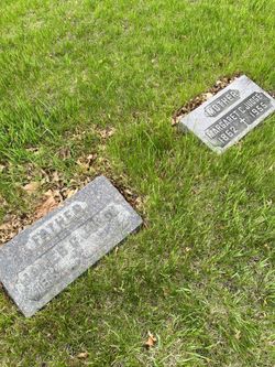
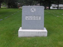
| Burial | : | Saint Bernard's Cemetery, Enfield, Hartford County, USA |
| Coordinate | : | 41.9930992, -72.5274963 |
| Description | : | Boone County Democrat Friday, December 25, 1908 Michael E. Judge, one of the best known farmers of the county, passed away at his home in Colfax Township, one mile west of Napier, on Sunday morning at 8:10 o'clock after an illness of ten days. Death was caused from pleural pneumonia and while the deceased had complained for some time his condition was not thought serious until he was taken to his bed. His death came as a shock to the community but all that medical aid and nursing could do was of no avail. He was in this... Read More |
frequently asked questions (FAQ):
-
Where is Michael Emmet Judge's memorial?
Michael Emmet Judge's memorial is located at: Saint Bernard's Cemetery, Enfield, Hartford County, USA.
-
When did Michael Emmet Judge death?
Michael Emmet Judge death on 20 Dec 1908 in Napier, Boone County, Iowa, USA
-
Where are the coordinates of the Michael Emmet Judge's memorial?
Latitude: 41.9930992
Longitude: -72.5274963
Family Members:
Parent
Spouse
Siblings
Children
Flowers:
Nearby Cemetories:
1. Saint Bernard's Cemetery
Enfield, Hartford County, USA
Coordinate: 41.9930992, -72.5274963
2. Islamic Center Cemetery
Enfield, Hartford County, USA
Coordinate: 41.9968109, -72.5389862
3. Old Hazardville Cemetery
Hazardville, Hartford County, USA
Coordinate: 41.9867897, -72.5409393
4. New Hazardville Cemetery
Hazardville, Hartford County, USA
Coordinate: 41.9883804, -72.5450592
5. Shaker Cemetery
Enfield, Hartford County, USA
Coordinate: 42.0141400, -72.5161600
6. Lindy Farms Cemetery
Enfield, Hartford County, USA
Coordinate: 41.9589427, -72.5195122
7. Saint Adalbert Cemetery
Enfield, Hartford County, USA
Coordinate: 42.0026207, -72.5878754
8. Holy Cross Cemetery
Enfield, Hartford County, USA
Coordinate: 42.0035362, -72.5912170
9. Enfield Street Cemetery
Enfield, Hartford County, USA
Coordinate: 41.9844017, -72.5916977
10. West Cemetery
Somers, Tolland County, USA
Coordinate: 41.9836006, -72.4606018
11. Billings Hill Cemetery
East Longmeadow, Hampden County, USA
Coordinate: 42.0433860, -72.5000000
12. Melrose Cemetery
East Windsor, Hartford County, USA
Coordinate: 41.9372711, -72.5246735
13. Thompsonville Cemetery
Enfield, Hartford County, USA
Coordinate: 42.0054893, -72.6010895
14. Old Saint Patricks Cemetery
Enfield, Hartford County, USA
Coordinate: 42.0052528, -72.6022186
15. North Cemetery
Somers, Tolland County, USA
Coordinate: 41.9953003, -72.4492035
16. Somers Congregational Church Memorial Garden
Somers, Tolland County, USA
Coordinate: 41.9857190, -72.4461100
17. Austin Cemetery
Suffield, Hartford County, USA
Coordinate: 42.0075333, -72.6083833
18. Center Cemetery
Somers, Tolland County, USA
Coordinate: 41.9890900, -72.4391937
19. New Saint Patricks Cemetery
Enfield, Hartford County, USA
Coordinate: 41.9558100, -72.6030700
20. Longmeadow Cemetery
Longmeadow, Hampden County, USA
Coordinate: 42.0495262, -72.5791397
21. Green Lawn Cemetery
East Longmeadow, Hampden County, USA
Coordinate: 42.0645561, -72.5079727
22. Sikes Cemetery
Suffield, Hartford County, USA
Coordinate: 42.0268010, -72.6153050
23. Baptist Village Cemetery
East Longmeadow, Hampden County, USA
Coordinate: 42.0559920, -72.4711310
24. Woodlawn Cemetery
Suffield, Hartford County, USA
Coordinate: 41.9771996, -72.6311035


