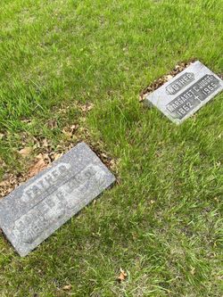
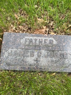
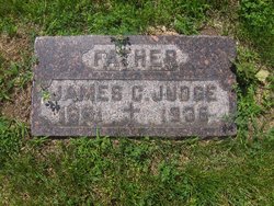
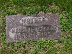
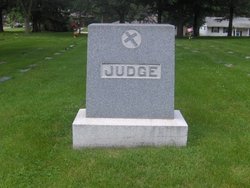
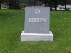
James C. Judge
| Birth | : | 24 Sep 1861 Wisconsin, USA |
| Death | : | Sep 1936 Napier, Boone County, Iowa, USA |
| Burial | : | Oakview Cemetery, Royal Oak, Oakland County, USA |
| Coordinate | : | 42.5005989, -83.1393967 |
| Description | : | James A. Judge, 74, a pioneer farmer of this vicinity who had lived on farms near Napier for 64 years, died at 6:30 p. m., Sunday at the Mary Greeley hospital. He was taken to the hospital Tuesday, ill with pneumonia. James Judge was born in Wisconsin Sept. 24, 1861 and came here in May 1872. He first lived on the present Dean C. F. Curtiss farm west of Ames and later moved to farms on rural route 3, Ames. Surviving him are his wife, five sons, James E., on a farm near the parental home; William, Charles, Richard and... Read More |
frequently asked questions (FAQ):
-
Where is James C. Judge's memorial?
James C. Judge's memorial is located at: Oakview Cemetery, Royal Oak, Oakland County, USA.
-
When did James C. Judge death?
James C. Judge death on Sep 1936 in Napier, Boone County, Iowa, USA
-
Where are the coordinates of the James C. Judge's memorial?
Latitude: 42.5005989
Longitude: -83.1393967
Family Members:
Parent
Spouse
Siblings
Flowers:
Nearby Cemetories:
1. Oakview Cemetery
Royal Oak, Oakland County, USA
Coordinate: 42.5005989, -83.1393967
2. Saint Marys Cemetery
Royal Oak, Oakland County, USA
Coordinate: 42.5002430, -83.1444560
3. Royal Oak Cemetery
Royal Oak, Oakland County, USA
Coordinate: 42.5036011, -83.1442032
4. Saint Johns Episcopal Church Resurrection Garden
Royal Oak, Oakland County, USA
Coordinate: 42.4892970, -83.1574120
5. Roseland Park Cemetery
Berkley, Oakland County, USA
Coordinate: 42.5060997, -83.1797028
6. Saint Andrews Memorial Garden
Clawson, Oakland County, USA
Coordinate: 42.5359612, -83.1460571
7. Congregation Beth Tefilo Cemetery
Ferndale, Oakland County, USA
Coordinate: 42.4536819, -83.1303940
8. Machpelah Cemetery
Ferndale, Oakland County, USA
Coordinate: 42.4525470, -83.1295570
9. Clover Hill Park Cemetery
Birmingham, Oakland County, USA
Coordinate: 42.5349998, -83.1885986
10. Beth Abraham Cemetery
Ferndale, Oakland County, USA
Coordinate: 42.4508290, -83.1285990
11. Saint David Episcopal Church Columbarium
Southfield, Oakland County, USA
Coordinate: 42.5030990, -83.2096400
12. Perrin Cemetery
Troy, Oakland County, USA
Coordinate: 42.5398254, -83.1857605
13. Woodlawn Cemetery
Detroit, Wayne County, USA
Coordinate: 42.4430962, -83.1277542
14. Beekman Cemetery
Southfield, Oakland County, USA
Coordinate: 42.5098076, -83.2176285
15. Detroit Memorial Park East
Warren, Macomb County, USA
Coordinate: 42.5196880, -83.0644300
16. Holy Trinity Cemetery
Sterling Heights, Macomb County, USA
Coordinate: 42.5461006, -83.0830994
17. Warren Union Cemetery
Warren, Macomb County, USA
Coordinate: 42.5276380, -83.0632550
18. Acacia Park Cemetery
Beverly Hills, Oakland County, USA
Coordinate: 42.5217018, -83.2197037
19. Evergreen Cemetery
Detroit, Wayne County, USA
Coordinate: 42.4384710, -83.1206700
20. Saint James Episcopal Church Columbarium
Birmingham, Oakland County, USA
Coordinate: 42.5465088, -83.2179642
21. Crooks Road Cemetery
Troy, Oakland County, USA
Coordinate: 42.5727997, -83.1680984
22. Southfield Reformed Cemetery
Southfield, Oakland County, USA
Coordinate: 42.4848420, -83.2405580
23. Big Beaver United Methodist Church Columbarium
Troy, Oakland County, USA
Coordinate: 42.5747223, -83.1094131
24. Greenwood Cemetery
Birmingham, Oakland County, USA
Coordinate: 42.5539017, -83.2238998

