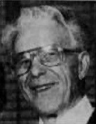
| Birth | : | 29 Sep 1875 |
| Death | : | 1947 Goldstone, Hill County, Montana, USA |
| Burial | : | Saint Wenceslaus Cemetery, Goldstone, Hill County, USA |
| Coordinate | : | 48.9002610, -110.5310160 |
| Description | : | Michael Warhank Michael was born in Yugoslavia (defunct) Married to Anna M. Children: Barbara, Carl, Margaret, Wilhelmina; Esther, Raymond. (from 'cara' in the 'Goldstone Cemetery' site in 'Find A Grave' NOTE: St. Wenceslaus Cemetery same as Goldstone Cemetery. |
frequently asked questions (FAQ):
-
Where is Michael Warhank's memorial?
Michael Warhank's memorial is located at: Saint Wenceslaus Cemetery, Goldstone, Hill County, USA.
-
When did Michael Warhank death?
Michael Warhank death on 1947 in Goldstone, Hill County, Montana, USA
-
Where are the coordinates of the Michael Warhank's memorial?
Latitude: 48.9002610
Longitude: -110.5310160
Family Members:
Spouse
Children
Flowers:
Nearby Cemetories:
1. Saint Wenceslaus Cemetery
Goldstone, Hill County, USA
Coordinate: 48.9002610, -110.5310160
2. Grace Church Cemetery
Rudyard, Hill County, USA
Coordinate: 48.8269930, -110.6209890
3. Cool Spring Colony Cemetery
Rudyard, Hill County, USA
Coordinate: 48.7704000, -110.5860000
4. Spring Coulee Cemetery
Hill County, USA
Coordinate: 48.9138985, -110.2035980
5. Bethel Cemetery
Hill County, USA
Coordinate: 48.6685982, -110.6406021
6. Comrey Cemetery
Manyberries, Medicine Hat Census Division, Canada
Coordinate: 49.1204000, -110.7179700
7. Sage Creek Colony Cemetery
Sage Creek Colony, Liberty County, USA
Coordinate: 48.9271000, -110.9735000
8. Milk River Valley Church Graveyard
Hill County, USA
Coordinate: 48.6787180, -110.2261080
9. Rudyard Cemetery
Rudyard, Hill County, USA
Coordinate: 48.5659500, -110.5390000
10. Hingham Union Cemetery
Hingham, Hill County, USA
Coordinate: 48.5601570, -110.4178980
11. Gildford Hill County Cemetery
Gildford, Hill County, USA
Coordinate: 48.5778008, -110.2957993
12. Inverness Cemetery
Hill County, USA
Coordinate: 48.5531340, -110.6688450
13. Joplin Cemetery
Joplin, Liberty County, USA
Coordinate: 48.5576720, -110.7622930
14. Pleasant View Cemetery
Manyberries, Medicine Hat Census Division, Canada
Coordinate: 49.2610400, -110.7579200
15. Pendant d'Oreille Cemetery
Manyberries, Medicine Hat Census Division, Canada
Coordinate: 49.2202530, -110.8806230
16. Saint Johns Catholic Cemetery
Havre, Hill County, USA
Coordinate: 48.7625008, -109.9638977
17. Old Indian Cemetery
Liberty County, USA
Coordinate: 48.8680992, -111.2585983
18. Chester Cemetery
Chester, Liberty County, USA
Coordinate: 48.5219002, -110.9807968
19. Eagle Creek Colony Cemetery
Chester, Liberty County, USA
Coordinate: 48.6976000, -111.2011000
20. Whitlash Cemetery
Liberty County, USA
Coordinate: 48.9085999, -111.2699966
21. Grainbelt Cemetery
Hill County, USA
Coordinate: 48.6828003, -109.8657990
22. Trinity Church Cemetery
Lothair, Liberty County, USA
Coordinate: 48.7263000, -111.2296000
23. Hilldale Hutterite Colony Cemetery
Hilldale Colony, Hill County, USA
Coordinate: 48.7997000, -109.7872000
24. Cottonwood Lutheran Church Cemetery
Havre, Hill County, USA
Coordinate: 48.4545000, -110.1748000


