
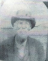
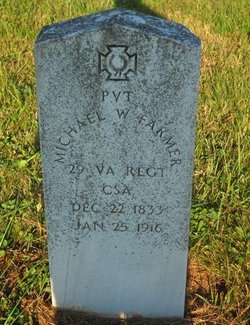
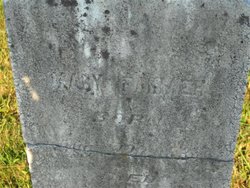
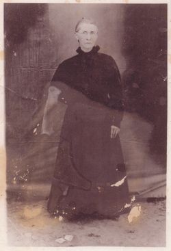
Michael Washington Farmer
| Birth | : | 22 Dec 1833 |
| Death | : | 25 Jan 1916 |
| Burial | : | St John the Evangelist Cemetery, Bath, Bath and North East Somerset Unitary Authority, England |
| Coordinate | : | 51.3696700, -2.3487400 |
| Description | : | 29th VA Regt CSA -- He served in the **63rd Virginia Infantry; Co. A -- Michael enlisted in the military on June 1, 1861 in Carrol County, Virginia, company fifer, reenlisted pril 1862, wounded in action May 14, 1864 at Drewry's Bluff, Virginia, he was shot in the left side, hospitalized at Richmond May 14, 1864 and furloughed 30 days on June 4, 1864, he was present on December 1864. --- He was a musician in the Confederate Army, and in the battle of Drewy's Buff, he was shot in the butt. The Yankees patched him up and told him to... Read More |
frequently asked questions (FAQ):
-
Where is Michael Washington Farmer's memorial?
Michael Washington Farmer's memorial is located at: St John the Evangelist Cemetery, Bath, Bath and North East Somerset Unitary Authority, England.
-
When did Michael Washington Farmer death?
Michael Washington Farmer death on 25 Jan 1916 in
-
Where are the coordinates of the Michael Washington Farmer's memorial?
Latitude: 51.3696700
Longitude: -2.3487400
Family Members:
Parent
Spouse
Siblings
Children
Flowers:


Nearby Cemetories:
1. St John the Evangelist Cemetery
Bath, Bath and North East Somerset Unitary Authority, England
Coordinate: 51.3696700, -2.3487400
2. Bath Abbey Cemetery
Widcombe, Bath and North East Somerset Unitary Authority, England
Coordinate: 51.3712850, -2.3483060
3. Unitarian Chapel Burial Ground
Widcombe, Bath and North East Somerset Unitary Authority, England
Coordinate: 51.3704650, -2.3539270
4. St Thomas à Becket's Church
Widcombe, Bath and North East Somerset Unitary Authority, England
Coordinate: 51.3734250, -2.3465560
5. Quaker Burial Ground
Widcombe, Bath and North East Somerset Unitary Authority, England
Coordinate: 51.3744350, -2.3498460
6. Prior Park College
Bath, Bath and North East Somerset Unitary Authority, England
Coordinate: 51.3645990, -2.3442400
7. Abbey & St James' Graveyard for the Poor
Widcombe, Bath and North East Somerset Unitary Authority, England
Coordinate: 51.3753550, -2.3545640
8. Old Baptist Burial Ground
Walcot, Bath and North East Somerset Unitary Authority, England
Coordinate: 51.3755070, -2.3544360
9. Smallcombe Vale Cemetery
Bathwick, Bath and North East Somerset Unitary Authority, England
Coordinate: 51.3757400, -2.3429400
10. St. Mary The Virgin Churchyard
Bathwick, Bath and North East Somerset Unitary Authority, England
Coordinate: 51.3759930, -2.3411930
11. Baptist Burial Ground
Widcombe, Bath and North East Somerset Unitary Authority, England
Coordinate: 51.3764216, -2.3556947
12. Saint Mark's Churchyard
Widcombe, Bath and North East Somerset Unitary Authority, England
Coordinate: 51.3766660, -2.3588010
13. Jewish Burial Ground
Combe Down, Bath and North East Somerset Unitary Authority, England
Coordinate: 51.3599170, -2.3534670
14. Union Chapel
Combe Down, Bath and North East Somerset Unitary Authority, England
Coordinate: 51.3594751, -2.3443662
15. St Mary Magdalen Chapel
Widcombe, Bath and North East Somerset Unitary Authority, England
Coordinate: 51.3760486, -2.3643405
16. Old Orchard Street Catholic Burial Vault
Bath, Bath and North East Somerset Unitary Authority, England
Coordinate: 51.3800370, -2.3579910
17. St James Old Burial Ground
Bath, Bath and North East Somerset Unitary Authority, England
Coordinate: 51.3798600, -2.3610100
18. Bath Abbey
Bath, Bath and North East Somerset Unitary Authority, England
Coordinate: 51.3815310, -2.3586640
19. St. Mary de Stall Churchyard (Defunct)
Bath, Bath and North East Somerset Unitary Authority, England
Coordinate: 51.3813350, -2.3600353
20. Quaker Meeting House
Bath, Bath and North East Somerset Unitary Authority, England
Coordinate: 51.3823280, -2.3604380
21. Bath General Hospital Burial Ground
Bath and North East Somerset Unitary Authority, England
Coordinate: 51.3824715, -2.3614742
22. Ss Michael & Paul Churchyard
Bath, Bath and North East Somerset Unitary Authority, England
Coordinate: 51.3834970, -2.3596980
23. St. Michael's Burial Ground
Bath, Bath and North East Somerset Unitary Authority, England
Coordinate: 51.3838810, -2.3594090
24. St Mary's Chapel, Queens Square
Bath, Bath and North East Somerset Unitary Authority, England
Coordinate: 51.3827790, -2.3649790