
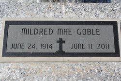

Mildred Mae Matheny Goble
| Birth | : | 24 Jun 1914 Girard, Crawford County, Kansas, USA |
| Death | : | 11 Jun 2011 Frontenac, Crawford County, Kansas, USA |
| Burial | : | Washington Park Memorial Gardens, Grand Rapids, Kent County, USA |
| Coordinate | : | 42.9944000, -85.7007980 |
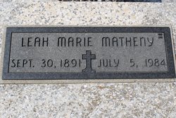
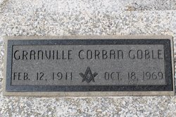
| Description | : | Mildred Mae Goble, age 96, passed gently from this life on Saturday, June 11, 2011. She had recently taken residence in Frontenac at Sunset Manor Nursing Home, ever hoping to recuperate and reclaim the vitality and independence she had so enjoyed throughout her long and productive life. Born June 24, 1914 to Louis and Leah Matheny of Girard, KS, the family moved to Pittsburg in 1924 and Mildred graduated from Pittsburg High School in 1932. She studied home economics in Pittsburg at Kansas State Teachers College. Married in 1942 to Granville Corban Goble of Weir, she accompanied Corb to Hattiesburg,... Read More |
frequently asked questions (FAQ):
-
Where is Mildred Mae Matheny Goble's memorial?
Mildred Mae Matheny Goble's memorial is located at: Washington Park Memorial Gardens, Grand Rapids, Kent County, USA.
-
When did Mildred Mae Matheny Goble death?
Mildred Mae Matheny Goble death on 11 Jun 2011 in Frontenac, Crawford County, Kansas, USA
-
Where are the coordinates of the Mildred Mae Matheny Goble's memorial?
Latitude: 42.9944000
Longitude: -85.7007980
Family Members:
Parent
Spouse
Flowers:


Nearby Cemetories:
1. Washington Park Memorial Gardens
Grand Rapids, Kent County, USA
Coordinate: 42.9944000, -85.7007980
2. Lithuanian Freedom Cemetery
Grand Rapids, Kent County, USA
Coordinate: 42.9956430, -85.6991170
3. Achim Cemetery
Grand Rapids, Kent County, USA
Coordinate: 42.9961014, -85.6994019
4. Saints Peter and Paul Cemetery
Grand Rapids, Kent County, USA
Coordinate: 42.9963890, -85.6997220
5. Greenwood Cemetery
Grand Rapids, Kent County, USA
Coordinate: 42.9892006, -85.7055969
6. Mount Calvary Cemetery
Grand Rapids, Kent County, USA
Coordinate: 42.9846992, -85.7043991
7. Holy Cross Cemetery
Grand Rapids, Kent County, USA
Coordinate: 42.9953003, -85.7153015
8. Gerald R Ford Museum
Grand Rapids, Kent County, USA
Coordinate: 42.9668140, -85.6771000
9. Saint Pauls Anglican Church Columbarium
Grand Rapids, Kent County, USA
Coordinate: 42.9711200, -85.7321700
10. Second Congregational UCC Memorial Garden
Grand Rapids, Kent County, USA
Coordinate: 43.0032900, -85.6549900
11. Grand Rapids Veterans Home Cemetery
Grand Rapids, Kent County, USA
Coordinate: 43.0182915, -85.6588898
12. Brooklawn Cemetery
Walker, Kent County, USA
Coordinate: 43.0280991, -85.7300034
13. Mill Creek Cemetery
Walker, Kent County, USA
Coordinate: 43.0288890, -85.6705560
14. First United Methodist Church Columbarium
Grand Rapids, Kent County, USA
Coordinate: 42.9634200, -85.6633300
15. Westminster Presbyterian Church Columbarium
Grand Rapids, Kent County, USA
Coordinate: 42.9619070, -85.6646760
16. Fairplains Cemetery
Grand Rapids, Kent County, USA
Coordinate: 43.0005989, -85.6421967
17. Central Reformed Church Crypt
Grand Rapids, Kent County, USA
Coordinate: 42.9634410, -85.6563430
18. Saint Andrews Episcopal Gardens
Grand Rapids, Kent County, USA
Coordinate: 43.0142030, -85.6430840
19. United Church of Christ Cemetery
Comstock Park, Kent County, USA
Coordinate: 43.0359210, -85.6684260
20. Fulton Street Cemetery
Grand Rapids, Kent County, USA
Coordinate: 42.9639200, -85.6486400
21. Holy Trinity Cemetery
Alpine Township, Kent County, USA
Coordinate: 43.0511017, -85.6992035
22. Saint Andrews Catholic Cemetery
Grand Rapids, Kent County, USA
Coordinate: 42.9463997, -85.6567001
23. Oakhill Cemetery
Grand Rapids, Kent County, USA
Coordinate: 42.9411011, -85.6517029
24. Rosedale Memorial Park
Tallmadge Township, Ottawa County, USA
Coordinate: 42.9721160, -85.7876870