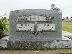
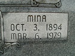
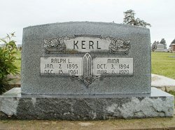
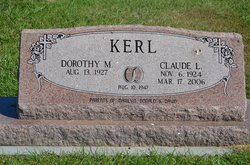
Mina Cook Kerl
| Birth | : | 3 Oct 1894 |
| Death | : | 6 Mar 1979 |
| Burial | : | Lincoln Memory Gardens, Whitestown, Boone County, USA |
| Coordinate | : | 39.9418983, -86.3525009 |
| Plot | : | Hazel Hill 7-2-6 |
| Description | : | Married to Ralph Lemar Kerl May 28, 1917 in Pawnee County, NE. (Pawnee Library, book of obits in the Pawnee Republican.) |
frequently asked questions (FAQ):
-
Where is Mina Cook Kerl's memorial?
Mina Cook Kerl's memorial is located at: Lincoln Memory Gardens, Whitestown, Boone County, USA.
-
When did Mina Cook Kerl death?
Mina Cook Kerl death on 6 Mar 1979 in
-
Where are the coordinates of the Mina Cook Kerl's memorial?
Latitude: 39.9418983
Longitude: -86.3525009
Family Members:
Parent
Spouse
Siblings
Children
Flowers:
Nearby Cemetories:
1. Jones Cemetery
Boone County, USA
Coordinate: 39.9639015, -86.3458023
2. Howards Cemetery
Fayette, Boone County, USA
Coordinate: 39.9309860, -86.3813490
3. Salem Cemetery
Zionsville, Boone County, USA
Coordinate: 39.9432487, -86.3190613
4. Schooler Cemetery
Eagle Township, Boone County, USA
Coordinate: 39.9678000, -86.3461000
5. Pitzer Cemetery
Zionsville, Boone County, USA
Coordinate: 39.9636002, -86.3206024
6. Mount Tabor Cemetery
Fayette, Boone County, USA
Coordinate: 39.9378242, -86.3980713
7. Dickerson Cemetery
Fayette, Boone County, USA
Coordinate: 39.9244003, -86.3944016
8. Smith-Shepherd Cemetery
Brownsburg, Hendricks County, USA
Coordinate: 39.9165500, -86.3978500
9. Johnson Cemetery
Brownsburg, Hendricks County, USA
Coordinate: 39.9162990, -86.3978230
10. Macedonia Baptist Church Cemetery
Brownsburg, Hendricks County, USA
Coordinate: 39.8989334, -86.3392029
11. McCord Cemetery
Whitestown, Boone County, USA
Coordinate: 39.9843200, -86.3319600
12. Marvel Cemetery
Hendricks County, USA
Coordinate: 39.8949814, -86.3307037
13. Smith Cemetery
Boone County, USA
Coordinate: 39.9749985, -86.4075012
14. Sheets Cemetery
Boone County, USA
Coordinate: 39.9317017, -86.2797012
15. Saint Francis of the Fields Episcopal Columbarium
Zionsville, Boone County, USA
Coordinate: 39.9643200, -86.2816300
16. Pleasant Hill Cemetery
Indianapolis, Marion County, USA
Coordinate: 39.9053001, -86.2919006
17. Bethesda Cemetery
Brownsburg, Hendricks County, USA
Coordinate: 39.8883320, -86.3915220
18. Harmon Family Cemetery
Traders Point, Marion County, USA
Coordinate: 39.9167500, -86.2767500
19. Crown Point Cemetery
Indianapolis, Marion County, USA
Coordinate: 39.8877983, -86.3080978
20. Hopewell Cemetery
Indianapolis, Marion County, USA
Coordinate: 39.8962200, -86.2827200
21. Eagle Creek Regular Baptist Cemetery
Eagle Village, Boone County, USA
Coordinate: 39.9799538, -86.2736588
22. Zionsville Cemetery
Zionsville, Boone County, USA
Coordinate: 39.9402771, -86.2577744
23. Evans Cemetery
Brownsburg, Hendricks County, USA
Coordinate: 39.8718681, -86.3266296
24. Parker Cemetery
Traders Point, Marion County, USA
Coordinate: 39.8754980, -86.3083790

