Minerva Ann Tate Brookshier
| Birth | : | 16 Jul 1842 Callaway County, Missouri, USA |
| Death | : | 14 Feb 1924 Saint Charles, St. Charles County, Missouri, USA |
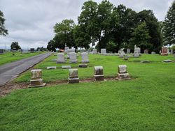
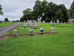
| Burial | : | Woodlawn Cemetery, Stewartville, Olmsted County, USA |
| Coordinate | : | 43.8561707, -92.4966507 |
| Description | : | She was the daughter of John Gilliam Tate and Jinnetty W. Heptinstall Tate. She married George Allen Brookshire, they were the parnets of Pleasant C., Mary F., Ida G., Missouri A., Eliza A., Nancy A. and Arthur M. * * * * * Suggested edit: No marker Contributor: Bernadette Hall (48883467) * * * * * |
frequently asked questions (FAQ):
-
Where is Minerva Ann Tate Brookshier's memorial?
Minerva Ann Tate Brookshier's memorial is located at: Woodlawn Cemetery, Stewartville, Olmsted County, USA.
-
When did Minerva Ann Tate Brookshier death?
Minerva Ann Tate Brookshier death on 14 Feb 1924 in Saint Charles, St. Charles County, Missouri, USA
-
Where are the coordinates of the Minerva Ann Tate Brookshier's memorial?
Latitude: 43.8561707
Longitude: -92.4966507
Family Members:
Spouse
Children
Flowers:
Nearby Cemetories:
1. Woodlawn Cemetery
Stewartville, Olmsted County, USA
Coordinate: 43.8561707, -92.4966507
2. Saint Bernard Catholic Cemetery
Stewartville, Olmsted County, USA
Coordinate: 43.8624992, -92.4942017
3. High Forest Cemetery
High Forest, Olmsted County, USA
Coordinate: 43.8472214, -92.5413895
4. Jerusalem Evangelical Cemetery
Pleasant Grove, Olmsted County, USA
Coordinate: 43.8917389, -92.4381256
5. Pilot Grove Cemetery
Racine, Mower County, USA
Coordinate: 43.7926903, -92.4798660
6. Saint Johns Evangelical Cemetery
Racine, Mower County, USA
Coordinate: 43.8053017, -92.5586014
7. Saint Bridgets Catholic Church Cemetery
Simpson, Olmsted County, USA
Coordinate: 43.9230423, -92.4351883
8. Union Cemetery
Pleasant Grove, Olmsted County, USA
Coordinate: 43.8698300, -92.3802300
9. Fairview Cemetery
Simpson, Olmsted County, USA
Coordinate: 43.9131012, -92.4088974
10. Pleasant Valley Cemetery
Racine, Mower County, USA
Coordinate: 43.8116989, -92.6074982
11. Immanuel Cemetery
Racine, Mower County, USA
Coordinate: 43.8107986, -92.6089020
12. Racine Salem Cemetery
Racine, Mower County, USA
Coordinate: 43.7611008, -92.5061035
13. Hamilton Cemetery
Hamilton, Fillmore County, USA
Coordinate: 43.7671432, -92.4489136
14. Oakridge Farm Cemetery
Rochester, Olmsted County, USA
Coordinate: 43.9479480, -92.5435090
15. Millet Cemetery
Sumner, Fillmore County, USA
Coordinate: 43.7778015, -92.3985977
16. Sever Temanson Cemetery
Grand Meadow, Mower County, USA
Coordinate: 43.7475014, -92.5377808
17. Norwegian Methodist Church Cemetery
Grand Meadow, Mower County, USA
Coordinate: 43.7397385, -92.5555878
18. Bear Creek Lutheran Church Cemetery
Mower County, USA
Coordinate: 43.7391701, -92.5555573
19. Zion Cemetery
Rock Dell, Olmsted County, USA
Coordinate: 43.9297218, -92.6377792
20. East Saint Olaf Lutheran Church Cemetery
Rock Dell, Olmsted County, USA
Coordinate: 43.9327812, -92.6383286
21. Stone Church Cemetery
Sumner, Fillmore County, USA
Coordinate: 43.8114357, -92.3295975
22. Mayowood Cemetery
Rochester, Olmsted County, USA
Coordinate: 43.9909500, -92.5218800
23. Washington Cemetery
Spring Valley Township, Fillmore County, USA
Coordinate: 43.7788887, -92.3391724
24. Marion Cemetery
Marion, Olmsted County, USA
Coordinate: 43.9480591, -92.3494415


