
| Birth | : | 6 Feb 1916 Elloree, Orangeburg County, South Carolina, USA |
| Death | : | 13 Feb 2003 Orangeburg, Orangeburg County, South Carolina, USA |
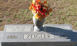
| Burial | : | East Bethel United Methodist Church Cemetery, Saint Matthews, Calhoun County, USA |
| Coordinate | : | 33.6350770, -80.6353840 |
| Description | : | Orangeburg - Mrs. Minnie Elizabeth Stroman Felder, 87, of 860 Five Chop Road, Orangeburg, died Thursday, Feb. 13, 2003, at The Regional Medical Center, Orangeburg. The funeral will be held at 3 p.m. Sunday, Feb. 16, at East Bethel Methodist Church, Lone Star, with the Rev. Lindsey Rivers and the Rev. Judy C. Hames officiating. Burial in the church cemetery. Pallbearers will be Bobby Mount, Donnie Mount, Tommy Smith, Troy Zeigler, Johnny Stroman and Jimmy Smith. The casket will be in the church at 2 p.m. Mrs. Felder was born Feb. 6, 1916, in Elloree, a daughter of the late... Read More |
frequently asked questions (FAQ):
-
Where is Minnie Elizabeth Stroman Felder's memorial?
Minnie Elizabeth Stroman Felder's memorial is located at: East Bethel United Methodist Church Cemetery, Saint Matthews, Calhoun County, USA.
-
When did Minnie Elizabeth Stroman Felder death?
Minnie Elizabeth Stroman Felder death on 13 Feb 2003 in Orangeburg, Orangeburg County, South Carolina, USA
-
Where are the coordinates of the Minnie Elizabeth Stroman Felder's memorial?
Latitude: 33.6350770
Longitude: -80.6353840
Family Members:
Parent
Spouse

Siblings
Flowers:


Nearby Cemetories:
1. East Bethel United Methodist Church Cemetery
Saint Matthews, Calhoun County, USA
Coordinate: 33.6350770, -80.6353840
2. Saint Luke A.M.E. Church Cemetery
Lone Star, Calhoun County, USA
Coordinate: 33.6415340, -80.6286180
3. Pine Grove Lutheran Church Cemetery
Lone Star, Calhoun County, USA
Coordinate: 33.6349610, -80.6016470
4. Saint Paul AME Church Cemetery
Creston, Calhoun County, USA
Coordinate: 33.6137640, -80.6624160
5. Rast Cemetery
Calhoun County, USA
Coordinate: 33.6121000, -80.6631660
6. Saint Mark Baptist Church Cemetery
Lone Star, Calhoun County, USA
Coordinate: 33.6545810, -80.6008700
7. Cedar Grove Baptist Church Cemetery
Lone Star, Calhoun County, USA
Coordinate: 33.6259320, -80.5947950
8. Saint Matthews Lutheran Church
Saint Matthews, Calhoun County, USA
Coordinate: 33.6175190, -80.6719850
9. Irick Cemetery
Lone Star, Calhoun County, USA
Coordinate: 33.6283580, -80.5924100
10. Bodrick Cemetery
Lone Star, Calhoun County, USA
Coordinate: 33.6245880, -80.5891440
11. New Bethany Baptist Church Cemetery
Fort Motte, Calhoun County, USA
Coordinate: 33.6826040, -80.6412690
12. Mizpah Baptist Church Cemetery
Fort Motte, Calhoun County, USA
Coordinate: 33.6826400, -80.6410970
13. Bethlehem Baptist Church Cemetery
Fort Motte, Calhoun County, USA
Coordinate: 33.6632980, -80.6851910
14. Gates Family Cemetery
Saint Matthews, Calhoun County, USA
Coordinate: 33.6590790, -80.6943780
15. Haynes Chapel AME Church Cemetery
Cameron, Calhoun County, USA
Coordinate: 33.6130110, -80.5751970
16. Shady Grove Methodist Church Cemetery
Cameron, Calhoun County, USA
Coordinate: 33.5896560, -80.6767060
17. Mount Pleasant Baptist Church Cemetery
Fort Motte, Calhoun County, USA
Coordinate: 33.6947670, -80.6497860
18. Greater Saint Stephen's AME Church Cemetery
Saint Matthews, Calhoun County, USA
Coordinate: 33.6551260, -80.7127280
19. Mount Zion AME Church Cemetery
Creston, Calhoun County, USA
Coordinate: 33.5689940, -80.6151050
20. Bouzard Family Cemetery
Fort Motte, Calhoun County, USA
Coordinate: 33.6962800, -80.6776210
21. Elloree Hillcrest Cemetery
Elloree, Orangeburg County, USA
Coordinate: 33.5608720, -80.6099720
22. Mount Salem Missionary Baptist Church Cemetery
Saint Matthews, Calhoun County, USA
Coordinate: 33.6839870, -80.7080780
23. Union AME Church Cemetery
Calhoun County, USA
Coordinate: 33.5840910, -80.5575110
24. Saint Matthews Parish Episcopal Church Cemetery
Fort Motte, Calhoun County, USA
Coordinate: 33.7137960, -80.6706760