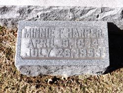
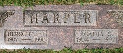
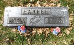
Minnie F Kasper Harper
| Birth | : | 9 Apr 1874 Muscatine, Muscatine County, Iowa, USA |
| Death | : | 27 Jul 1953 Muscatine, Muscatine County, Iowa, USA |
| Burial | : | Orowaiti Old Cemetery, Westport, Buller District, New Zealand |
| Coordinate | : | -41.7548580, 171.6311430 |
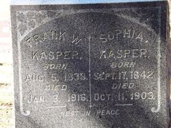
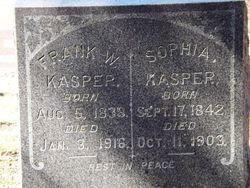
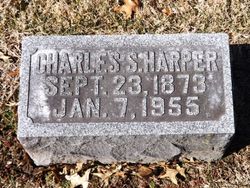
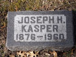
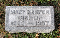
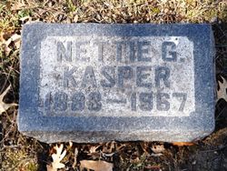
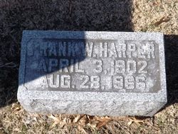
| Description | : | MRS HARPER, 79, TAKEN BY DEATH; RITES WEDNESDAY Mrs. Charles S. Harper, 79, of route 5, a lifetime resident of Muscatine county, died at 1 a.m. today at Hershey hospital after an extended illness. She was born April 9, 1874, being a daughter of Frank and Sophia Kasper. She was married to Mr. Harper April 19, 1899 at Muscatine. Mrs. Harper was a member of St. Mary's church. Surviving are her husband; three sons, Frank Harper, Herschel Harper and Clarence Harper, all of this community; three sisters, Mrs. Katherine Schoo of Davenport, Mrs. Mary Bishop and Miss Nettie Kasper, both of Muscatine; and... Read More |
frequently asked questions (FAQ):
-
Where is Minnie F Kasper Harper's memorial?
Minnie F Kasper Harper's memorial is located at: Orowaiti Old Cemetery, Westport, Buller District, New Zealand.
-
When did Minnie F Kasper Harper death?
Minnie F Kasper Harper death on 27 Jul 1953 in Muscatine, Muscatine County, Iowa, USA
-
Where are the coordinates of the Minnie F Kasper Harper's memorial?
Latitude: -41.7548580
Longitude: 171.6311430
Family Members:
Parent
Spouse
Siblings
Children
Flowers:
Nearby Cemetories:
1. Orowaiti Old Cemetery
Westport, Buller District, New Zealand
Coordinate: -41.7548580, 171.6311430
2. Orowaiti Middle Cemetery
Westport, Buller District, New Zealand
Coordinate: -41.7541860, 171.6322800
3. Orowaiti Cemetery
Westport, Buller District, New Zealand
Coordinate: -41.7516090, 171.6340510
4. Waimangaroa Cemetery
Waimangaroa, Buller District, New Zealand
Coordinate: -41.7008100, 171.7480200
5. Addison's Flat Cemetery
Westport, Buller District, New Zealand
Coordinate: -41.8462220, 171.5569580
6. Nile Hill Cemetery
Charleston, Buller District, New Zealand
Coordinate: -41.8991610, 171.4394080
7. Charleston Catholic Cemetery
Charleston, Buller District, New Zealand
Coordinate: -41.9093390, 171.4359110
8. Inangahua Junction Cemetery
Inangahua Junction, Buller District, New Zealand
Coordinate: -41.8608000, 171.9346400
9. Lyell New Cemetery
Lyell, Buller District, New Zealand
Coordinate: -41.7921729, 172.0318747
10. Lyell Old Cemetery
Lyell, Buller District, New Zealand
Coordinate: -41.7968480, 172.0528130
11. Mokihinui Cemetery
Waimarie, Buller District, New Zealand
Coordinate: -41.5282350, 171.9421150
12. Boatmans Cemetery
Cronadun, Buller District, New Zealand
Coordinate: -42.0391020, 171.8775660
13. Reefton Cemetery
Reefton, Buller District, New Zealand
Coordinate: -42.0856940, 171.8470730
14. Old Reefton Cemetery
Reefton, Buller District, New Zealand
Coordinate: -42.1115220, 171.8590850
15. Murchison Cemetery
Murchison, Tasman District, New Zealand
Coordinate: -41.7953490, 172.3401110
16. Barrytown Cemetery
Barrytown, Grey District, New Zealand
Coordinate: -42.2455150, 171.3166710
17. Maruia Cemetery
Maruia, Buller District, New Zealand
Coordinate: -42.1400300, 172.2358870
18. Ahaura Cemetery
Ahaura, Grey District, New Zealand
Coordinate: -42.3516790, 171.5581700
19. South Terrace Cemetery
Karamea, Buller District, New Zealand
Coordinate: -41.2601150, 172.1128510
20. Karamea Cemetery
Karamea, Buller District, New Zealand
Coordinate: -41.2475960, 172.1297550
21. Blackball Cemetery
Greymouth, Grey District, New Zealand
Coordinate: -42.3757410, 171.4135760
22. Nelson Creek Cemetery
Ngahere, Grey District, New Zealand
Coordinate: -42.3865620, 171.4595500
23. Notown Cemetery
Dobson, Grey District, New Zealand
Coordinate: -42.4514530, 171.4465670
24. Stillwater Cemetery
Greymouth, Grey District, New Zealand
Coordinate: -42.4394820, 171.3494380

