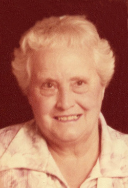
Minnie Mae King Smith
| Birth | : | 20 Mar 1877 Gilman, Marshall County, Iowa, USA |
| Death | : | 4 Oct 1953 Osceola, Clarke County, Iowa, USA |
| Burial | : | Brooklawn Cemetery, Walker, Kent County, USA |
| Coordinate | : | 43.0280991, -85.7300034 |
| Plot | : | Row 01, Headstone 14 |
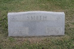
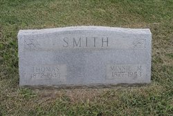
| Inscription | : | SMITH MINNIE M. 1877 - 1953 |
| Description | : | The Osceola Sentinel, Osceola, Iowa October 8, 1953, Page 1 Services Tuesday For Mamie Smith Services were held at Bethel Chapel Tuesday for Mamie Mae Smith, who died Sunday, Oct. 4. The Rev. Archie Beals of Russell presided. Music was provided by Mrs. Herman Smith, Mrs. Deyo Mills and Mrs. Don Lester. They sang "In the Garden" and "Beyond the Sunset." Pallbearers were Calvin Smith, Earl Smith, Keith Arnold, Evert Smith, James Pross, Orval Arnold and honorary bearer Cecil Smith. The Osceola Sentinel, Osceola, Iowa October 8, 1953, Page 11 Mrs. Tom Smith passed... Read More |
frequently asked questions (FAQ):
-
Where is Minnie Mae King Smith's memorial?
Minnie Mae King Smith's memorial is located at: Brooklawn Cemetery, Walker, Kent County, USA.
-
When did Minnie Mae King Smith death?
Minnie Mae King Smith death on 4 Oct 1953 in Osceola, Clarke County, Iowa, USA
-
Where are the coordinates of the Minnie Mae King Smith's memorial?
Latitude: 43.0280991
Longitude: -85.7300034
Family Members:
Parent
Spouse
Siblings
Children
Flowers:
Nearby Cemetories:
1. Brooklawn Cemetery
Walker, Kent County, USA
Coordinate: 43.0280991, -85.7300034
2. Holy Trinity Cemetery
Alpine Township, Kent County, USA
Coordinate: 43.0511017, -85.6992035
3. Holy Cross Cemetery
Grand Rapids, Kent County, USA
Coordinate: 42.9953003, -85.7153015
4. Saints Peter and Paul Cemetery
Grand Rapids, Kent County, USA
Coordinate: 42.9963890, -85.6997220
5. Achim Cemetery
Grand Rapids, Kent County, USA
Coordinate: 42.9961014, -85.6994019
6. Lithuanian Freedom Cemetery
Grand Rapids, Kent County, USA
Coordinate: 42.9956430, -85.6991170
7. Washington Park Memorial Gardens
Grand Rapids, Kent County, USA
Coordinate: 42.9944000, -85.7007980
8. Greenwood Cemetery
Grand Rapids, Kent County, USA
Coordinate: 42.9892006, -85.7055969
9. Mill Creek Cemetery
Walker, Kent County, USA
Coordinate: 43.0288890, -85.6705560
10. Alpine Center Cemetery
Comstock Park, Kent County, USA
Coordinate: 43.0724983, -85.7285995
11. United Church of Christ Cemetery
Comstock Park, Kent County, USA
Coordinate: 43.0359210, -85.6684260
12. Mount Calvary Cemetery
Grand Rapids, Kent County, USA
Coordinate: 42.9846992, -85.7043991
13. Saur-Cross Cemetery
Walker, Kent County, USA
Coordinate: 43.0738890, -85.7569440
14. Grand Rapids Veterans Home Cemetery
Grand Rapids, Kent County, USA
Coordinate: 43.0182915, -85.6588898
15. Saint Pauls Anglican Church Columbarium
Grand Rapids, Kent County, USA
Coordinate: 42.9711200, -85.7321700
16. Pine Grove Cemetery
Comstock Park, Kent County, USA
Coordinate: 43.0757700, -85.6827600
17. Second Congregational UCC Memorial Garden
Grand Rapids, Kent County, USA
Coordinate: 43.0032900, -85.6549900
18. Saint Andrews Episcopal Gardens
Grand Rapids, Kent County, USA
Coordinate: 43.0142030, -85.6430840
19. Marne Cemetery
Marne, Ottawa County, USA
Coordinate: 43.0309810, -85.8238630
20. Fairplains Cemetery
Grand Rapids, Kent County, USA
Coordinate: 43.0005989, -85.6421967
21. Rosedale Memorial Park
Tallmadge Township, Ottawa County, USA
Coordinate: 42.9721160, -85.7876870
22. Gerald R Ford Museum
Grand Rapids, Kent County, USA
Coordinate: 42.9668140, -85.6771000
23. Garden of the Pines
Grand Rapids, Kent County, USA
Coordinate: 43.0422710, -85.6279260
24. First United Methodist Church Columbarium
Grand Rapids, Kent County, USA
Coordinate: 42.9634200, -85.6633300

