


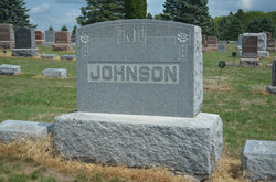
Minnie Mathilda Appleton Johnson
| Birth | : | 10 May 1882 Wenona, LaSalle County, Illinois, USA |
| Death | : | 30 Aug 1922 Chicago, Cook County, Illinois, USA |
| Burial | : | Dayton Cemetery, Dayton, Webster County, USA |
| Coordinate | : | 42.2675000, -94.0755000 |
| Plot | : | Section 4, Lot 137 |
| Description | : | Daughter of Augusta and Matilda Appleton. Wife of Charles B. Johnson. Dayton Review September 7, 1922 Minnie Mathilda Appleton was born at Wenona, Illinois, May 18, 1882, and passed away in the hospital at Chicago, Illinois, August 30, 1922, aged 40 years, 3 months, 20 days. There she grew to young womanhood, having been confirmed into the Lutheran Church. She was united in marriage to Carl J.B. Johnson, February 23, 1905. Their marriage has been blessed with seven children, five sons and two daughters, who survive with the bereaved husband to mourn her early death. She is also... Read More |
frequently asked questions (FAQ):
-
Where is Minnie Mathilda Appleton Johnson's memorial?
Minnie Mathilda Appleton Johnson's memorial is located at: Dayton Cemetery, Dayton, Webster County, USA.
-
When did Minnie Mathilda Appleton Johnson death?
Minnie Mathilda Appleton Johnson death on 30 Aug 1922 in Chicago, Cook County, Illinois, USA
-
Where are the coordinates of the Minnie Mathilda Appleton Johnson's memorial?
Latitude: 42.2675000
Longitude: -94.0755000
Family Members:
Spouse
Children
Flowers:


Nearby Cemetories:
1. Dayton Cemetery
Dayton, Webster County, USA
Coordinate: 42.2675000, -94.0755000
2. Christ the King Catholic Cemetery
Dayton, Webster County, USA
Coordinate: 42.2601929, -94.0727539
3. Bass Cemetery
Dayton, Webster County, USA
Coordinate: 42.2966995, -94.0149994
4. Swedish Lutheran Church Cemetery
Dayton, Webster County, USA
Coordinate: 42.2175000, -94.1065000
5. Oak Grove Cemetery
Lehigh, Webster County, USA
Coordinate: 42.3438988, -94.0475006
6. Hardin Township Cemetery
Hardin Township, Webster County, USA
Coordinate: 42.2411003, -93.9708023
7. Linn Cemetery
Pilot Mound, Boone County, USA
Coordinate: 42.2045330, -93.9970230
8. Lawn Cemetery
Boone County, USA
Coordinate: 42.1771011, -94.0867996
9. West Lawn Cemetery
Lehigh, Webster County, USA
Coordinate: 42.3616982, -94.0678024
10. McGuire Bend Cemetery
Dayton, Webster County, USA
Coordinate: 42.3410000, -93.9880000
11. Runyan Cemetery
Pilot Mound, Boone County, USA
Coordinate: 42.1749992, -94.0015030
12. Pilot Mound Cemetery
Pilot Mound, Boone County, USA
Coordinate: 42.1636200, -94.0282600
13. Vegors Cemetery
Webster County, USA
Coordinate: 42.3177986, -93.9421997
14. Lost Grove Cemetery
Harcourt, Webster County, USA
Coordinate: 42.2583008, -94.2331009
15. Hooks Point Cemetery
Hamilton County, USA
Coordinate: 42.2944530, -93.9199090
16. Oakwood Cemetery
Stratford, Hamilton County, USA
Coordinate: 42.2942009, -93.9182968
17. Hartman Cemetery
Lehigh, Webster County, USA
Coordinate: 42.3666397, -93.9835627
18. White Cemetery
Boone County, USA
Coordinate: 42.1777992, -93.9636002
19. Border Plains Cemetery
Border Plains, Webster County, USA
Coordinate: 42.3917000, -94.0448000
20. Ober and Scott Cemetery
Duncombe, Webster County, USA
Coordinate: 42.3841390, -93.9982856
21. Union Cemetery
Boxholm, Boone County, USA
Coordinate: 42.1369019, -94.0852966
22. Renner Cemetery
Boone County, USA
Coordinate: 42.1380420, -94.1256570
23. Otho Cemetery
Otho, Webster County, USA
Coordinate: 42.4025002, -94.1153030
24. Schlicht Cemetery
Fraser, Boone County, USA
Coordinate: 42.1444200, -93.9780100