
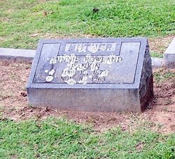
Minnie Rowland Rankin
| Birth | : | 16 Mar 1873 Virginia, USA |
| Death | : | 10 Nov 1963 Raleigh, Wake County, North Carolina, USA |
| Burial | : | Evergreen Home Cemetery, Beatrice, Gage County, USA |
| Coordinate | : | 40.2677994, -96.7052994 |
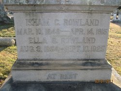
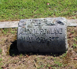
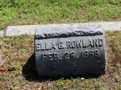
| Description | : | Minnie Rowland's parents were I. C. Rowland and Ella Goodrich (Rowland). Her husband James Robert Rankin and her son Whitney Goodrich Rankin predeceased her. |
frequently asked questions (FAQ):
-
Where is Minnie Rowland Rankin's memorial?
Minnie Rowland Rankin's memorial is located at: Evergreen Home Cemetery, Beatrice, Gage County, USA.
-
When did Minnie Rowland Rankin death?
Minnie Rowland Rankin death on 10 Nov 1963 in Raleigh, Wake County, North Carolina, USA
-
Where are the coordinates of the Minnie Rowland Rankin's memorial?
Latitude: 40.2677994
Longitude: -96.7052994
Family Members:
Parent

Spouse
Siblings

Children
Flowers:


Nearby Cemetories:
1. Evergreen Home Cemetery
Beatrice, Gage County, USA
Coordinate: 40.2677994, -96.7052994
2. Beatrice Cemetery
Beatrice, Gage County, USA
Coordinate: 40.2625970, -96.7332670
3. Walnut Grove Pet Cemetery
Beatrice, Gage County, USA
Coordinate: 40.2613200, -96.7605920
4. Emmanuel Lutheran Cemetery
Beatrice, Gage County, USA
Coordinate: 40.2934100, -96.6521900
5. Saint Joseph Cemetery
Beatrice, Gage County, USA
Coordinate: 40.3054700, -96.7460700
6. Austin Creek Cemetery
Beatrice, Gage County, USA
Coordinate: 40.3282280, -96.7233020
7. Brethren Cemetery
Holmesville, Gage County, USA
Coordinate: 40.2125015, -96.6331024
8. Pleasant View Cemetery
Pickrell, Gage County, USA
Coordinate: 40.3493240, -96.7101000
9. First Mennonite Church Cemetery
Beatrice, Gage County, USA
Coordinate: 40.2856800, -96.8120500
10. Stark Cemetery
Holmesville, Gage County, USA
Coordinate: 40.2122002, -96.6147003
11. Homestead National Historical Park
Beatrice, Gage County, USA
Coordinate: 40.2864800, -96.8271100
12. Zion Evangelical Lutheran Cemetery
Pickrell, Gage County, USA
Coordinate: 40.3456001, -96.6147003
13. Freeman Cemetery
Beatrice, Gage County, USA
Coordinate: 40.2966933, -96.8435666
14. Blue Springs Cemetery
Blue Springs, Gage County, USA
Coordinate: 40.1526800, -96.6627000
15. Dolen Cemetery
Gage County, USA
Coordinate: 40.3494950, -96.8225930
16. Saint Marys Cemetery
Blue Springs, Gage County, USA
Coordinate: 40.1464005, -96.6806030
17. Filley Cemetery
Filley, Gage County, USA
Coordinate: 40.2761002, -96.5306015
18. First Trinity Lutheran Cemetery
Beatrice, Gage County, USA
Coordinate: 40.3053600, -96.8794400
19. Ellis Cemetery
Beatrice, Gage County, USA
Coordinate: 40.2260017, -96.8785019
20. Anyon Cemetery
Beatrice, Gage County, USA
Coordinate: 40.1548600, -96.8128800
21. Christ Lutheran Church Cemetery
Pickrell, Gage County, USA
Coordinate: 40.4079410, -96.6848370
22. Wymore Cemetery
Wymore, Gage County, USA
Coordinate: 40.1241989, -96.6917038
23. Calvary Cemetery
Wymore, Gage County, USA
Coordinate: 40.1225014, -96.6917038
24. Sparks Cemetery
Beatrice, Gage County, USA
Coordinate: 40.2485180, -96.8984970