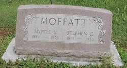
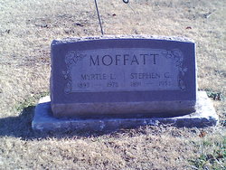
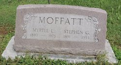
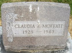
Myrtle L. Winterrowd Moffatt
| Birth | : | 25 Jan 1893 Missouri, USA |
| Death | : | 19 Oct 1975 Redmond, King County, Washington, USA |
| Burial | : | Elk Point Cemetery, Elk Point, Union County, USA |
| Coordinate | : | 42.6794586, -96.6794586 |
| Plot | : | Sec 120 Blk 2 Lot 38 Sp 2 |
| Description | : | Washington Death Index, 1940-1996 Name Myrtle L Moffatt Gender Female Age 82 Birth Year abt 1893 Residence Place King, Washington, USA Death Date 19 Oct 1975 Death Place Redmond, Washington, USA Certificate Number 023511 |
frequently asked questions (FAQ):
-
Where is Myrtle L. Winterrowd Moffatt's memorial?
Myrtle L. Winterrowd Moffatt's memorial is located at: Elk Point Cemetery, Elk Point, Union County, USA.
-
When did Myrtle L. Winterrowd Moffatt death?
Myrtle L. Winterrowd Moffatt death on 19 Oct 1975 in Redmond, King County, Washington, USA
-
Where are the coordinates of the Myrtle L. Winterrowd Moffatt's memorial?
Latitude: 42.6794586
Longitude: -96.6794586
Family Members:
Parent
Spouse
Siblings
Children
Flowers:
Nearby Cemetories:
1. Elk Point Cemetery
Elk Point, Union County, USA
Coordinate: 42.6794586, -96.6794586
2. Saint Joseph Cemetery
Elk Point, Union County, USA
Coordinate: 42.6794014, -96.6797028
3. Mills Family Cemetery
Westfield, Plymouth County, USA
Coordinate: 42.7188460, -96.6019280
4. Dewitt Cemetery
Ponca, Dixon County, USA
Coordinate: 42.6248000, -96.7437500
5. Elmwood Cemetery
Elk Point, Union County, USA
Coordinate: 42.6036700, -96.6881900
6. Saint Paul Cemetery
Elk Point, Union County, USA
Coordinate: 42.7641983, -96.7061005
7. Union County Poor Farm Cemetery
Union County, USA
Coordinate: 42.7649210, -96.7077580
8. Richland Cemetery
Richland, Union County, USA
Coordinate: 42.7682991, -96.6624985
9. Westfield Township Cemetery
Westfield, Plymouth County, USA
Coordinate: 42.7510986, -96.5914001
10. Ionia Cemetery
Newcastle, Dixon County, USA
Coordinate: 42.6893997, -96.8300018
11. Ponca Cemetery
Ponca, Dixon County, USA
Coordinate: 42.5689011, -96.7130966
12. Saint Peters Cemetery
Jefferson, Union County, USA
Coordinate: 42.6045799, -96.5594025
13. Civil Bend Cemetery
Jefferson, Union County, USA
Coordinate: 42.5769005, -96.6061020
14. First Brule Creek Cemetery
Elk Point, Union County, USA
Coordinate: 42.7943993, -96.7069016
15. Gibb's Cemetery
Newcastle, Dixon County, USA
Coordinate: 42.6985100, -96.8518400
16. Gores Bluff Cemetery
Union County, USA
Coordinate: 42.8035069, -96.6260468
17. Dowlin Cemetery
Burbank, Clay County, USA
Coordinate: 42.7789001, -96.8107986
18. Newcastle Cemetery
Newcastle, Dixon County, USA
Coordinate: 42.6550500, -96.8708700
19. Holmes Family Cemetery
Ponca, Dixon County, USA
Coordinate: 42.5389300, -96.7316200
20. Saint Peters Calvary Cemetery
Newcastle, Dixon County, USA
Coordinate: 42.6533800, -96.8744700
21. Silver Ridge Cemetery
Ponca, Dixon County, USA
Coordinate: 42.5685997, -96.8189011
22. Salem Lutheran Cemetery
Dixon County, USA
Coordinate: 42.5251900, -96.6938800
23. Ahlsborg Lutheran Cemetery
Union County, USA
Coordinate: 42.8228000, -96.7612000
24. Brule Creek Cemetery
Spink Township, Union County, USA
Coordinate: 42.8346510, -96.7324350

