Myrtle Lillian Prange Schwada
| Birth | : | 16 Jul 1902 Shelby County, Missouri, USA |
| Death | : | 19 Jan 1971 Florissant, St. Louis County, Missouri, USA |
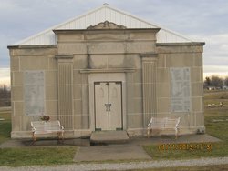
| Burial | : | Mataura Cemetery, Mataura, Gore District, New Zealand |
| Coordinate | : | -46.2016960, 168.8808060 |
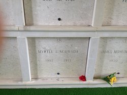
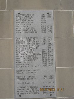
| Plot | : | Mausoleum Crypt 38 |
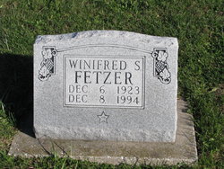
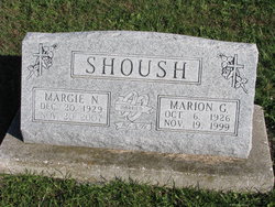
| Description | : | The daughter of Christian Franklin Prange and Emma Neuschafer, Myrtle married James "Monloe" Schwada on 12 Oct 1922. Monloe was a farmer in Shelby County, Missouri, and they were the parents of 3 children. Myrtle was an active member of the Clarence Christian Church. Monloe died in 1959, and Myrtle passed away at the home of her daughter, Genevieve Meredith, 12 years later. At the time of her death she was 68 years, 6 months and 3 days old. She was survived by 3 daughters and 2 sons-in-law, Winifred Schwada of Arlington, Virginia, Genevieve and Charles Meredith of Florissant, Missouri, and Margie Nell and Marion... Read More |
frequently asked questions (FAQ):
-
Where is Myrtle Lillian Prange Schwada's memorial?
Myrtle Lillian Prange Schwada's memorial is located at: Mataura Cemetery, Mataura, Gore District, New Zealand.
-
When did Myrtle Lillian Prange Schwada death?
Myrtle Lillian Prange Schwada death on 19 Jan 1971 in Florissant, St. Louis County, Missouri, USA
-
Where are the coordinates of the Myrtle Lillian Prange Schwada's memorial?
Latitude: -46.2016960
Longitude: 168.8808060
Family Members:
Parent
Spouse
Siblings
Children
Flowers:
Nearby Cemetories:
1. Mataura Cemetery
Mataura, Gore District, New Zealand
Coordinate: -46.2016960, 168.8808060
2. Charlton Park Cemetery
Gore, Gore District, New Zealand
Coordinate: -46.1265490, 168.8992730
3. Wyndham Cemetery
Wyndham, Southland District, New Zealand
Coordinate: -46.3147020, 168.8823690
4. Gore Cemetery
Gore, Gore District, New Zealand
Coordinate: -46.0900000, 168.9360000
5. Otaraia Cemetery
Gore District, New Zealand
Coordinate: -46.1978780, 169.0815990
6. Edendale Cemetery
Edendale, Southland District, New Zealand
Coordinate: -46.3080400, 168.7327360
7. Pukerau Cemetery
Pukerau, Gore District, New Zealand
Coordinate: -46.0989170, 169.1057690
8. Waikoikoi Cemetery
Waikoikoi, Clutha District, New Zealand
Coordinate: -46.0257040, 169.1568238
9. Mokoreta Cemetery
Southland District, New Zealand
Coordinate: -46.4332000, 169.0649650
10. Waipahi Cemetery
Waipahi, Clutha District, New Zealand
Coordinate: -46.1019420, 169.2380910
11. Woodlands Cemetery
Woodlands, Southland District, New Zealand
Coordinate: -46.3568800, 168.5463770
12. Waikaka Cemetery
Waikaka, Gore District, New Zealand
Coordinate: -45.9312400, 169.0188900
13. Riversdale Cemetery
Riversdale, Southland District, New Zealand
Coordinate: -45.9180100, 168.7263600
14. Clinton Cemetery
Clinton, Clutha District, New Zealand
Coordinate: -46.1971400, 169.3638100
15. Forest Hill Cemetery
Southland District, New Zealand
Coordinate: -46.2049720, 168.3969970
16. Quarry Hills Cemetery
Quarry Hills, Southland District, New Zealand
Coordinate: -46.5433100, 169.0398300
17. East Winton Cemetery
Winton, Southland District, New Zealand
Coordinate: -46.1374640, 168.3557030
18. Fortrose Cemetery
Fortrose, Southland District, New Zealand
Coordinate: -46.5694400, 168.8088500
19. Tapanui Cemetery
Tapanui, Clutha District, New Zealand
Coordinate: -45.9425830, 169.2832320
20. Winton Cemetery
Winton, Southland District, New Zealand
Coordinate: -46.1289300, 168.3250400
21. Ryal Bush
Ryal Bush, Southland District, New Zealand
Coordinate: -46.2836700, 168.3256000
22. Eastern Cemetery
Invercargill, Invercargill City, New Zealand
Coordinate: -46.4070770, 168.3961480
23. Te Hau Mutunga Urupā
Invercargill, Invercargill City, New Zealand
Coordinate: -46.4288704, 168.4148361
24. Southland Crematorium
Invercargill, Invercargill City, New Zealand
Coordinate: -46.4109100, 168.3961330

