
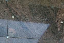
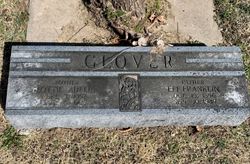
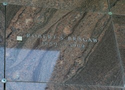
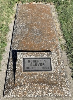
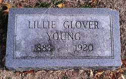
Myrtle M. Glover Bragaw
| Birth | : | 13 Oct 1888 Kansas, USA |
| Death | : | 23 Aug 1973 Mount Vernon, Skagit County, Washington, USA |
| Burial | : | McRaes Chapel Cemetery, Big Sandy, Benton County, USA |
| Coordinate | : | 36.2187940, -88.0747570 |
frequently asked questions (FAQ):
-
Where is Myrtle M. Glover Bragaw's memorial?
Myrtle M. Glover Bragaw's memorial is located at: McRaes Chapel Cemetery, Big Sandy, Benton County, USA.
-
When did Myrtle M. Glover Bragaw death?
Myrtle M. Glover Bragaw death on 23 Aug 1973 in Mount Vernon, Skagit County, Washington, USA
-
Where are the coordinates of the Myrtle M. Glover Bragaw's memorial?
Latitude: 36.2187940
Longitude: -88.0747570
Family Members:
Parent

Spouse
Siblings
Flowers:


Nearby Cemetories:
1. McRaes Chapel Cemetery
Big Sandy, Benton County, USA
Coordinate: 36.2187940, -88.0747570
2. Ramble Creek Cemetery
Big Sandy, Benton County, USA
Coordinate: 36.2036000, -88.0784750
3. Richardson Cemetery
Big Sandy, Benton County, USA
Coordinate: 36.2346220, -88.0680200
4. Edward Lindsey Cemetery
Big Sandy, Benton County, USA
Coordinate: 36.2401740, -88.0707360
5. Margaret McKenzie Brewer Cemetery
Big Sandy, Benton County, USA
Coordinate: 36.2028000, -88.0543000
6. Willow Cemetery
Big Sandy, Benton County, USA
Coordinate: 36.2548020, -88.0759660
7. Craig - Farmer Family Cemetery
Henry County, USA
Coordinate: 36.2350006, -88.1292038
8. Pleasant Ridge Cemetery
Big Sandy, Benton County, USA
Coordinate: 36.2630390, -88.0556540
9. Beaton Cemetery
Benton County, USA
Coordinate: 36.2677994, -88.0777969
10. Bakers Chapel Cemetery
Big Sandy, Benton County, USA
Coordinate: 36.1772003, -88.1164017
11. Mount Vinson Cemetery
Big Sandy, Benton County, USA
Coordinate: 36.2732060, -88.0686740
12. Roney Cemetery
Big Sandy, Benton County, USA
Coordinate: 36.2762160, -88.0668460
13. Mount Zion Cemetery
Benton County, USA
Coordinate: 36.1782840, -88.0200180
14. Lowry Cemetery
Henry County, USA
Coordinate: 36.2132988, -88.1519012
15. Cooper Cemetery
Big Sandy, Benton County, USA
Coordinate: 36.2783480, -88.0462480
16. Cedar Grove Church of Christ Cemetery
Big Sandy, Benton County, USA
Coordinate: 36.1555280, -88.0420920
17. Bucy Cemetery
Henry County, USA
Coordinate: 36.2860985, -88.1010971
18. Moore Cemetery
Big Sandy, Benton County, USA
Coordinate: 36.1473000, -88.0852000
19. Mount Carmel Congregational Methodist Church Cemet
Big Sandy, Benton County, USA
Coordinate: 36.2869850, -88.0377230
20. Manleyville Cemetery
Manleyville, Henry County, USA
Coordinate: 36.2268982, -88.1669006
21. Lindsey Cemetery
Benton County, USA
Coordinate: 36.2655983, -87.9989014
22. Wheatley Cemetery
Benton County, USA
Coordinate: 36.1864014, -87.9878006
23. Pierce Cemetery
Big Sandy, Benton County, USA
Coordinate: 36.2972060, -88.0789180
24. Rushings Creek Cemetery
Camden, Benton County, USA
Coordinate: 36.1431340, -88.1096870