
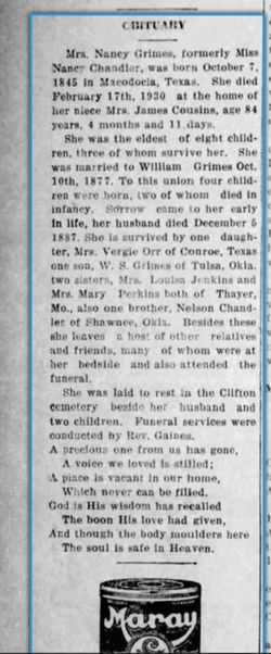
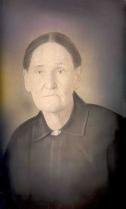
Nancy Chandler Grimes
| Birth | : | 7 Oct 1845 Texas, USA |
| Death | : | 17 Feb 1930 Oregon County, Missouri, USA |
| Burial | : | Concord Cemetery, Ford County, USA |
| Coordinate | : | 37.5910988, -100.1157990 |
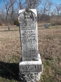
| Description | : | Daughter of Nelson Chandler and Mary 'Polly' (Allen) Chandler. Married Mr. Jones; widow on 1900 census. Married James W. Grimes. Per MO Death certificate #5864, burial 19/Feb/1930. |
frequently asked questions (FAQ):
-
Where is Nancy Chandler Grimes's memorial?
Nancy Chandler Grimes's memorial is located at: Concord Cemetery, Ford County, USA.
-
When did Nancy Chandler Grimes death?
Nancy Chandler Grimes death on 17 Feb 1930 in Oregon County, Missouri, USA
-
Where are the coordinates of the Nancy Chandler Grimes's memorial?
Latitude: 37.5910988
Longitude: -100.1157990
Family Members:
Parent
Spouse

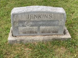
Siblings
Flowers:


Nearby Cemetories:
1. Concord Cemetery
Ford County, USA
Coordinate: 37.5910988, -100.1157990
2. Amish Cemetery
Dodge City, Ford County, USA
Coordinate: 37.6639500, -100.0913300
3. German Mission Schlichting Cemetery
Dodge City, Ford County, USA
Coordinate: 37.5030530, -100.0886890
4. Ensign Cemetery
Ensign, Gray County, USA
Coordinate: 37.6274986, -100.2339020
5. Christ the King Cemetery
Ford County, USA
Coordinate: 37.6493073, -100.0056305
6. Cave Cemetery
Gray County, USA
Coordinate: 37.5469017, -100.2518997
7. Wilburn Cemetery
Fowler, Meade County, USA
Coordinate: 37.4742012, -100.1264038
8. Johnson Cemetery
Ensign, Gray County, USA
Coordinate: 37.7086010, -100.2156130
9. McCauley Cemetery
Fowler, Meade County, USA
Coordinate: 37.4609000, -100.2155800
10. First Congregational Church Cemetery
Fowler, Meade County, USA
Coordinate: 37.4606400, -100.2152600
11. Scroggins Mausoleum
Dodge City, Ford County, USA
Coordinate: 37.7403000, -100.0498200
12. Maple Grove Cemetery
Dodge City, Ford County, USA
Coordinate: 37.7612410, -100.0507630
13. Boot Hill Cemetery (Defunct)
Dodge City, Ford County, USA
Coordinate: 37.7544800, -100.0222800
14. Prairie Grove Cemetery (Defunct)
Dodge City, Ford County, USA
Coordinate: 37.7612600, -100.0129500
15. Bloom Cemetery
Bloom, Ford County, USA
Coordinate: 37.4928017, -99.8966980
16. Kansas Veterans Cemetery at Fort Dodge
Dodge City, Ford County, USA
Coordinate: 37.7315903, -99.9314041
17. Appleton Township Cemetery
Minneola, Clark County, USA
Coordinate: 37.4011002, -100.0046997
18. Fowler Cemetery
Fowler, Meade County, USA
Coordinate: 37.3732986, -100.2018967
19. Fairview Cemetery
Montezuma, Gray County, USA
Coordinate: 37.6431007, -100.4147034
20. Morningside Cemetery
Montezuma, Gray County, USA
Coordinate: 37.5762900, -100.4337100
21. Ridenhour Cemetery
Ford County, USA
Coordinate: 37.8396988, -100.1716995
22. Saint Andrew Catholic Cemetery
Wright, Ford County, USA
Coordinate: 37.7790800, -99.8875100
23. Pleasant Vale Cemetery
Ford County, USA
Coordinate: 37.7933006, -99.9047012
24. Cimarron Cemetery
Cimarron, Gray County, USA
Coordinate: 37.8178200, -100.3411900