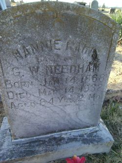
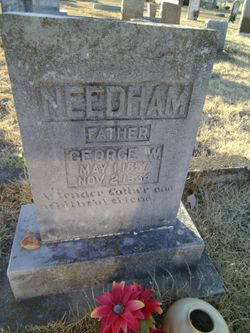
Nannie Rains Needham
| Birth | : | 14 Jan 1868 Houston County, Texas, USA |
| Death | : | 14 Mar 1932 Formosa, Van Buren County, Arkansas, USA |
| Burial | : | Queens Meadow Point Cemetery, Keyser, Mineral County, USA |
| Coordinate | : | 39.4291992, -78.9627991 |
| Description | : | obit from Van Buren County Democrat Mar 18, 1932 : " Mrs. Geo. Needham Dies at Home Near Formosa Mrs. Nannie R. Needham, beloved wife of Geo. W. Needham, died at her home near Formosa at 3:30 A.M. Monday March 14, from the effects of poison taken Saturday evening after her family had retired. Interment took place at Union Hill cemetery at 10 o'clock Tuesday morning, funeral services being conducted by Rev. J. C. Jenkins. Mrs. Needham's maiden name was Rains. She... Read More |
frequently asked questions (FAQ):
-
Where is Nannie Rains Needham's memorial?
Nannie Rains Needham's memorial is located at: Queens Meadow Point Cemetery, Keyser, Mineral County, USA.
-
When did Nannie Rains Needham death?
Nannie Rains Needham death on 14 Mar 1932 in Formosa, Van Buren County, Arkansas, USA
-
Where are the coordinates of the Nannie Rains Needham's memorial?
Latitude: 39.4291992
Longitude: -78.9627991
Family Members:
Parent
Spouse
Siblings
Children
Flowers:
Nearby Cemetories:
1. Queens Meadow Point Cemetery
Keyser, Mineral County, USA
Coordinate: 39.4291992, -78.9627991
2. Potomac Memorial Gardens
Keyser, Mineral County, USA
Coordinate: 39.4312000, -78.9579700
3. Dayton Cemetery
McCoole, Allegany County, USA
Coordinate: 39.4437000, -78.9573400
4. Locust Cemetery
Keyser, Mineral County, USA
Coordinate: 39.4449577, -78.9769135
5. Town Hill Cemetery
Petersburg, Grant County, USA
Coordinate: 39.4351762, -78.9882074
6. Thorn Rose Hill Cemetery
Keyser, Mineral County, USA
Coordinate: 39.4374352, -78.9929199
7. Arnold Cemetery
Keyser, Mineral County, USA
Coordinate: 39.4263992, -78.9950027
8. Saint Thomas Cemetery
Keyser, Mineral County, USA
Coordinate: 39.4406900, -78.9960300
9. Saint Mary's Cemetery
Keyser, Mineral County, USA
Coordinate: 39.4403000, -78.9963989
10. Cabin Run Cemetery
Keyser, Mineral County, USA
Coordinate: 39.4206009, -78.9216995
11. Sears Cemetery
Mineral County, USA
Coordinate: 39.4026900, -78.9148200
12. Leatherman-Parish Cemetery
Keyser, Mineral County, USA
Coordinate: 39.4075080, -79.0150020
13. Dawson Cemetery
Dawson, Allegany County, USA
Coordinate: 39.4737360, -78.9464880
14. Barrick and Rines Cemetery
Mineral County, USA
Coordinate: 39.3994010, -79.0143540
15. Duling Cemetery
New Creek, Mineral County, USA
Coordinate: 39.3906525, -79.0041940
16. County Poor House Cemetery
Mineral County, USA
Coordinate: 39.4788710, -78.9411070
17. Mount Zion Cemetery
Mineral County, USA
Coordinate: 39.4642900, -78.8974500
18. Orr Cemetery
Independence, Preston County, USA
Coordinate: 39.4252620, -78.8777500
19. Urice Cemetery
Mineral County, USA
Coordinate: 39.4687400, -78.8923000
20. Miller Cemetery
Westernport, Allegany County, USA
Coordinate: 39.4888110, -79.0043140
21. Bane Cemetery
Burlington, Mineral County, USA
Coordinate: 39.3579200, -78.9598200
22. Thrush Cemetery #01
Burlington, Mineral County, USA
Coordinate: 39.3588200, -78.9289400
23. Arnold Cemetery #2
Ridgeville, Mineral County, USA
Coordinate: 39.3612890, -79.0072440
24. Duckworth Cemetery at Stoney Run
Westernport, Allegany County, USA
Coordinate: 39.4984280, -79.0136400


