
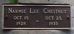


Narmie Erma Lee Chestnut
| Birth | : | 15 Oct 1928 Horry County, South Carolina, USA |
| Death | : | 25 Oct 1935 Horry County, South Carolina, USA |
| Burial | : | Garston Cemetery, Garston, Southland District, New Zealand |
| Coordinate | : | -45.4694520, 168.6840050 |
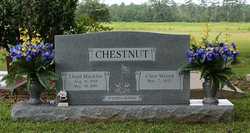
| Description | : | Her name: 1930 Census: Noamie or Normie L. Chestnut Death Certificate: Erma Lee Chestnut Headstone: Narmie Lee Chestnut |
frequently asked questions (FAQ):
-
Where is Narmie Erma Lee Chestnut's memorial?
Narmie Erma Lee Chestnut's memorial is located at: Garston Cemetery, Garston, Southland District, New Zealand.
-
When did Narmie Erma Lee Chestnut death?
Narmie Erma Lee Chestnut death on 25 Oct 1935 in Horry County, South Carolina, USA
-
Where are the coordinates of the Narmie Erma Lee Chestnut's memorial?
Latitude: -45.4694520
Longitude: 168.6840050
Family Members:
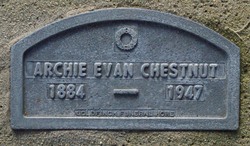
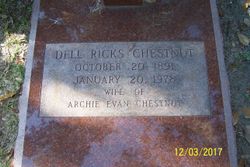
Parent
Siblings
Flowers:


Nearby Cemetories:
1. Garston Cemetery
Garston, Southland District, New Zealand
Coordinate: -45.4694520, 168.6840050
2. Athol Cemetery
Athol, Southland District, New Zealand
Coordinate: -45.5088440, 168.5772790
3. Nokomai Southern Cemetery
Gore District, New Zealand
Coordinate: -45.5533090, 168.6607170
4. Kingston Cemetery
Kingston, Queenstown-Lakes District, New Zealand
Coordinate: -45.3376030, 168.7252250
5. Jollies Graves
Eyre Creek, Southland District, New Zealand
Coordinate: -45.5790700, 168.4913300
6. Waikaia Cemetery
Waikaia, Southland District, New Zealand
Coordinate: -45.7169300, 168.8490600
7. Potters
Roxburgh, Central Otago District, New Zealand
Coordinate: -45.4702550, 169.1115970
8. Nevis Cemetery
Central Otago District, New Zealand
Coordinate: -45.2240700, 168.9529050
9. Lumsden Cemetery
Lumsden, Southland District, New Zealand
Coordinate: -45.7418320, 168.4534090
10. Balfour Cemetery
Balfour, Southland District, New Zealand
Coordinate: -45.8391000, 168.5986640
11. Centre Hill Cemetery
Mossburn, Southland District, New Zealand
Coordinate: -45.6973670, 168.1959000
12. Gorge Creek Miners' Monument
Roxburgh, Central Otago District, New Zealand
Coordinate: -45.3759790, 169.2764350
13. Queenstown Cemetery
Queenstown, Queenstown-Lakes District, New Zealand
Coordinate: -45.0298090, 168.6554360
14. Roxburgh Cemetery
Roxburgh, Central Otago District, New Zealand
Coordinate: -45.5267800, 169.3107700
15. Riversdale Cemetery
Riversdale, Southland District, New Zealand
Coordinate: -45.9180100, 168.7263600
16. Frankton Cemetery
Queenstown, Queenstown-Lakes District, New Zealand
Coordinate: -45.0155230, 168.7325580
17. Lower Shotover Cemetery
Lower Shotover, Queenstown-Lakes District, New Zealand
Coordinate: -45.0004018, 168.7673740
18. Dipton Cemetery
Dipton, Southland District, New Zealand
Coordinate: -45.8957730, 168.3508000
19. Ettrick Cemetery
Millers Flat, Central Otago District, New Zealand
Coordinate: -45.6318900, 169.3645500
20. Waikaka Cemetery
Waikaka, Gore District, New Zealand
Coordinate: -45.9312400, 169.0188900
21. St. Michael & All Angels Church Cemetery
Clyde, Central Otago District, New Zealand
Coordinate: -45.1887000, 169.3172167
22. Clyde Cemetery
Clyde, Central Otago District, New Zealand
Coordinate: -45.1941880, 169.3398930
23. Arrowtown Cemetery
Arrowtown, Queenstown-Lakes District, New Zealand
Coordinate: -44.9402010, 168.8273840
24. Arrowtown War Memorial
Arrowtown, Queenstown-Lakes District, New Zealand
Coordinate: -44.9397300, 168.8284300