
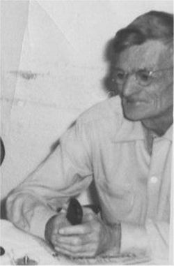
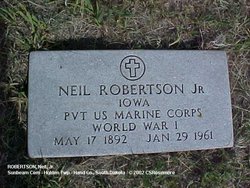
Neil Robertson Jr.
| Birth | : | 17 May 1892 Plymouth County, Iowa, USA |
| Death | : | 29 Jan 1961 Holden Township, Hand County, South Dakota, USA |
| Burial | : | Sunbeam Cemetery, Hand County, USA |
| Coordinate | : | 44.6777992, -98.8407974 |
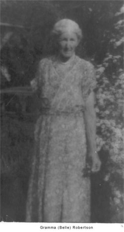
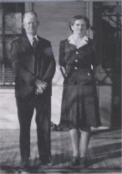
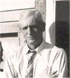
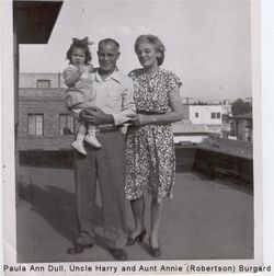
| Description | : | Birth: Washinigton Township. Marriage: Leora Marie Taylor, 8 Aug 1923, Nashua Co., Iowa. Neil Robertson, 68 year old Holden Township farmer, died Sunday afternoon, January 29, at his home. Death came after an illness of several years. Funeral services were conducted at the Sunbeam Congregational Church Wednesday afternoon, and burial was made in the Holden Cemetery. Brief rites were held earlier at the Reck Funeral Home, which had charge of the arrangements. Rev. Douglas Barrows of Faulkton conducted the rites, and pallbearers were E. V. Story, J.W. Dynes, Dwight Chipman, John Peterman, Herbert Zieger and John Wheelhouse. Robertson was born... Read More |
frequently asked questions (FAQ):
-
Where is Neil Robertson Jr.'s memorial?
Neil Robertson Jr.'s memorial is located at: Sunbeam Cemetery, Hand County, USA.
-
When did Neil Robertson Jr. death?
Neil Robertson Jr. death on 29 Jan 1961 in Holden Township, Hand County, South Dakota, USA
-
Where are the coordinates of the Neil Robertson Jr.'s memorial?
Latitude: 44.6777992
Longitude: -98.8407974
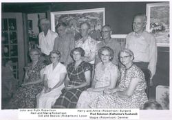
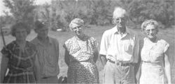
Family Members:
Parent

Spouse
Siblings
Children


Flowers:


Nearby Cemetories:
1. Sunbeam Cemetery
Hand County, USA
Coordinate: 44.6777992, -98.8407974
2. Burdette Cemetery
Burdette, Hand County, USA
Coordinate: 44.7002983, -98.7869034
3. Beulah Cemetery
Vayland, Hand County, USA
Coordinate: 44.6060982, -98.8060989
4. Buffalo Cemetery
Spink County, USA
Coordinate: 44.6918983, -98.6853027
5. Saint Johns Cemetery
Tulare, Spink County, USA
Coordinate: 44.7202988, -98.6600037
6. Howell Cemetery
Miller, Hand County, USA
Coordinate: 44.7757988, -98.9766998
7. Saint Lawrence Cemetery
Saint Lawrence, Hand County, USA
Coordinate: 44.5292015, -98.9321976
8. Saint Ann's Cemetery
Miller, Hand County, USA
Coordinate: 44.5222015, -98.9732971
9. Cottonwood Cemetery
Redfield, Spink County, USA
Coordinate: 44.8078800, -98.6579600
10. Hillcrest Cemetery
Miller, Hand County, USA
Coordinate: 44.5207000, -99.0006100
11. Alden Cemetery
Hand County, USA
Coordinate: 44.6775017, -99.1203003
12. G A R Cemetery
Miller, Hand County, USA
Coordinate: 44.5078011, -98.9858017
13. Garfield Cemetery
Spink County, USA
Coordinate: 44.6622009, -98.5535965
14. Mount Calvary Cemetery
Polo, Hand County, USA
Coordinate: 44.7827988, -99.1097031
15. Saint Marys Catholic Cemetery
Zell, Faulk County, USA
Coordinate: 44.8943340, -98.7283210
16. Rockham Cemetery
Rockham, Faulk County, USA
Coordinate: 44.9118996, -98.8375015
17. Saint Josephs Catholic Cemetery
Hand County, USA
Coordinate: 44.4574400, -98.7100400
18. Wessington Cemetery
Hand County, USA
Coordinate: 44.4569016, -98.7102966
19. Saint Michaels Cemetery
Hand County, USA
Coordinate: 44.8302994, -99.1106033
20. Tulare Cemetery
Tulare, Spink County, USA
Coordinate: 44.7486000, -98.4922028
21. Prairie View Cemetery
Hand County, USA
Coordinate: 44.8806000, -99.0888977
22. Bonilla Cemetery
Bonilla, Beadle County, USA
Coordinate: 44.5830994, -98.4835968
23. Saint Josephs Cemetery
Orient, Faulk County, USA
Coordinate: 44.9015500, -99.0920300
24. Morningside Cemetery
Ree Heights, Hand County, USA
Coordinate: 44.5147018, -99.1903000