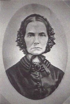
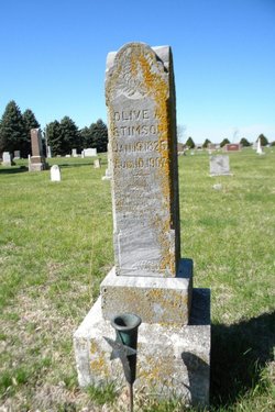
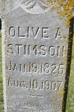
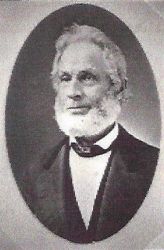
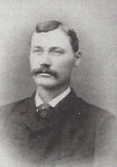
Olive Anee Collins Stimson
| Birth | : | 19 Jan 1825 St. Lawrence County, New York, USA |
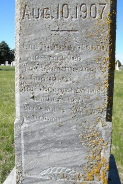
| Death | : | 10 Aug 1907 Cameron, Hall County, Nebraska, USA |
| Burial | : | Quiet Haven Memorial Park Cemetery, Sacramento, Sacramento County, USA |
| Coordinate | : | 38.5109711, -121.3245621 |
| Plot | : | Original Section Row 3 Lot 23 |
| Description | : | Olive Anee was the first born child of five known children and only daughter of Harley and Mary Stewart Collins. She married Henry Earl Stimson on 15 September 1843 in Franklin, Franklin, New York. They were the parents of four known children: Nancy E. Harley Collins George Henry Adda Mae |
frequently asked questions (FAQ):
-
Where is Olive Anee Collins Stimson's memorial?
Olive Anee Collins Stimson's memorial is located at: Quiet Haven Memorial Park Cemetery, Sacramento, Sacramento County, USA.
-
When did Olive Anee Collins Stimson death?
Olive Anee Collins Stimson death on 10 Aug 1907 in Cameron, Hall County, Nebraska, USA
-
Where are the coordinates of the Olive Anee Collins Stimson's memorial?
Latitude: 38.5109711
Longitude: -121.3245621
Family Members:
Spouse
Children
Flowers:
Nearby Cemetories:
1. Quiet Haven Memorial Park Cemetery
Sacramento, Sacramento County, USA
Coordinate: 38.5109711, -121.3245621
2. Bellview Cemetery
Sacramento, Sacramento County, USA
Coordinate: 38.5153580, -121.3257446
3. Camellia Memorial Lawn Cemetery
Sacramento, Sacramento County, USA
Coordinate: 38.5242004, -121.3097000
4. Sacramento Pet Cemetery
Sacramento, Sacramento County, USA
Coordinate: 38.4815870, -121.3402080
5. Greater Sacramento Muslim Cemetery
Sacramento, Sacramento County, USA
Coordinate: 38.5128300, -121.2616800
6. Chua Phuoc Thien Temple Columbarium
Sacramento, Sacramento County, USA
Coordinate: 38.4555400, -121.3345500
7. Tinh Xa Ngoc An Temple Columbarium
Sacramento, Sacramento County, USA
Coordinate: 38.5190200, -121.4159500
8. Elder Creek Cemetery
Florin, Sacramento County, USA
Coordinate: 38.5111008, -121.4169006
9. Sacramento County Cemetery
Sacramento County, USA
Coordinate: 38.5267900, -121.4233700
10. Sacramento County Veterans Memorial Cemetery
Sacramento, Sacramento County, USA
Coordinate: 38.5252838, -121.4239120
11. Russian Orthodox Cemetery
Sacramento, Sacramento County, USA
Coordinate: 38.5268800, -121.4244300
12. Sacramento County Hospital Cemetery
Sacramento, Sacramento County, USA
Coordinate: 38.5289300, -121.4239100
13. Union Cemetery
Sacramento County, USA
Coordinate: 38.4477997, -121.2619019
14. Pleasant Grove Cemetery
Elk Grove, Sacramento County, USA
Coordinate: 38.4302220, -121.3107670
15. Saint Mary's Catholic Cemetery and Mausoleum
Sacramento, Sacramento County, USA
Coordinate: 38.5298900, -121.4261200
16. Sacramento Memorial Lawn Cemetery
Sacramento, Sacramento County, USA
Coordinate: 38.5146484, -121.4380341
17. Home of Peace Cemetery
Sacramento, Sacramento County, USA
Coordinate: 38.5137558, -121.4382782
18. San Joaquin Cemetery
Sacramento, Sacramento County, USA
Coordinate: 38.4387665, -121.4034653
19. Saint Michaels Episcopal Church Columbarium
Carmichael, Sacramento County, USA
Coordinate: 38.6042800, -121.3547200
20. Kilgore Cemetery
Rancho Cordova, Sacramento County, USA
Coordinate: 38.5978012, -121.2683029
21. Hilltop Cemetery
Elk Grove, Sacramento County, USA
Coordinate: 38.4156490, -121.3534950
22. East Lawn Elk Grove Memorial Park
Elk Grove, Sacramento County, USA
Coordinate: 38.4282608, -121.3969955
23. Kim Quang Temple Columbarium
Sacramento, Sacramento County, USA
Coordinate: 38.5996600, -121.3904700
24. Saint Marks Methodist Church Memorial Tree
Sacramento, Sacramento County, USA
Coordinate: 38.6076500, -121.3750680

