
| Birth | : | 14 Mar 1924 Montgomery County, Iowa, USA |
| Death | : | 9 Jul 2015 Griswold, Cass County, Iowa, USA |
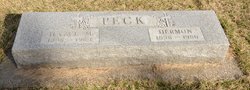
| Burial | : | Hillside Cemetery, Elliott, Montgomery County, USA |
| Coordinate | : | 41.1408005, -95.1544037 |
| Description | : | Opal Belle Smith (March 14, 1924 - July 9, 2015) Opal Belle Smith, the daughter of Hermon and Hazel Marie (Babb) Peck, was born March 14, 1924 at Elliott, IA and died July 9, 2015 at the Griswold Care Center in Griswold, IA at the age of 91 years, 3 months, and 25 days. Opal attended school at Elliott, graduating from Elliott High School. After graduating, she was married and moved to Stanton, IA. Her son Lloyd was born to this union. Opal and Lloyd moved back to Elliott, and Opal worked at several different jobs including the Griswold... Read More |
frequently asked questions (FAQ):
-
Where is Opal Belle Peck Smith's memorial?
Opal Belle Peck Smith's memorial is located at: Hillside Cemetery, Elliott, Montgomery County, USA.
-
When did Opal Belle Peck Smith death?
Opal Belle Peck Smith death on 9 Jul 2015 in Griswold, Cass County, Iowa, USA
-
Where are the coordinates of the Opal Belle Peck Smith's memorial?
Latitude: 41.1408005
Longitude: -95.1544037
Family Members:
Parent

Spouse
Siblings

Flowers:


Nearby Cemetories:
1. Hillside Cemetery
Elliott, Montgomery County, USA
Coordinate: 41.1408005, -95.1544037
2. Mercer Cemetery
Pottawattamie County, USA
Coordinate: 41.1753006, -95.1650009
3. Waveland Cemetery
Pottawattamie County, USA
Coordinate: 41.1738700, -95.1881500
4. Pilot Grove Center Cemetery
Elliott, Montgomery County, USA
Coordinate: 41.1190600, -95.0993700
5. Indian Graveyard
Sherman Township, Montgomery County, USA
Coordinate: 41.0955730, -95.1837580
6. Lowman Cemetery
Griswold, Cass County, USA
Coordinate: 41.1594009, -95.0886002
7. Pleasant Township Cemetery
Griswold, Cass County, USA
Coordinate: 41.2056000, -95.1370000
8. Haefflick Burial Site
Red Oak, Montgomery County, USA
Coordinate: 41.0726300, -95.1561700
9. L Laire Property Cemetery (Defunct)
Sherman Township, Montgomery County, USA
Coordinate: 41.0958257, -95.2224927
10. Pilot Grove Presbyterian Cemetery
Wallin, Montgomery County, USA
Coordinate: 41.0793991, -95.0699997
11. Saint Clair Cemetery
Red Oak Township, Montgomery County, USA
Coordinate: 41.0598400, -95.2049810
12. Flint Cemetery
Pottawattamie County, USA
Coordinate: 41.2289009, -95.1841965
13. Center Ridge Cemetery
Montgomery County, USA
Coordinate: 41.1452141, -95.2787018
14. Griswold Cemetery
Waveland Township, Pottawattamie County, USA
Coordinate: 41.2360992, -95.1735992
15. Saint Marys Cemetery
Red Oak, Montgomery County, USA
Coordinate: 41.0447006, -95.2275009
16. Tabor Cemetery
Wallin, Montgomery County, USA
Coordinate: 41.0543700, -95.0619900
17. Frankfort Cemetery
Montgomery County, USA
Coordinate: 41.0271988, -95.1327972
18. Gomer Cemetery
Wales, Montgomery County, USA
Coordinate: 41.1171989, -95.3082962
19. Smith Cemetery
Griswold, Cass County, USA
Coordinate: 41.2606010, -95.1453018
20. Grant Cemetery
Grant, Montgomery County, USA
Coordinate: 41.1405983, -94.9906006
21. Mortons Mill Cemetery
Morton Mills, Montgomery County, USA
Coordinate: 41.0793991, -95.0085983
22. Evergreen Cemetery
Red Oak, Montgomery County, USA
Coordinate: 41.0228004, -95.2205963
23. Old East Cemetery
Grant, Montgomery County, USA
Coordinate: 41.1444016, -94.9792023
24. Douglas Township Cemetery
Grant, Montgomery County, USA
Coordinate: 41.1360933, -94.9752558