
| Birth | : | 27 Jan 1904 Upland, Dickinson County, Kansas, USA |
| Death | : | 12 Sep 1963 Wichita, Sedgwick County, Kansas, USA |
| Burial | : | Liberty Cemetery, Upland, Dickinson County, USA |
| Coordinate | : | 39.0896988, -97.0278015 |
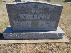
| Description | : | ORENO B. DAVIDSON Oreno B. Davidson, 59, of 413 West Roosevelt, died Thursday evening at Wesleyan hospital in Wichita after an illness of two months. Born Jan. 27, 1904 near Upland, Mr. Davidson had lived here for the past 30 years. He married Vivian L. Towle on Feb. 15, 1930, who survives him. Besides his wife, survivors include three children, Mrs. Charlene Towsley, Wichita; Cecil Davidson, Sioux Falls, S.D., and Loren Davidson, Lincoln; two brothers, Dewey, of Wichita, and Lemerick, of Georgia; two sisters, Mrs. Roy Sutter, Wakefield, and Samantha Watkins, of Wichita; and three grandchildren. The body is at Mass-Hinitt Funeral Home. Funeral... Read More |
frequently asked questions (FAQ):
-
Where is Oreno Baker “Hap” Davidson's memorial?
Oreno Baker “Hap” Davidson's memorial is located at: Liberty Cemetery, Upland, Dickinson County, USA.
-
When did Oreno Baker “Hap” Davidson death?
Oreno Baker “Hap” Davidson death on 12 Sep 1963 in Wichita, Sedgwick County, Kansas, USA
-
Where are the coordinates of the Oreno Baker “Hap” Davidson's memorial?
Latitude: 39.0896988
Longitude: -97.0278015
Family Members:
Parent

Spouse
Siblings
Children
Flowers:


Nearby Cemetories:
1. Liberty Cemetery
Upland, Dickinson County, USA
Coordinate: 39.0896988, -97.0278015
2. Alida Zion Evangelical Cemetery
Upland, Dickinson County, USA
Coordinate: 39.0750008, -96.9721985
3. Jones Cemetery
Dickinson County, USA
Coordinate: 39.0703011, -97.0860977
4. Alida Cemetery
Geary County, USA
Coordinate: 39.1030998, -96.9618988
5. Saint Johns Cemetery
Geary County, USA
Coordinate: 39.0741997, -96.9610977
6. Good Hope Cemetery
Chapman, Dickinson County, USA
Coordinate: 39.0388985, -96.9991989
7. Sutphen Mill Cemetery
Chapman, Dickinson County, USA
Coordinate: 39.0330190, -97.0368770
8. Greenridge Cemetery
Dickinson County, USA
Coordinate: 39.1199989, -97.1433029
9. Madura Cemetery
Wakefield, Clay County, USA
Coordinate: 39.1842003, -97.0117035
10. Bethel Cemetery
Moonlight, Dickinson County, USA
Coordinate: 39.0022011, -97.1110535
11. Saint Patricks Cemetery
Chapman, Dickinson County, USA
Coordinate: 38.9803330, -97.0062850
12. Buckeye Cemetery
Buckeye, Dickinson County, USA
Coordinate: 39.0463070, -97.1665840
13. Indian Hill Cemetery
Chapman, Dickinson County, USA
Coordinate: 38.9714012, -97.0327988
14. Henry Cemetery
Buckeye, Dickinson County, USA
Coordinate: 39.0828018, -97.1857986
15. Branscom Cemetery
Milford, Geary County, USA
Coordinate: 39.1627998, -96.8942032
16. Barry Cemetery
Milford, Geary County, USA
Coordinate: 39.1889000, -96.9218979
17. Highland Cemetery
Wakefield, Clay County, USA
Coordinate: 39.2190247, -97.0133667
18. Milford Cemetery
Milford, Geary County, USA
Coordinate: 39.1828003, -96.9047012
19. Timber Creek Cemetery
Wakefield, Clay County, USA
Coordinate: 39.2182999, -96.9805984
20. Saint John's Episcopal Cemetery
Clay County, USA
Coordinate: 39.2193985, -97.0744019
21. Mizpah Cemetery
Clay County, USA
Coordinate: 39.2057800, -97.1238500
22. Union Cemetery
Buckeye, Dickinson County, USA
Coordinate: 39.0243988, -97.1856003
23. Athelstane Cemetery
Athelstane Township, Clay County, USA
Coordinate: 39.1768990, -97.1753006
24. Geary County Poor Farm Cemetery
Junction City, Geary County, USA
Coordinate: 39.0064500, -96.8727100