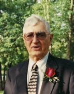
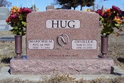
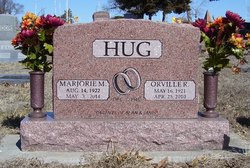
Orville Ray Hug
| Birth | : | 16 May 1921 Mayetta, Jackson County, Kansas, USA |
| Death | : | 25 Apr 2010 Topeka, Shawnee County, Kansas, USA |
| Burial | : | Hillside Memorial Park, Akron, Summit County, USA |
| Coordinate | : | 41.0387001, -81.4255981 |
| Plot | : | Section A (east) |
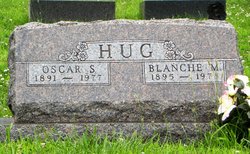
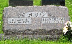
| Description | : | HOLTON Orville R. Hug, 88, of Holton died Sunday, April 25, 2010 at a Topeka hospital. He was born May 16, 1921 in Mayetta, KS, the son of Oscar S. and Blanche Edwards Hug. Orville graduated from Hoyt High School in 1939 and served in the Army during World War II. Orville owned and operated Western Auto from 1953 to 1992. He was a member of First United Methodist Church, a past Commander of American Legion Post #44, former President of Holton Chamber of Commerce and a member of the Holton Country Club. Orville married Marjorie M. Rudy on December... Read More |
frequently asked questions (FAQ):
-
Where is Orville Ray Hug's memorial?
Orville Ray Hug's memorial is located at: Hillside Memorial Park, Akron, Summit County, USA.
-
When did Orville Ray Hug death?
Orville Ray Hug death on 25 Apr 2010 in Topeka, Shawnee County, Kansas, USA
-
Where are the coordinates of the Orville Ray Hug's memorial?
Latitude: 41.0387001
Longitude: -81.4255981
Family Members:
Parent
Spouse
Siblings
Flowers:
Nearby Cemetories:
1. Hillside Memorial Park
Akron, Summit County, USA
Coordinate: 41.0387001, -81.4255981
2. Grace Cathedral Cemetery
Akron, Summit County, USA
Coordinate: 41.0361958, -81.4297615
3. Ellet Cemetery
Akron, Summit County, USA
Coordinate: 41.0452995, -81.4360962
4. Maple Hill Cemetery
Akron, Summit County, USA
Coordinate: 41.0416527, -81.4056473
5. Memory Lane Cemetery
Ellet, Summit County, USA
Coordinate: 41.0495140, -81.4416990
6. Edwin Shaw Sanitarium Cemetery
South Akron, Summit County, USA
Coordinate: 41.0162010, -81.4332962
7. Greenwood Cemetery
Mogadore, Summit County, USA
Coordinate: 41.0518990, -81.3983002
8. Boosinger Cemetery
Tallmadge, Summit County, USA
Coordinate: 41.0677700, -81.4250000
9. Kent Corners Cemetery
Suffield, Portage County, USA
Coordinate: 41.0250000, -81.3831000
10. Old Springfield Cemetery
Akron, Summit County, USA
Coordinate: 41.0501780, -81.4722920
11. Milheim Cemetery
Millheim, Summit County, USA
Coordinate: 41.0018005, -81.4345016
12. Slovak Evangelical Cemetery
Krumroy, Summit County, USA
Coordinate: 41.0131989, -81.4675980
13. Saint Michaels Cemetery
Portage County, USA
Coordinate: 41.0518990, -81.3739014
14. Watson Park Vietnam Memory Garden
Akron, Summit County, USA
Coordinate: 41.0695100, -81.4627300
15. Tison Road Cemetery
Akron, Summit County, USA
Coordinate: 40.9995003, -81.3936996
16. East Akron Cemetery
Akron, Summit County, USA
Coordinate: 41.0681000, -81.4805984
17. Middlebury Cemetery
Akron, Summit County, USA
Coordinate: 41.0733986, -81.4784012
18. Pleasant Valley Cemetery
Akron, Summit County, USA
Coordinate: 41.0065002, -81.4931030
19. Greenlawn Cemetery
Uniontown, Stark County, USA
Coordinate: 40.9782982, -81.4103012
20. Tallmadge Cemetery
Tallmadge, Summit County, USA
Coordinate: 41.0989990, -81.4420013
21. East-Lawn Cemetery
Suffield, Portage County, USA
Coordinate: 41.0234200, -81.3453400
22. Old Lutheran Cemetery
Uniontown, Stark County, USA
Coordinate: 40.9772290, -81.4081710
23. Infirmary Cemetery
Tallmadge, Summit County, USA
Coordinate: 41.1003340, -81.4492790
24. First Congregational Churchyard
Tallmadge, Summit County, USA
Coordinate: 41.1018880, -81.4412870

