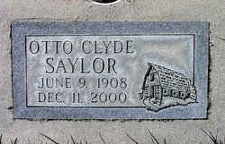
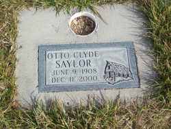
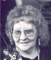
Otto Clyde Saylor
| Birth | : | 9 Jun 1908 |
| Death | : | 11 Dec 2000 |
| Burial | : | Otahuhu Public Cemetery, Ōtāhūhū, Auckland Council, New Zealand |
| Coordinate | : | -36.9377500, 174.8432390 |
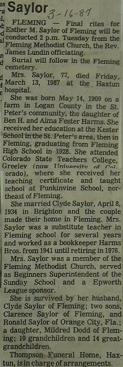
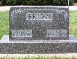
| Description | : | Otto Clyde Saylor, 92, of Sterling, formerly of Fleming, died Monday, Dec. 11, 2000 in Sterling of natural causes. Visitation will be from 1-7 p.m. on Wednesday, Dec. 13, at Tennant Funeral Home. Funeral services will be at 11 a.m. on Thursday, Dec. 14, at Fleming United Methodist Church with Rev. Tom Peacock officiating. A private family inurnment will be at the Fleming Cemetery. Mr. Saylor was born on June 9, 1908 to Arthur and Maggie(Mullikin) Saylor in western Nebraska. On April 8, 1934 he married Esther Harms. She died in 1987. He married Irene Brown on Aug. 16, 1987. She died in October... Read More |
frequently asked questions (FAQ):
-
Where is Otto Clyde Saylor's memorial?
Otto Clyde Saylor's memorial is located at: Otahuhu Public Cemetery, Ōtāhūhū, Auckland Council, New Zealand.
-
When did Otto Clyde Saylor death?
Otto Clyde Saylor death on 11 Dec 2000 in
-
Where are the coordinates of the Otto Clyde Saylor's memorial?
Latitude: -36.9377500
Longitude: 174.8432390
Family Members:
Spouse
Children
Flowers:
Nearby Cemetories:
1. Otahuhu Public Cemetery
Ōtāhūhū, Auckland Council, New Zealand
Coordinate: -36.9377500, 174.8432390
2. Holy Trinity Memorial Park
Ōtāhūhū, Auckland Council, New Zealand
Coordinate: -36.9374510, 174.8448580
3. St. Joseph and St. Joachim Catholic Cemetery
Ōtāhūhū, Auckland Council, New Zealand
Coordinate: -36.9436100, 174.8490100
4. Nixon Memorial
Ōtāhūhū, Auckland Council, New Zealand
Coordinate: -36.9499366, 174.8449909
5. St. John's Presbyterian Church Cemetery
Papatoetoe, Auckland Council, New Zealand
Coordinate: -36.9674185, 174.8598178
6. St Matthias Churchyard
Panmure, Auckland Council, New Zealand
Coordinate: -36.9053300, 174.8577200
7. St. Patrick's Roman Catholic Church Cemetery
Panmure, Auckland Council, New Zealand
Coordinate: -36.9029680, 174.8564960
8. Waikaraka Cemetery
Ōnehunga, Auckland Council, New Zealand
Coordinate: -36.9297140, 174.7967170
9. St. John's Church Cemetery
East Tamaki, Auckland Council, New Zealand
Coordinate: -36.9522250, 174.8964540
10. Onehunga Catholic Cemetery
Ōnehunga, Auckland Council, New Zealand
Coordinate: -36.9224360, 174.7884560
11. Our Lady of the Assumption Catholic Church
Ōnehunga, Auckland Council, New Zealand
Coordinate: -36.9223690, 174.7884530
12. Mangere Piriti Urupā St. James Churchyard
Mangere, Auckland Council, New Zealand
Coordinate: -36.9418970, 174.7835260
13. St. Peter's Anglican Cemetery
Ōnehunga, Auckland Council, New Zealand
Coordinate: -36.9227113, 174.7847550
14. Pakuranga Methodist Cemetery
Pakuranga, Auckland Council, New Zealand
Coordinate: -36.9054000, 174.8914900
15. Papatoetoe Cemetery
Papatoetoe, Auckland Council, New Zealand
Coordinate: -36.9893110, 174.8373530
16. Mangere Lawn Cemetery
Mangere, Auckland Council, New Zealand
Coordinate: -36.9626150, 174.7857000
17. Mangere Presbyterian Cemetery
Mangere, Auckland Council, New Zealand
Coordinate: -36.9750197, 174.7924783
18. Flat Bush Cemetery
East Tamaki, Auckland Council, New Zealand
Coordinate: -36.9563500, 174.9097100
19. Howick Historical Village
Pakuranga, Auckland Council, New Zealand
Coordinate: -36.9067680, 174.9027080
20. Manukau Memorial Gardens
Manukau, Auckland Council, New Zealand
Coordinate: -36.9944380, 174.8397300
21. Point England Presbyterian Cemetery
Point England, Auckland Council, New Zealand
Coordinate: -36.8823420, 174.8601550
22. St. Paul's Anglican Cemetery
East Tamaki, Auckland Council, New Zealand
Coordinate: -36.9615200, 174.9082000
23. St. John’s College Graveyard
Saint Johns, Auckland Council, New Zealand
Coordinate: -36.8738169, 174.8416826
24. Woodside Methodist Cemetery
Manukau, Auckland Council, New Zealand
Coordinate: -36.9929680, 174.8837860

