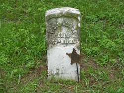
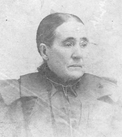
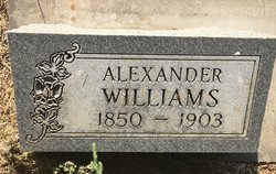
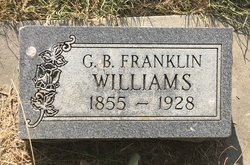
Perry C. Williams
| Birth | : | 1824 Crawford County, Pennsylvania, USA |
| Death | : | 3 Nov 1880 Wynot, Cedar County, Nebraska, USA |
| Burial | : | Lyndhurst Cemetery, Lyndhurst, Blayney Shire, Australia |
| Coordinate | : | -33.6694310, 149.0298390 |
| Plot | : | Lot 105 Block 1 |
| Description | : | Perry C. Williams was the son of William Williams and Sarah Seely. He married Martha Campbell in Crawford County, Pennsylvania on 3 February 1848. He enlisted into the Union Army during the Civil War in Monmouth, Illinois on 4 August 1862, serving with Co. A, 83rd Illinois Infantry Regiment. He sustained severe wounds during the Battle of the Wilderness, which necessitated four months of hospitalization at Paducah, Kentucky. After the war he moved his family to Winona County, Minnesota where he farmed and served as an evangelist preacher. |
frequently asked questions (FAQ):
-
Where is Perry C. Williams's memorial?
Perry C. Williams's memorial is located at: Lyndhurst Cemetery, Lyndhurst, Blayney Shire, Australia.
-
When did Perry C. Williams death?
Perry C. Williams death on 3 Nov 1880 in Wynot, Cedar County, Nebraska, USA
-
Where are the coordinates of the Perry C. Williams's memorial?
Latitude: -33.6694310
Longitude: 149.0298390
Family Members:
Parent
Spouse
Siblings
Children
Flowers:
Nearby Cemetories:
1. Lyndhurst Cemetery
Lyndhurst, Blayney Shire, Australia
Coordinate: -33.6694310, 149.0298390
2. Carcoar Anglican Church Cemetery
Carcoar, Blayney Shire, Australia
Coordinate: -33.6097560, 149.1407530
3. Carcoar Cemetery
Carcoar, Blayney Shire, Australia
Coordinate: -33.5931600, 149.1522750
4. Neville Cemetery
Neville, Blayney Shire, Australia
Coordinate: -33.7207917, 149.2114111
5. Woodstock Cemetery
Woodstock, Cowra Shire, Australia
Coordinate: -33.7575190, 148.8569250
6. Cadia Cemetery
Orange, Orange City, Australia
Coordinate: -33.4582190, 148.9918270
7. Blayney Cemetery
Blayney, Blayney Shire, Australia
Coordinate: -33.5244200, 149.2338720
8. Hobbys Yards Cemetery
Hobbys Yards, Blayney Shire, Australia
Coordinate: -33.6763540, 149.3270730
9. St. Peter's Uniting Church Cemetery
Hobbys Yards, Blayney Shire, Australia
Coordinate: -33.6939850, 149.3271790
10. Millthorpe Cemetery
Millthorpe, Blayney Shire, Australia
Coordinate: -33.4545400, 149.1857520
11. St Andrews Anglican Church (closed) Cemetery
Moorilda, Blayney Shire, Australia
Coordinate: -33.6087430, 149.3386340
12. Arkell Cemetery
Arkell, Bathurst Regional Council, Australia
Coordinate: -33.7450540, 149.3816430
13. Long Swamp Catholic Cemetery
Triangle Flat, Oberon Shire, Australia
Coordinate: -33.7290510, 149.3890000
14. Newbridge Cemetery
Newbridge, Blayney Shire, Australia
Coordinate: -33.5870966, 149.3853014
15. Cowra Japanese War Cemetery
Cowra, Cowra Shire, Australia
Coordinate: -33.8012429, 148.6918062
16. Cowra War Cemetery
Cowra, Cowra Shire, Australia
Coordinate: -33.8016220, 148.6917260
17. Cowra General Cemetery
Cowra, Cowra Shire, Australia
Coordinate: -33.8004890, 148.6901560
18. Cargo General Cemetery
Cargo, Cabonne Shire, Australia
Coordinate: -33.4117100, 148.8034600
19. East Guyong Cemetery
East Guyong, Cabonne Shire, Australia
Coordinate: -33.4184710, 149.2698020
20. Jerula Homestead Cemetery
Cowra, Cowra Shire, Australia
Coordinate: -33.8487830, 148.7087030
21. Canowindra Cemetery
Canowindra, Cabonne Shire, Australia
Coordinate: -33.5487100, 148.6718000
22. Lone Graves
Cowra, Cowra Shire, Australia
Coordinate: -33.8346330, 148.6904240
23. Godolphin Homestead
Guyong West, Orange City, Australia
Coordinate: -33.3858980, 149.2597710
24. Soldiers Flat Memorial Cemetery
Billimari, Cowra Shire, Australia
Coordinate: -33.6833180, 148.6183260

