| Birth | : | 12 Dec 1879 |
| Death | : | 4 Oct 1934 |
| Burial | : | Spring Hill Cemetery, Easton, Talbot County, USA |
| Coordinate | : | 38.7775002, -76.0727997 |
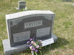
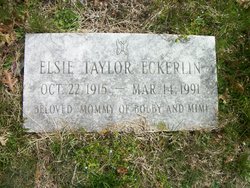
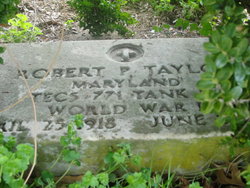
| Description | : | Name: Perry Derochebrune Taylor Given Name: Perry Derochebrune Surname: Taylor Sex: M Birth: 12 Dec 1879 in Caroline County, Maryland Death: 4 Oct 1934 in Caroline County, Maryland Father: Robert Patton Taylor b: 25 Mar 1848 in Maryland Mother: Mary E. Williams b: 6 Jan 1838 in Maryland Marriage (1st) Eva Grace Murphy b: 26 Aug 1878 in Caroline County, Maryland Divorced: Y Children: + John Smith Taylor b: 29 Nov 1904 in Caroline County, Maryland Marriage (2nd) Gladys Reeder b: 18 Jan 1892 in Baltimore, Maryland, married: 5 Jan 1912 in Caroline County, Maryland Children: + Leroy Raymond Taylor b: 10 Dec 1912 in Preston, Caroline County, Maryland + Elsie May Taylor b:... Read More |
frequently asked questions (FAQ):
-
Where is Perry Derochebrune Taylor's memorial?
Perry Derochebrune Taylor's memorial is located at: Spring Hill Cemetery, Easton, Talbot County, USA.
-
When did Perry Derochebrune Taylor death?
Perry Derochebrune Taylor death on 4 Oct 1934 in
-
Where are the coordinates of the Perry Derochebrune Taylor's memorial?
Latitude: 38.7775002
Longitude: -76.0727997
Family Members:
Parent
Spouse
Children
Flowers:
Nearby Cemetories:
1. Spring Hill Cemetery
Easton, Talbot County, USA
Coordinate: 38.7775002, -76.0727997
2. Maryland State Police Canine Cemetery Barrack I
Easton, Talbot County, USA
Coordinate: 38.7843938, -76.0753632
3. Richards Memorial Park
Easton, Talbot County, USA
Coordinate: 38.7761002, -76.0821991
4. Doverbrook Cemetery
Easton, Talbot County, USA
Coordinate: 38.7733002, -76.0643997
5. Third Haven Meeting Burial Ground
Easton, Talbot County, USA
Coordinate: 38.7672005, -76.0764008
6. Peachblossom Meeting House Cemetery
Easton, Talbot County, USA
Coordinate: 38.7332900, -76.0681500
7. Lombardy Farm Cemetery
Unionville, Talbot County, USA
Coordinate: 38.8158530, -76.1259852
8. Chapel Cemetery
Easton, Talbot County, USA
Coordinate: 38.8171997, -76.0211029
9. Saint Stephens Church Cemetery
Easton, Talbot County, USA
Coordinate: 38.8091020, -76.1397660
10. Roberts Cemetery
Talbot County, USA
Coordinate: 38.7192001, -76.0488968
11. Ashby-Goldsborough Family Cemetery
Easton, Talbot County, USA
Coordinate: 38.8251600, -76.1239840
12. Queen Esther Cemetery
Talbot County, USA
Coordinate: 38.7132988, -76.0456009
13. All Saints Cemetery
Easton, Talbot County, USA
Coordinate: 38.8464012, -76.0817032
14. Saint Pauls Cemetery
Talbot County, USA
Coordinate: 38.7439003, -76.1624985
15. White Marsh Cemetery
Trappe, Talbot County, USA
Coordinate: 38.6970329, -76.0600662
16. Landing Neck Cemetery
Trappe Landing, Talbot County, USA
Coordinate: 38.7000008, -76.0402985
17. Woodlawn Memorial Park
Easton, Talbot County, USA
Coordinate: 38.8610992, -76.0597000
18. Royal Oak Cemetery
Bellevue, Talbot County, USA
Coordinate: 38.7421989, -76.1774979
19. DeShields Cemetery
Talbot County, USA
Coordinate: 38.8278008, -76.1678009
20. Banning Graveyard
Easton, Talbot County, USA
Coordinate: 38.7205353, -76.1647339
21. Kings Creek Cemetery
Talbot County, USA
Coordinate: 38.8167000, -75.9527969
22. Hammond Family Plot
Saint Michaels, Talbot County, USA
Coordinate: 38.7495600, -76.1988400
23. Mount Zion Cemetery
Bethlehem, Caroline County, USA
Coordinate: 38.7500000, -75.9430900
24. Tuckahoe Friends Meeting House Burying Ground
Talbot County, USA
Coordinate: 38.8253460, -75.9531270


