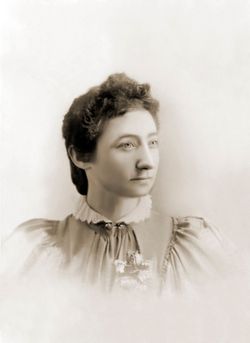
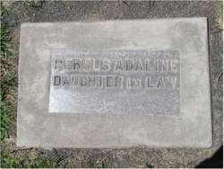
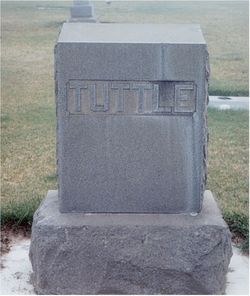
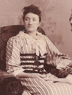
Persus Adaline “Addie” Schoonover Tuttle
| Birth | : | 22 Aug 1872 Richland Center, Richland County, Wisconsin, USA |
| Death | : | 7 May 1909 Ritzville, Adams County, Washington, USA |
| Burial | : | St Andrew Churchyard, Little Snoring, North Norfolk District, England |
| Coordinate | : | 52.8551400, 0.8990400 |
| Plot | : | Division 4, Block 33, Grave 7 |
| Description | : | Wife of William Seymour Tuttle. Daughter of Nathaniel Schoonover and Sarah Andrews. "Addie" was the 8th child out of 19 born to Nathaniel Schoonover. MRS. W. S. TUTTLE DEAD Passes Away at the home of Relatives In Ritzville Last Sunday Mrs. William S. Tuttle whose maiden name was Persus Adelaide Schoonover died at the home of Frank Stuart at 6 o'clock last Friday morning after a long struggle with a complication of physical troubles which defied the skill of the physicians, and made evident what the result would be several weeks before the end came. She was married to William S.... Read More |
frequently asked questions (FAQ):
-
Where is Persus Adaline “Addie” Schoonover Tuttle's memorial?
Persus Adaline “Addie” Schoonover Tuttle's memorial is located at: St Andrew Churchyard, Little Snoring, North Norfolk District, England.
-
When did Persus Adaline “Addie” Schoonover Tuttle death?
Persus Adaline “Addie” Schoonover Tuttle death on 7 May 1909 in Ritzville, Adams County, Washington, USA
-
Where are the coordinates of the Persus Adaline “Addie” Schoonover Tuttle's memorial?
Latitude: 52.8551400
Longitude: 0.8990400
Family Members:
Parent
Spouse
Siblings
Children
Flowers:
Nearby Cemetories:
1. St Andrew Churchyard
Little Snoring, North Norfolk District, England
Coordinate: 52.8551400, 0.8990400
2. All Saints Churchyard
Kettlestone, North Norfolk District, England
Coordinate: 52.8468600, 0.9205100
3. St Mary The Virgin Churchyard
Great Snoring, North Norfolk District, England
Coordinate: 52.8736000, 0.8914000
4. St. John the Baptist Chapelyard
Fulmodeston, North Norfolk District, England
Coordinate: 52.8397799, 0.9440578
5. All Saints Churchyard
East Barsham, North Norfolk District, England
Coordinate: 52.8666620, 0.8459870
6. St Giles Churchyard
Barsham, North Norfolk District, England
Coordinate: 52.8813000, 0.8574300
7. St. Mary's Churchyard
Barney, North Norfolk District, England
Coordinate: 52.8555700, 0.9606080
8. Fakenham Cemetery
Fakenham, North Norfolk District, England
Coordinate: 52.8324060, 0.8500670
9. Christ Church Churchyard
Fulmodeston, North Norfolk District, England
Coordinate: 52.8385680, 0.9569670
10. Saint Mary & All Saints Churchyard
Little Walsingham, North Norfolk District, England
Coordinate: 52.8910800, 0.8748300
11. St Peter & St Paul Churchyard
Fakenham, North Norfolk District, England
Coordinate: 52.8308090, 0.8474920
12. All Saints Churchyard
North Barsham, North Norfolk District, England
Coordinate: 52.8777330, 0.8451480
13. Our Lady of Walsingham Chapel
Little Walsingham, North Norfolk District, England
Coordinate: 52.8936750, 0.8755360
14. Fakenham Creake Road Cemetery
Fakenham, North Norfolk District, England
Coordinate: 52.8403170, 0.8348050
15. St. Mary's Churchyard
Fulmodeston, North Norfolk District, England
Coordinate: 52.8306490, 0.9558700
16. Assumption of the Blessed Virgin Mary Churchyard
Barsham, North Norfolk District, England
Coordinate: 52.8667710, 0.8283940
17. St. Martin's Churchyard
Hindringham, North Norfolk District, England
Coordinate: 52.8882000, 0.9477300
18. All Saints Churchyard (Ruins)
Ryburgh, North Norfolk District, England
Coordinate: 52.8105000, 0.9181000
19. St Peter Churchyard
Great Walsingham, North Norfolk District, England
Coordinate: 52.9009100, 0.8824300
20. St. Andrew's Churchyard
Great Ryburgh, North Norfolk District, England
Coordinate: 52.8072980, 0.9094190
21. St Mary Churchyard
Gunthorpe, North Norfolk District, England
Coordinate: 52.8767720, 0.9883020
22. St Mary the Virgin Churchyard
Colkirk, Breckland Borough, England
Coordinate: 52.8021610, 0.8433730
23. All Saints Churchyard
Bale, North Norfolk District, England
Coordinate: 52.8906290, 0.9871950
24. All Saints Churchyard Waterden
South Creake, Kings Lynn and West Norfolk Borough, England
Coordinate: 52.8866500, 0.7997600

