
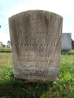
PVT Elisha Angell
| Birth | : | 22 Feb 1757 North Providence, Providence County, Rhode Island, USA |
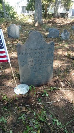
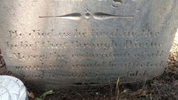
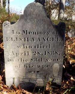
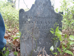
| Death | : | 28 Apr 1838 North Providence, Providence County, Rhode Island, USA |
| Burial | : | Earlham Road Cemetery, Norwich, City of Norwich, England |
| Coordinate | : | 52.6305900, 1.2677400 |
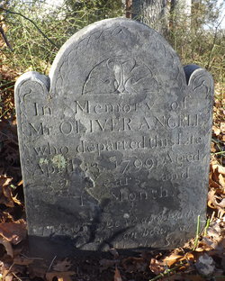
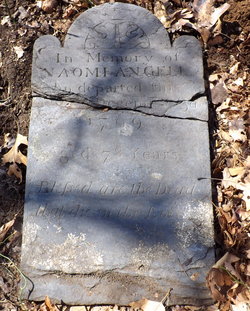
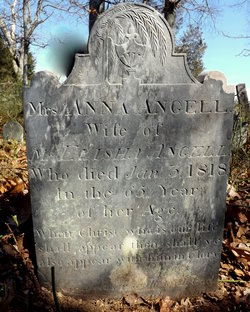
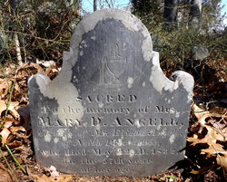
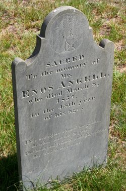
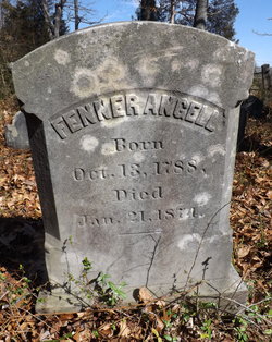
| Description | : | Parents: . Oliver Angell (1717 - 1799) . Naomi Smith (1721 - 1799) Marriages: [1] Anna Fenner, 24 Aug 1783 [2] Mary Dean, 7 May 1820 [3] Catherine Pearce, 11 Feb 1835 Children with Anna Fenner: 1. Enos Angell (1784 - 1832) 2. Emma Angell (b. 1786) + sp.: Benjamin Gorham: (1786 - 1809) + sp.: Samuel Bloss: m. 26 Dec 1814 3. Naomi Ann Angell Eddy (1788 - 1817) + sp.: Samuel Eddy (1769 - 1839) 4. Fenner Angell (b. 1790) Grandchildren: . Zachariah Angell |
frequently asked questions (FAQ):
-
Where is PVT Elisha Angell's memorial?
PVT Elisha Angell's memorial is located at: Earlham Road Cemetery, Norwich, City of Norwich, England.
-
When did PVT Elisha Angell death?
PVT Elisha Angell death on 28 Apr 1838 in North Providence, Providence County, Rhode Island, USA
-
Where are the coordinates of the PVT Elisha Angell's memorial?
Latitude: 52.6305900
Longitude: 1.2677400
Family Members:
Parent
Spouse
Siblings

Children
Flowers:


Nearby Cemetories:
1. Earlham Road Cemetery
Norwich, City of Norwich, England
Coordinate: 52.6305900, 1.2677400
2. Cathedral of Saint John the Baptist
Norwich, City of Norwich, England
Coordinate: 52.6292000, 1.2840000
3. St. Bartholomew's Churchyard Heigham
Norwich, City of Norwich, England
Coordinate: 52.6401560, 1.2743680
4. St. Benedict's Churchyard
Norwich, City of Norwich, England
Coordinate: 52.6311700, 1.2860580
5. St Giles Churchyard
Norwich, City of Norwich, England
Coordinate: 52.6294900, 1.2871500
6. St. Swithin Churchyard
Norwich, City of Norwich, England
Coordinate: 52.6316140, 1.2877760
7. Saint Margaret's Churchyard
Norwich, City of Norwich, England
Coordinate: 52.6313370, 1.2886400
8. St. Margaret's Churchyard
Norwich, City of Norwich, England
Coordinate: 52.6312260, 1.2886730
9. St Margaret de Westwick Parish Church
Norwich, City of Norwich, England
Coordinate: 52.6313610, 1.2887497
10. St. Laurence's Churchyard
Norwich, City of Norwich, England
Coordinate: 52.6310440, 1.2901140
11. St. Martin at Oak Church
Norwich, City of Norwich, England
Coordinate: 52.6348420, 1.2901930
12. St. Gregory's Churchyard
Norwich, City of Norwich, England
Coordinate: 52.6304430, 1.2914150
13. Saint Michael Coslany Parish Churchyard
Norwich, City of Norwich, England
Coordinate: 52.6329420, 1.2914110
14. St. Michael of Closany Churchyard
Norwich, City of Norwich, England
Coordinate: 52.6329950, 1.2914510
15. St Mary Coslany Churchyard
Norwich, City of Norwich, England
Coordinate: 52.6341180, 1.2914040
16. St. John Maddermarket Church
Norwich, City of Norwich, England
Coordinate: 52.6300230, 1.2927980
17. St. Peter Mancroft Churchyard
Norwich, City of Norwich, England
Coordinate: 52.6277780, 1.2925000
18. Saint Stephens Churchyard
Norwich, City of Norwich, England
Coordinate: 52.6266260, 1.2921140
19. Quaker Burial Ground
Norwich, City of Norwich, England
Coordinate: 52.6361120, 1.2914810
20. St George Colegate Church
Norwich, City of Norwich, England
Coordinate: 52.6332060, 1.2940200
21. St. Augustine's Churchyard
Norwich, City of Norwich, England
Coordinate: 52.6371000, 1.2925960
22. St. Andrew's Churchyard
Norwich, City of Norwich, England
Coordinate: 52.6304640, 1.2953880
23. Black Friars
Norwich, City of Norwich, England
Coordinate: 52.6311800, 1.2959050
24. Old Meeting House
Norwich, City of Norwich, England
Coordinate: 52.6338830, 1.2956790