Ransom Amos
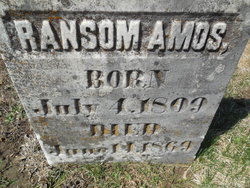
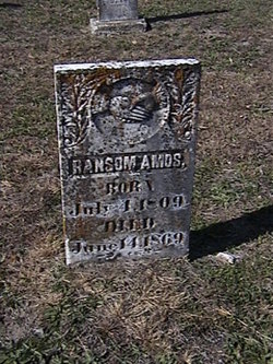
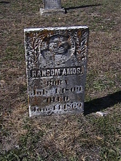
| Birth | : | 4 Jul 1809 Allen County, Kentucky, USA |
| Death | : | 14 Jun 1869 Moniteau County, Missouri, USA |
| Burial | : | Anderson District Cemetery, Anderson, Shasta County, USA |
| Coordinate | : | 40.4419518, -122.2967300 |
| Plot | : | Section 1 |
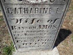
| Description | : | husb of Catherine Amos son of Benjamin Amos and Elizabeth Griffin md Catherine A. Enloe--12 Jul 1832--Cole Co,MO father of Griffin Hickman-Benjamin-Frances Elizabeth-Enoch E.-Rebecca-Samuel-William Haywood-Ransom Jr.-J. Clark-Catherine-Eliza-Robert William Amos |
frequently asked questions (FAQ):
-
Where is Ransom Amos's memorial?
Ransom Amos's memorial is located at: Anderson District Cemetery, Anderson, Shasta County, USA.
-
When did Ransom Amos death?
Ransom Amos death on 14 Jun 1869 in Moniteau County, Missouri, USA
-
Where are the coordinates of the Ransom Amos's memorial?
Latitude: 40.4419518
Longitude: -122.2967300
Family Members:
Parent
Spouse
Siblings
Children
Flowers:
R.I.P
Left by Anonymous on 22 Feb 2004
Ransom Amos, son of Benjamin Amos and Elizabeth Griffin, b. 4 Jul 1809 Warren County, Kentucky; d. 14 jun 1869 Moniteau County, Missouri. Married Catherine A. Enloe 12 Jul 1832 Cole County, Missouri. Father of Griffin Hickman, Benjamin, Frances Elizabeth, Enoch E., Rebecca, Samuel, William Haywood, Ransom Jr., J. Clark, Catherine, Eliza and Robert William Amos. Read less
Left by Anonymous on 04 Dec 2007
Nearby Cemetories:
1. Anderson District Cemetery
Anderson, Shasta County, USA
Coordinate: 40.4419518, -122.2967300
2. Oddfellows Cemetery
Anderson, Shasta County, USA
Coordinate: 40.4431590, -122.2907070
3. Anderson Pioneer Cemetery
Anderson, Shasta County, USA
Coordinate: 40.4439011, -122.2904968
4. Sleepy Hollow Pet Cemetery
Anderson, Shasta County, USA
Coordinate: 40.4199430, -122.2858410
5. Cottonwood Cemetery
Cottonwood, Shasta County, USA
Coordinate: 40.3856100, -122.2936500
6. Cottonwood Creek Ranch Cemetery
Cottonwood, Shasta County, USA
Coordinate: 40.3663100, -122.2598800
7. Major Pierson B Reading Family Cemetery
Cottonwood, Shasta County, USA
Coordinate: 40.3924300, -122.2126900
8. Parkville Cemetery
Anderson, Shasta County, USA
Coordinate: 40.4640200, -122.1897500
9. Haggard Family Ranch Cemetery
Palo Cedro, Shasta County, USA
Coordinate: 40.5105600, -122.2227800
10. Bates Pioneer Cemetery
Shasta County, USA
Coordinate: 40.5348816, -122.2968674
11. Happy Valley Cemetery
Redding, Shasta County, USA
Coordinate: 40.4668999, -122.4535980
12. Shasta General Hospital Cemetery
Redding, Shasta County, USA
Coordinate: 40.5509200, -122.3841800
13. Shasta General Hospital Cemetery
Redding, Shasta County, USA
Coordinate: 40.5516000, -122.3894000
14. Lawncrest Memorial Park
Redding, Shasta County, USA
Coordinate: 40.5732994, -122.3432999
15. Texas Springs Cemetery
Redding, Shasta County, USA
Coordinate: 40.5116844, -122.4516144
16. Millville Masonic Cemetery
Millville, Shasta County, USA
Coordinate: 40.5555000, -122.1842804
17. Beck Cemetery
Shasta County, USA
Coordinate: 40.5487400, -122.1720900
18. Millville IOOF Cemetery
Millville, Shasta County, USA
Coordinate: 40.5539017, -122.1663971
19. Old Saint Joseph Cemetery
Redding, Shasta County, USA
Coordinate: 40.5781326, -122.3912811
20. Inks Creek Cemetery
Tehama County, USA
Coordinate: 40.3419800, -122.1297100
21. Redding Memorial Park
Redding, Shasta County, USA
Coordinate: 40.5894814, -122.3872833
22. Middletown Cemetery
Redding, Shasta County, USA
Coordinate: 40.5392800, -122.4748700
23. Barbara Glass Gravesite
Shasta County, USA
Coordinate: 40.5067600, -122.5049700
24. Saint Joseph Cemetery
Redding, Shasta County, USA
Coordinate: 40.5824509, -122.4310989

