
| Birth | : | 17 Mar 1853 Indiana, USA |
| Death | : | 2 Sep 1895 Boone County, Iowa, USA |
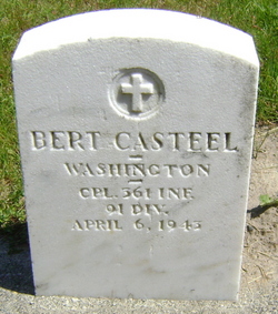
| Burial | : | Rake Lane Cemetery, Wallasey, Metropolitan Borough of Wirral, England |
| Coordinate | : | 53.4256120, -3.0437320 |
| Description | : | First wife of George Washington Cassteel, married 02 Oct 1873, Boone Co., IA "George W Casteel and Rebecca A Johnson, on the testimony of G R Johnson, were married 2 October 1873 at the residence of the minister, Lewis Doren, in Boone County, Iowa." Rebecca tied of typhoid fever. Source: Boone County Register of deaths |
frequently asked questions (FAQ):
-
Where is Rebecca Anna Johnson Cassteel's memorial?
Rebecca Anna Johnson Cassteel's memorial is located at: Rake Lane Cemetery, Wallasey, Metropolitan Borough of Wirral, England.
-
When did Rebecca Anna Johnson Cassteel death?
Rebecca Anna Johnson Cassteel death on 2 Sep 1895 in Boone County, Iowa, USA
-
Where are the coordinates of the Rebecca Anna Johnson Cassteel's memorial?
Latitude: 53.4256120
Longitude: -3.0437320
Family Members:
Spouse

Children
Flowers:


Nearby Cemetories:
1. Rake Lane Cemetery
Wallasey, Metropolitan Borough of Wirral, England
Coordinate: 53.4256120, -3.0437320
2. St Alban's Catholic Church
Wallasey, Metropolitan Borough of Wirral, England
Coordinate: 53.4181339, -3.0445808
3. St Hilary Churchyard
Wallasey, Metropolitan Borough of Wirral, England
Coordinate: 53.4216480, -3.0601780
4. St. John the Evangelist Churchyard
Egremont, Metropolitan Borough of Wirral, England
Coordinate: 53.4163500, -3.0329700
5. St Oswald's Churchyard
Bidston, Metropolitan Borough of Wirral, England
Coordinate: 53.4043400, -3.0791000
6. Flaybrick Memorial Gardens
Birkenhead, Metropolitan Borough of Wirral, England
Coordinate: 53.3968130, -3.0633240
7. Liverpool Naval Memorial
Liverpool, Metropolitan Borough of Liverpool, England
Coordinate: 53.4061220, -2.9981050
8. St Martin-in-the-Fields Churchyard
Liverpool, Metropolitan Borough of Liverpool, England
Coordinate: 53.4210110, -2.9877860
9. St. Alexander Church
Bootle, Metropolitan Borough of Sefton, England
Coordinate: 53.4401090, -2.9922250
10. St. Nicholas' Churchyard
Liverpool, Metropolitan Borough of Liverpool, England
Coordinate: 53.4069350, -2.9951480
11. St. Paul's Churchyard
Liverpool, Metropolitan Borough of Liverpool, England
Coordinate: 53.4099460, -2.9919370
12. St. Mary's Churchyard
Bootle, Metropolitan Borough of Sefton, England
Coordinate: 53.4492620, -3.0006520
13. St. Anthony's Churchyard
Liverpool, Metropolitan Borough of Liverpool, England
Coordinate: 53.4223190, -2.9815350
14. St. George's Churchyard
Liverpool, Metropolitan Borough of Liverpool, England
Coordinate: 53.4049700, -2.9901030
15. St. Werburgh & St. Laurence Catholic Churchyard
Birkenhead, Metropolitan Borough of Wirral, England
Coordinate: 53.3894910, -3.0217530
16. Kirkdale Goal Cemetery
Kirkdale, Metropolitan Borough of Liverpool, England
Coordinate: 53.4361110, -2.9802780
17. St. Anne's Churchyard
Liverpool, Metropolitan Borough of Liverpool, England
Coordinate: 53.4149050, -2.9782840
18. St. Peter's Churchyard
Liverpool, Metropolitan Borough of Liverpool, England
Coordinate: 53.4051290, -2.9844200
19. Friends Burial Ground (Defunct)
Liverpool, Metropolitan Borough of Liverpool, England
Coordinate: 53.4111670, -2.9795830
20. St. Mary's Churchyard
Birkenhead, Metropolitan Borough of Wirral, England
Coordinate: 53.3895930, -3.0112520
21. St. John's Garden
Liverpool, Metropolitan Borough of Liverpool, England
Coordinate: 53.4087890, -2.9810070
22. St. Mary's Cemetery
Kirkdale, Metropolitan Borough of Liverpool, England
Coordinate: 53.4323690, -2.9752500
23. St. Thomas Churchyard
Liverpool, Metropolitan Borough of Liverpool, England
Coordinate: 53.4010330, -2.9861190
24. Holy Trinity Churchyard
Liverpool, Metropolitan Borough of Liverpool, England
Coordinate: 53.4117490, -2.9759560