
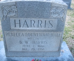
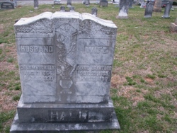
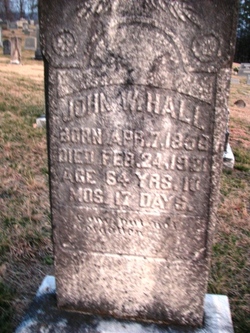
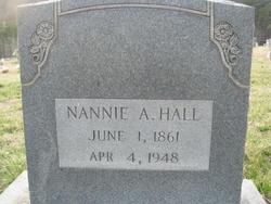
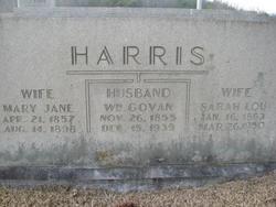
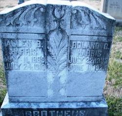
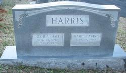
Rebecca LOUVENNIE “Vennie” Hall Harris
| Birth | : | 7 Jun 1867 McDowell County, North Carolina, USA |
| Death | : | 20 Dec 1958 McDowell County, North Carolina, USA |
| Burial | : | South Lead Cemetery, Lead, Lawrence County, USA |
| Coordinate | : | 44.3478510, -103.7606260 |
frequently asked questions (FAQ):
-
Where is Rebecca LOUVENNIE “Vennie” Hall Harris's memorial?
Rebecca LOUVENNIE “Vennie” Hall Harris's memorial is located at: South Lead Cemetery, Lead, Lawrence County, USA.
-
When did Rebecca LOUVENNIE “Vennie” Hall Harris death?
Rebecca LOUVENNIE “Vennie” Hall Harris death on 20 Dec 1958 in McDowell County, North Carolina, USA
-
Where are the coordinates of the Rebecca LOUVENNIE “Vennie” Hall Harris's memorial?
Latitude: 44.3478510
Longitude: -103.7606260
Family Members:
Parent

Spouse
Siblings
Children


Nearby Cemetories:
1. West Lead Cemetery
Lead, Lawrence County, USA
Coordinate: 44.3484001, -103.7779999
2. Mount Moriah Cemetery
Deadwood, Lawrence County, USA
Coordinate: 44.3760986, -103.7253036
3. Saint Ambrose Cemetery
Deadwood, Lawrence County, USA
Coordinate: 44.3821983, -103.7266998
4. Terry Cemetery
Terry, Lawrence County, USA
Coordinate: 44.3344290, -103.8165110
5. Oak Ridge Cemetery
Deadwood, Lawrence County, USA
Coordinate: 44.3891983, -103.6766968
6. Holy Cross Cemetery
Englewood, Lawrence County, USA
Coordinate: 44.2818985, -103.8047028
7. Mountain Lawn Cemetery
Englewood, Lawrence County, USA
Coordinate: 44.2818985, -103.8047028
8. Galena Cemetery
Galena, Lawrence County, USA
Coordinate: 44.3349220, -103.6438410
9. Preston Ghost Town Cemetery
Preston, Lawrence County, USA
Coordinate: 44.3577500, -103.8871670
10. Carbonate Cemetery
Maurice, Lawrence County, USA
Coordinate: 44.4000000, -103.8680500
11. Roubaix Cemetery
Roubaix, Lawrence County, USA
Coordinate: 44.2789380, -103.6656600
12. Dumont Cemetery
Lawrence County, USA
Coordinate: 44.2270000, -103.7860000
13. Carr Cemetery
Hanna, Lawrence County, USA
Coordinate: 44.2411003, -103.8606033
14. Crook City Cemetery
Crook City, Lawrence County, USA
Coordinate: 44.4432100, -103.6241500
15. Anderson Cemetery
Lawrence County, USA
Coordinate: 44.4747009, -103.6896973
16. Whitewood Cemetery
Whitewood, Lawrence County, USA
Coordinate: 44.4617820, -103.6330030
17. Rose Hill Cemetery
Spearfish, Lawrence County, USA
Coordinate: 44.4802180, -103.8509270
18. Mountain Meadow Cemetery
Lawrence County, USA
Coordinate: 44.2038994, -103.6557999
19. Saint Aloysius Cemetery
Sturgis, Meade County, USA
Coordinate: 44.4141340, -103.5193420
20. Little Dane Cemetery
Saint Onge, Lawrence County, USA
Coordinate: 44.5252500, -103.6705540
21. Gate of Heaven Cemetery
Saint Onge, Lawrence County, USA
Coordinate: 44.5353000, -103.7237000
22. Bear Gulch Cemetery
Lawrence County, USA
Coordinate: 44.3819008, -104.0325012
23. Bear Butte Cemetery
Sturgis, Meade County, USA
Coordinate: 44.4111595, -103.4947968
24. Black Hills National Cemetery
Sturgis, Meade County, USA
Coordinate: 44.3689003, -103.4753036