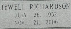
| Birth | : | 17 Apr 1925 Grayson County, Virginia, USA |
| Death | : | 2 Jan 2011 Marion, Smyth County, Virginia, USA |
| Burial | : | Oak Hill Cemetery, Taylorville, Christian County, USA |
| Coordinate | : | 39.5410995, -89.2899780 |
| Description | : | Rena Lorraine Richardson Farmer, 85, died, leaving her earthly place and reaching her heavenly home Sunday, Jan. 2, 2011, surrounded by loving family in Smyth County Community Hospital. She was a faithful member of Falling Water Baptist Church and had been employed by Southwestern State Hospital for more than 20 years where she showed her patients the same loving care she offered to her family. She was a very proud graduate of Konnarock Training School for Girls, Konnarock. She was a loving and devoted wife, mother and granny. She enjoyed playing the piano and accordion (as long as no one... Read More |
frequently asked questions (FAQ):
-
Where is Rena Lorraine Richardson Farmer's memorial?
Rena Lorraine Richardson Farmer's memorial is located at: Oak Hill Cemetery, Taylorville, Christian County, USA.
-
When did Rena Lorraine Richardson Farmer death?
Rena Lorraine Richardson Farmer death on 2 Jan 2011 in Marion, Smyth County, Virginia, USA
-
Where are the coordinates of the Rena Lorraine Richardson Farmer's memorial?
Latitude: 39.5410995
Longitude: -89.2899780
Family Members:
Parent
Spouse
Siblings
Flowers:
Nearby Cemetories:
1. Oak Hill Cemetery
Taylorville, Christian County, USA
Coordinate: 39.5410995, -89.2899780
2. Young-Denton Cemetery
Taylorville, Christian County, USA
Coordinate: 39.5294910, -89.3064785
3. Kay the Elephant Burial Site
Taylorville, Christian County, USA
Coordinate: 39.5177994, -89.2973022
4. Glen Haven Memorial Gardens
Taylorville, Christian County, USA
Coordinate: 39.5675350, -89.2592840
5. Fraley Cemetery
Taylorville, Christian County, USA
Coordinate: 39.5505981, -89.2356033
6. Langleyville Cemetery
Langleyville, Christian County, USA
Coordinate: 39.5622190, -89.3587970
7. Anderson Cemetery
Vanderville, Christian County, USA
Coordinate: 39.4868760, -89.3371380
8. Harris Cemetery
Christian County, USA
Coordinate: 39.5657997, -89.2099991
9. Brush Creek Cemetery
Palmer, Christian County, USA
Coordinate: 39.4852982, -89.3447037
10. Donner Cemetery
Owaneco, Christian County, USA
Coordinate: 39.4792044, -89.2373039
11. Mound Chapel Cemetery
Taylorville, Christian County, USA
Coordinate: 39.4658012, -89.2774963
12. Goode Cemetery
Taylorville, Christian County, USA
Coordinate: 39.5233270, -89.1908540
13. Tanner Cemetery
Willeys, Christian County, USA
Coordinate: 39.5967354, -89.2058461
14. Owaneco Cemetery
Owaneco, Christian County, USA
Coordinate: 39.4796820, -89.1948570
15. Old Walnut Hill Cemetery
Sharpsburg, Christian County, USA
Coordinate: 39.6091800, -89.3786250
16. Walnut Hill Cemetery
Sharpsburg, Christian County, USA
Coordinate: 39.6120110, -89.3766970
17. Bethel Cemetery
Sharpsburg, Christian County, USA
Coordinate: 39.6285320, -89.3466140
18. Ponting Cemetery
Stonington, Christian County, USA
Coordinate: 39.6146000, -89.1960000
19. Thomas Anderson Cemetery
Palmer, Christian County, USA
Coordinate: 39.4922218, -89.4130173
20. Achenbach Cemetery
Jeisyville, Christian County, USA
Coordinate: 39.5539230, -89.4293700
21. Long Cemetery
Christian County, USA
Coordinate: 39.5546989, -89.1477966
22. Durbin Cemetery
Palmer, Christian County, USA
Coordinate: 39.4913400, -89.4185900
23. Durbin Cemetery
Locust Township, Christian County, USA
Coordinate: 39.4586500, -89.1935800
24. Buckeye Prairie Cemetery
Christian County, USA
Coordinate: 39.4363900, -89.2295800

